Enable Location

We need your location to show you interesting places around you

Discover nearby places

Find interesting locations and hidden gems around you

Precise directions

Get accurate directions and distances to places

Your location is never shared with other users. It's only used when you tap the location button.

Log in to your account

Start exploring — it's free

Trusted by 65,199 travelers worldwide

Continue with Google
Continue with Apple
or

We will send you a code to connect

By continuing, you accept our Terms and Conditions and our Privacy Policy

Check your inbox

We've sent a pincode in your inbox. Please enter the code below.

Frenchman Flat
Discussion Reviews Photo
18.1k Popularity

Frenchman Flat, Nuclear test site in Nye County, United States.

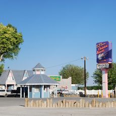
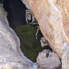
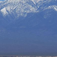
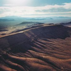
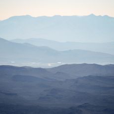
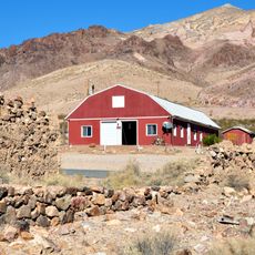
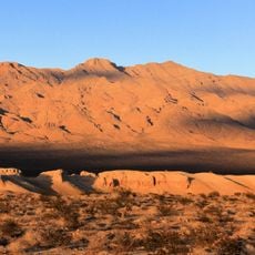
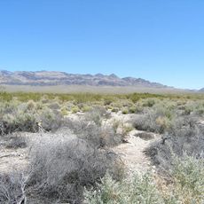
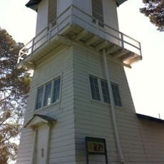
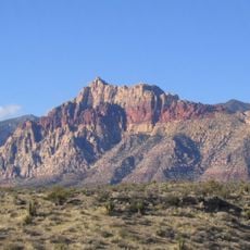
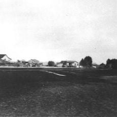
Frenchman Flat is an expansive desert area within the Nevada National Security Site, ringed by mountains and composed of sand and gravel plains. The landscape contains more than 100 deteriorated structures and measurement instrumentation scattered across the terrain from decades of research activity.

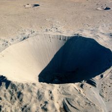
The location hosted dozens of atmospheric nuclear detonations between 1951 and 1962, representing a turning point in United States military and scientific research. This intensive testing period fundamentally shaped the geological and physical character of the landscape.

The district contains 157 documented locations, including experimental structures, instrumentation supports, and foundations that represent Cold War scientific developments.

Entry requires special authorization from the Department of Energy since the area lies within a military restricted zone. Visitors should contact relevant authorities in advance to arrange the necessary permissions before planning a trip.

The location preserves several original test structures built specifically to measure and document nuclear blast effects and impacts. These decaying buildings now form a rare outdoor museum of Cold War research activities.

The community of curious travelers

AroundUs brings together thousands of curated places, local tips, and hidden gems, enriched daily by 60,000 contributors worldwide.

Start exploring
Location
GPS coordinates
36.83023,-115.93725
Latest update
December 7, 2025 19:23
Around this place
Chicken Ranch
United States of America

Chicken Ranch

84.3 km
Devils Hole
United States of America

Devils Hole

55.1 km
Charleston Peak
United States of America

Charleston Peak

65.8 km
Sedan Crater
United States of America

Sedan Crater

39.8 km
Yucca Mountain
United States of America

Yucca Mountain

47.8 km
Red Rock Canyon National Conservation Area
United States of America

Red Rock Canyon National Conservation Area

83.7 km
Amargosa Opera House and Hotel
United States of America

Amargosa Opera House and Hotel

72.7 km
Tikaboo Peak
United States of America

Tikaboo Peak

76.9 km
Ash Meadows National Wildlife Refuge
United States of America

Ash Meadows National Wildlife Refuge

56.2 km
Goldwell Open Air Museum
United States of America

Goldwell Open Air Museum

80.1 km
Tule Springs Fossil Beds National Monument
United States of America

Tule Springs Fossil Beds National Monument

70.2 km
Angel's Ladies
United States of America

Angel's Ladies

72.3 km
Spring Mountain Motorsports Ranch
United States of America

Spring Mountain Motorsports Ranch

73.3 km
Desert National Wildlife Range
United States of America

Desert National Wildlife Range

45.5 km
Fallon Range Training Complex
United States of America

Fallon Range Training Complex

80.9 km
Mount Charleston Wilderness
United States of America

Mount Charleston Wilderness

64.9 km
Mummy Mountain
United States of America

Mummy Mountain

64.5 km
United States of America

Carpenter Canyon

73.5 km
Tule Springs Ranch
United States of America

Tule Springs Ranch

82.5 km
Bridge Mountain
United States of America

Bridge Mountain

87.1 km
Griffith Peak
United States of America

Griffith Peak

71.5 km
United States of America

Las Vegas Indian Colony

75.5 km
Harris Mountain
United States of America

Harris Mountain

71.7 km
McFarland Peak
United States of America

McFarland Peak

57.6 km
T&T Ranch
United States of America

T&T Ranch

61.8 km
Beatty Museum & Historical Society
United States of America

Beatty Museum & Historical Society

73.9 km
Beatty Museum
United States of America

Beatty Museum

73.9 km
Icebox Canyon
United States of America

Icebox Canyon

86 km
Show the full map
Reviews
Share your experience

No review yet

Discussions
Start a discussion...

No discussion yet

« Frenchman Flat - Nuclear test site in Nye County, United States » is provided by Around Us (aroundus.com). Images and texts are derived from Wikimedia project under a Creative Commons license. You are allowed to copy, distribute, and modify copies of this page, under the conditions set by the license, as long as this note is clearly visible.

Discover hidden gems everywhere you go!

From secret cafés to breathtaking viewpoints, skip the crowded tourist spots and find places that match your style. Our app makes it easy with voice search, smart filtering, route optimization, and insider tips from travelers worldwide. Download now for the complete mobile experience.

Around Us App Screenshot

A unique approach to discovering new places

Le Figaro

All the places worth exploring

France Info

A tailor-made excursion in just a few clicks

20 Minutes

Around Us
Travel Guide & Maps
Download

Send to your phone

QR Code
1

Open the camera app on your mobile.

2

Point at the QR code with your camera. A notification will appear.

3

Tap the notification to open the link.