Chest opened
+${chestReward.xp} XP
Explorer
NOUVEAU ×${chestReward.collectible.quantity}
tapez pour fermer
Chest locked

Open chests in the app

Around Us is built for your phone — chests unlock when you walk, explore and capture nearby places.

Enable Location

We need your location to show you interesting places around you

Discover nearby places

Find interesting locations and hidden gems around you

Precise directions

Get accurate directions and distances to places

Your location is never shared with other users. It's only used when you tap the location button.

Log in to your account

Start exploring — it's free

Trusted by 72,876 travelers worldwide

Continue with Google
Continue with Apple
or

We will send you a code to connect

By continuing, you accept our Terms and Conditions and our Privacy Policy

Check your inbox

We've sent a pincode in your inbox. Please enter the code below.

Browse, Utah
Discussion Reviews Photo
1.2k Popularity

Browse, Utah, Unincorporated ranching community in Washington County, Utah.

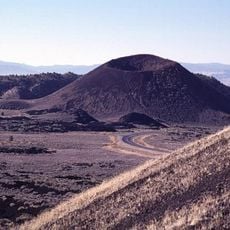
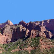
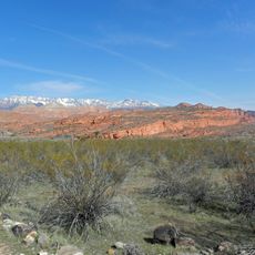
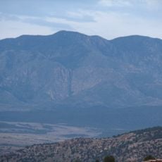
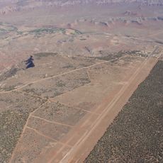
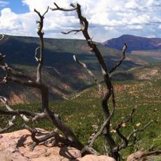
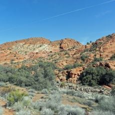
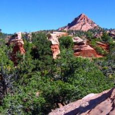
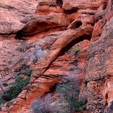
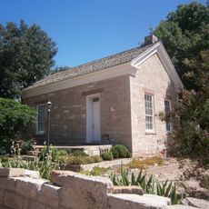
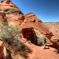
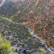
Browse is an unincorporated ranching settlement in Washington County, Utah, located near Interstate 15 in the southern part of the state where open grazing lands stretch across dry terrain. The surrounding landscape features mountains and canyons that define the character of this rural area.

The area received its name in the 1930s when research studied plants that served as food for grazing animals such as deer and elk. This research initiative led to the establishment and naming of the settlement.

Ranching families maintain traditional livestock management practices across the public lands, contributing to the agricultural heritage of Washington County.

Visitors should know this is an unincorporated community without major shops or services within the immediate area. Nearby towns provide basic amenities and supplies for anyone wanting to explore the region.

The name derives from scientific research on native plants that serve as food sources for grazing animals like deer and elk in the region.

The community of curious travelers

AroundUs brings together thousands of curated places, local tips, and hidden gems, enriched daily by 60,000 contributors worldwide.

Start exploring
Location
GPS coordinates
37.23930,-113.36100
Latest update
December 14, 2025 18:06
Around this place
Sand Hollow State Park
United States of America

Sand Hollow State Park

13.8 km
Santa Clara Volcano
United States of America

Santa Clara Volcano

23.5 km
Kolob Canyons
United States of America

Kolob Canyons

22.9 km
Quail Creek State Park
United States of America

Quail Creek State Park

5.6 km
Red Cliffs National Conservation Area
United States of America

Red Cliffs National Conservation Area

19.5 km
Signal Peak
United States of America

Signal Peak

14.6 km
Pine Valley Chapel and Tithing Office
United States of America

Pine Valley Chapel and Tithing Office

21.8 km
Hurricane Mesa
United States of America

Hurricane Mesa

13.3 km
Blackridge Wilderness
United States of America

Blackridge Wilderness

16.4 km
Cottonwood Canyon Wilderness
United States of America

Cottonwood Canyon Wilderness

10.8 km
Hurricane Canal
United States of America

Hurricane Canal

9.6 km
Red Butte Wilderness
United States of America

Red Butte Wilderness

22.9 km
Hurricane-LaVerkin Bridge
United States of America

Hurricane-LaVerkin Bridge

9.8 km
Elephant Arch
United States of America

Elephant Arch

13.7 km
Wells Fargo and Company Express Building
United States of America

Wells Fargo and Company Express Building

1.6 km
Old Washington County Courthouse
United States of America

Old Washington County Courthouse

24.2 km
John Steele House
United States of America

John Steele House

6.9 km
Naegle Winery
United States of America

Naegle Winery

5.8 km
Robert D. Covington House
United States of America

Robert D. Covington House

17.3 km
Thomas Forsyth House
United States of America

Thomas Forsyth House

6.9 km
Washington Relief Society Hall
United States of America

Washington Relief Society Hall

18.4 km
Leeds Tithing Office
United States of America

Leeds Tithing Office

342 m
James Jepson Jr. House
United States of America

James Jepson Jr. House

16.2 km
Hurricane Valley Heritage Park Museum
United States of America

Hurricane Valley Heritage Park Museum

9.5 km
Elephant Arch
United States of America

Elephant Arch

13.7 km
Quail Creek Reservoir
United States of America

Quail Creek Reservoir

7.5 km
Cottontown Village
United States of America

Cottontown Village

18.2 km
Great West Canyon
United States of America

Great West Canyon

23.8 km
Show the full map
Reviews
Share your experience

No review yet

Discussions
Start a discussion...

No discussion yet

« Browse, Utah - Unincorporated ranching community in Washington County, Utah » is provided by Around Us (aroundus.com). Images and texts are derived from Wikimedia project under a Creative Commons license. You are allowed to copy, distribute, and modify copies of this page, under the conditions set by the license, as long as this note is clearly visible.

Discover hidden gems everywhere you go!

From secret cafés to breathtaking viewpoints, skip the crowded tourist spots and find places that match your style. Our app makes it easy with voice search, smart filtering, route optimization, and insider tips from travelers worldwide. Download now for the complete mobile experience.

Around Us App Screenshot

A unique approach to discovering new places

Le Figaro

All the places worth exploring

France Info

A tailor-made excursion in just a few clicks

20 Minutes

Around Us
Travel Guide & Maps
Download

Send to your phone

QR Code
1

Open the camera app on your mobile.

2

Point at the QR code with your camera. A notification will appear.

3

Tap the notification to open the link.