See the monuments around you in AROpen chests in the app
Around Us is built for your phone — point your camera at the streets and discover the monuments and places around you in augmented reality.Around Us is built for your phone — chests unlock when you walk, explore and capture nearby places.
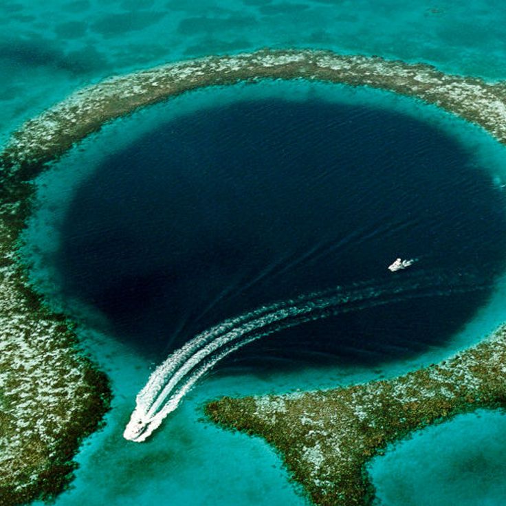
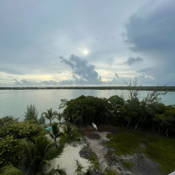
Belize protects over 300 miles of the second largest barrier reef in the Western Hemisphere and a substantial number of pre-Columbian Maya sites, many located deep within rainforests. The country combines marine protected areas, archaeological remains, and extensive nature reserves within a relatively compact territory. Visitors can explore the Great Blue Hole at Lighthouse Reef, a circular sinkhole roughly 1,000 feet (305 meters) across and 410 feet (125 meters) deep, one day and walk through the ruins of Caracol the next, the country's largest Maya site with pyramids rising over 140 feet (43 meters). The islands of Ambergris Caye and Caye Caulker provide direct access to the reef and stretches of sandy shoreline.
The Cockscomb Basin Wildlife Sanctuary preserves approximately 150 square miles (390 square kilometers) of rainforest as a protected area for jaguars and other mammals. Underwater protected areas like Hol Chan Marine Reserve and Turneffe Atoll Marine Reserve safeguard coral gardens, seagrass beds, and mangrove forests that support marine life. Archaeological sites such as Xunantunich, Lamanai, and Altun Ha showcase different building styles and periods of Maya civilization. Actun Tunichil Muknal cave combines geological formations with archaeological artifacts and is accessed by wading through underground rivers. The Mountain Pine Ridge Forest Reserve offers pine forests, waterfalls, and limestone formations in the western highlands.
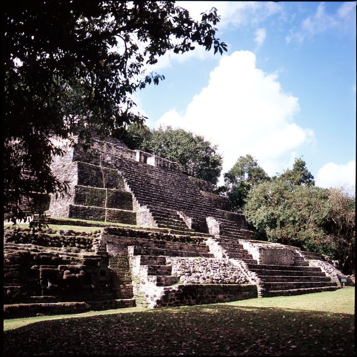
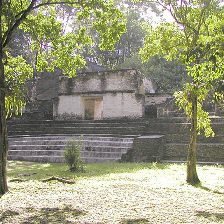
This Maya archaeological complex in Orange Walk District extends along the New River Lagoon and includes temples, pyramids and ball courts dating back to 1500 BC. Lamanai was inhabited for over three thousand years and displays structures from various periods of Maya civilization, including the 108-foot (33-meter) High Temple pyramid. The waterside location enabled continuous settlement through trade and resource access, reflected in the diversity of preserved structures.
This marine sinkhole in Lighthouse Reef spans nearly 1,000 feet (300 meters) across and drops just over 400 feet (124 meters) deep. The formation developed during the Ice Age when a cave system stood above sea level and later flooded. The Grand Trou Bleu draws divers who observe stalactites at roughly 130 feet (40 meters) down and reef sharks in open water. The site lies some 40 miles (65 kilometers) east of Belize City and forms part of the coral reef reserve belonging to the second largest reef system in the Western Hemisphere.
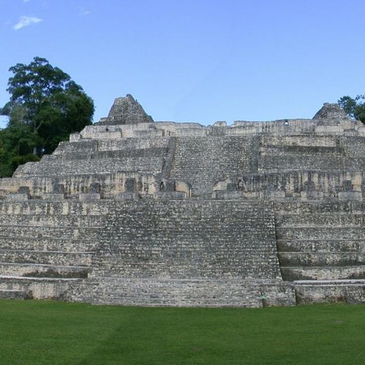
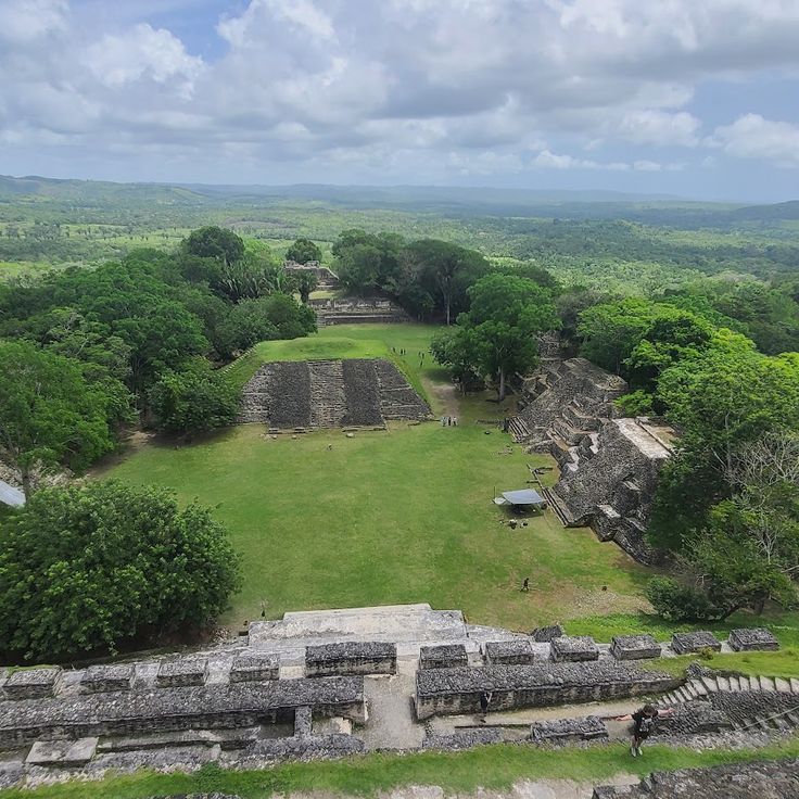
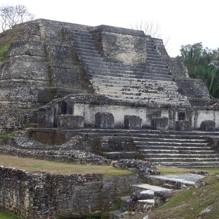
Caracol ranks among the largest Maya cities in present-day Belize and reached its peak between the 6th and 7th centuries AD, when more than 100,000 people lived here. This archaeological site contains around 35,000 structures, including the 141-foot (43-meter) Caana pyramid, the tallest human-made structure in Belize. Visitors can explore residential complexes, plazas, ball courts and numerous stelae bearing Maya inscriptions that document significant historical events. The ruins sit deep within tropical rainforest and are accessible via a road through the Mountain Pine Ridge Forest Reserve, with the journey taking roughly two hours.
This rainforest reserve covers 150 square miles (390 square kilometers) of protected wilderness and serves as the world's first jaguar sanctuary, with over 300 bird species, pumas, ocelots and tapirs along trails and waterfalls throughout Cockscomb Basin.
The Belize Zoo maintains over 170 native animals across 29 acres (12 hectares) in habitats designed to resemble their natural environments, including jaguars, tapirs, ocelots and toucans. The facility functions as a rescue center for injured or orphaned wildlife and participates in educational programs about Central American fauna. Visitors follow trails through wooded grounds where interpretive signs explain each species' role in the country's ecosystems. The zoo sits along the Western Highway between Belize City and the capital Belmopan.
Xunantunich encompasses thirteen plazas and several Maya temples, dominated by the El Castillo pyramid that rises 130 feet (40 meters) above the central plaza and ranks among the country's significant Maya structures.
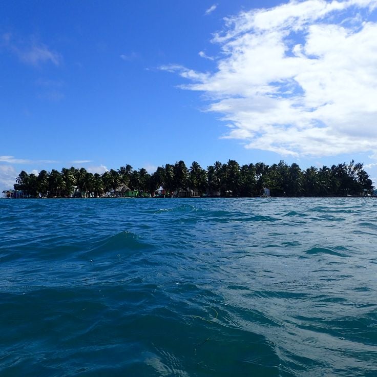
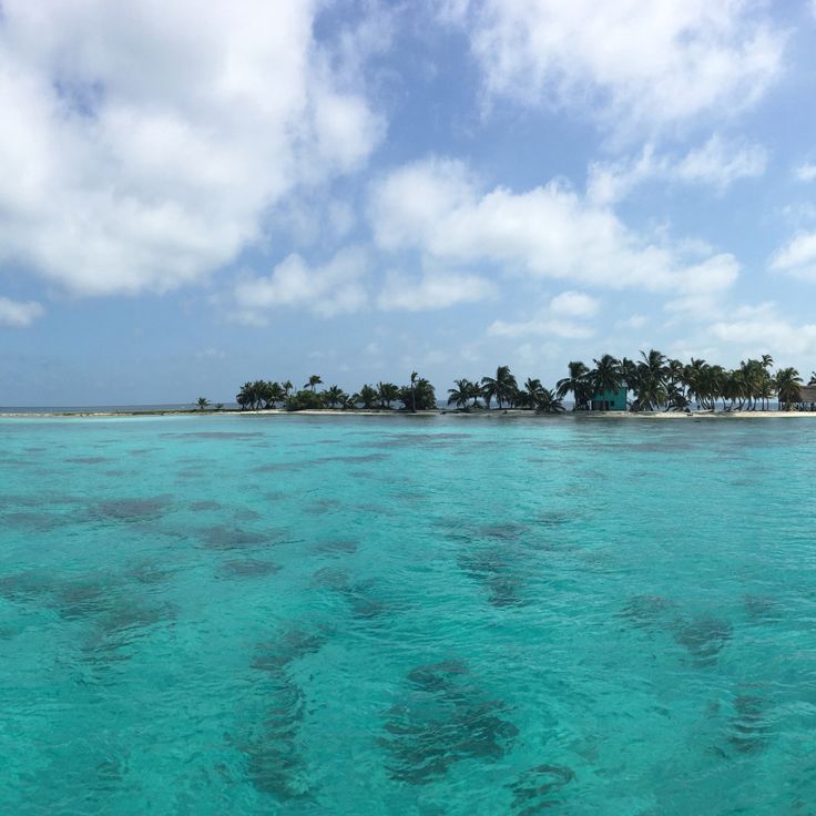
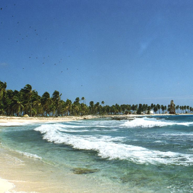
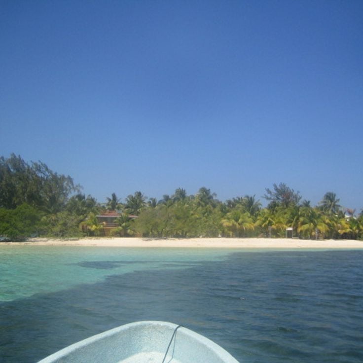
Ambergris Caye stretches 40 miles (64 kilometers) along the Mesoamerican Barrier Reef and forms Belize's largest island with San Pedro as its main town. This island provides direct access to diving sites within the reef system, mangrove channels along the western shore and sandy beaches on the eastern side. Several marine reserves protect coral formations and fish populations in the surrounding waters.
Caye Caulker is a 5-mile coral island in the Belize Barrier Reef, divided into two sections by a narrow channel. The island sits approximately 21 miles northeast of Belize City and serves as a base for diving and snorkeling trips to the surrounding reefs. Mangroves line the coastal areas while the waters around the island form part of the Belize Barrier Reef, home to sea turtles, rays and various fish species. The channel, known as The Split, was created by a hurricane and now functions as a swimming and recreation area.
This 18-square-mile (47-square-kilometer) marine reserve includes coral reefs and underwater channels along the coast of Belize District, contributing to the protection of the world's second largest barrier reef. Tropical fish move through the coral formations in shallow waters, while the channels serve as natural passages between reef and shore. The area protects various marine habitats and provides divers and snorkelers with access to the coral structures.
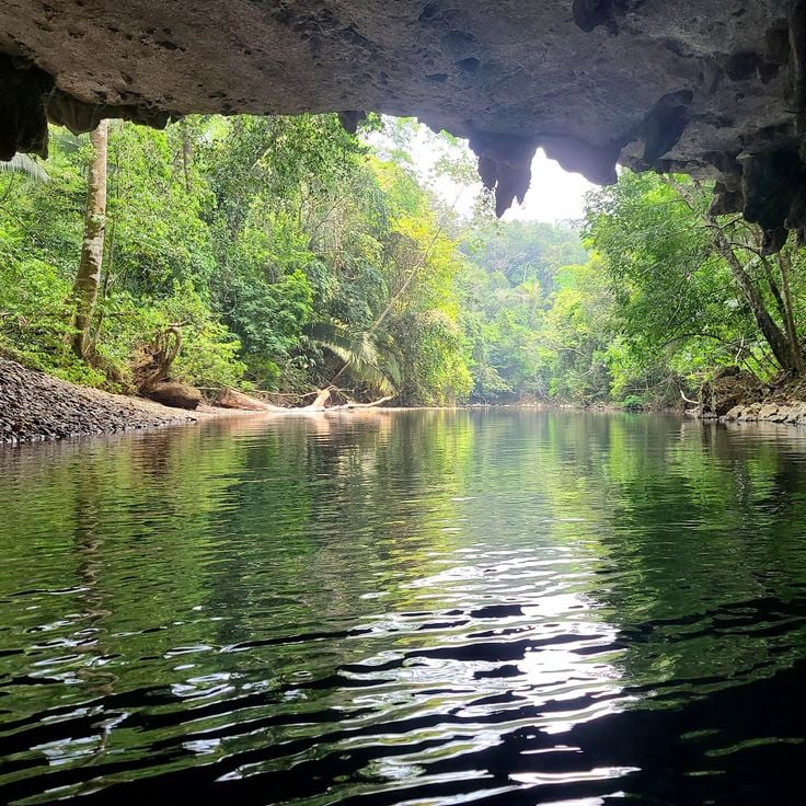
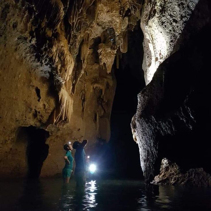
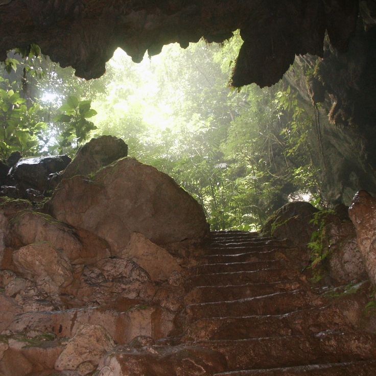
This cave system in Belize District extends three miles (5 kilometers) and leads through chambers containing ceremonial Maya objects, ceramics and calcified skeletons from the Late Classic period. Access follows a river route into multiple underground rooms where archaeological finds remain largely in their original positions. The Maya used the cave system for sacrificial rituals, and several human remains show evidence of ceremonial practices. Exploration requires swimming, climbing and crossing water at varying depths through the branching cave network.
The Green Iguana Conservation Project in San Ignacio focuses on studying and protecting green iguanas through breeding programs, egg incubation and research efforts aimed at preserving this reptile species within Belize's ecosystems.
Cahal Pech is a Maya ceremonial center established in 1200 BC with thirty-four limestone structures, terraces and a museum displaying funerary objects. The site sits on a hill above San Ignacio and provides insight into early Maya settlement in the region. Archaeologists have uncovered residential areas, plazas and temples that demonstrate sustained occupation. The museum displays ceramics, tools and ritual items recovered during excavations. A walking route leads through multiple levels of the site and illustrates architectural development over more than two thousand years.
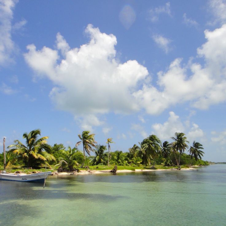
Laughing Bird Caye is a 10-acre (4-hectare) island surrounded by coral reefs that support populations of tropical fish. The island features walking trails and swimming areas. Located about 11 miles (18 kilometers) offshore, it serves as a protected reserve within the Belize Barrier Reef system.
This Maya archaeological site covers 8 square miles (13 square kilometers) and contains thirteen temples, two main plazas, and burial chambers with significant jade artifacts, including the famous carved jade head of the sun god Kinich Ahau. The settlement was occupied between 200 BCE and 900 CE and served as a trading center between the coast and inland regions. The preserved structures document architectural development across several centuries of Maya civilization.
The Crooked Tree Wildlife Sanctuary protects 15,000 acres (6,000 hectares) of lagoons, swamps and wetlands that serve as habitat for migratory birds and support a significant population of jabiru storks, the largest flying birds in the Western Hemisphere, which nest here between November and May and feed on fish in the seasonal floodplains.
Nohoch Che'en is an underground cave system with rivers, stalactites and stalagmites suitable for cave tubing and speleology. The caves extend for several miles and form part of a larger network of geological formations. Visitors can float through the underground waterways on inner tubes while observing the limestone formations that have developed over thousands of years.
Half Moon Caye covers 18 hectares (44 acres) and supports a major colony of frigatebirds and red-footed boobies. The island lies within Lighthouse Reef and is surrounded by coral gardens hosting numerous tropical fish species. A nature trail crosses the vegetation to a bird observation tower that overlooks the nesting grounds. Coastal waters provide access to several dive sites featuring walls and reef formations.
Glover's Reef extends over 22 miles (35 kilometers) and forms an atoll with five islands and a central lagoon. The reef area contains more than 800 individual coral formations and supports diverse marine life including sharks, rays and tropical fish. The lagoon reaches depths between 33 and 49 feet (10 and 15 meters) while the outer walls drop to 984 feet (300 meters).
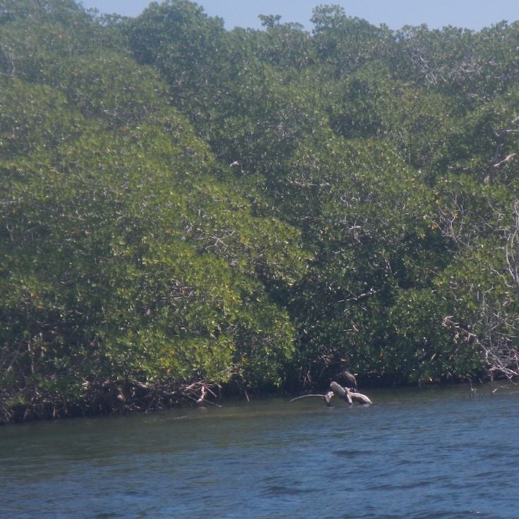
The Sapodilla Cayes form a cluster of fourteen islands in southern Belize, located approximately 40 miles (64 kilometers) offshore in the Gulf of Honduras. These islands are part of the Belize Barrier Reef Reserve System and lie within a marine reserve. White sand beaches alternate with mangrove forests and extensive seagrass beds that provide habitat for sea turtles, manatees, dolphins and various ray species. The surrounding coral reefs attract divers and snorkelers. Access is by boat from Punta Gorda, with crossings taking around two hours and subject to weather and sea conditions. Several islands remain uninhabited, while others offer basic accommodations for visitors.
This national park at the northern tip of Ambergris Caye protects 41 square miles (106 square kilometers) of terrestrial and marine ecosystems, including mangroves, lagoons and coral reefs. Archaeological sites document Maya settlement and their use of coastal resources. The research center monitors sea turtle nesting activities and coordinates conservation efforts for threatened species across the reef zones.
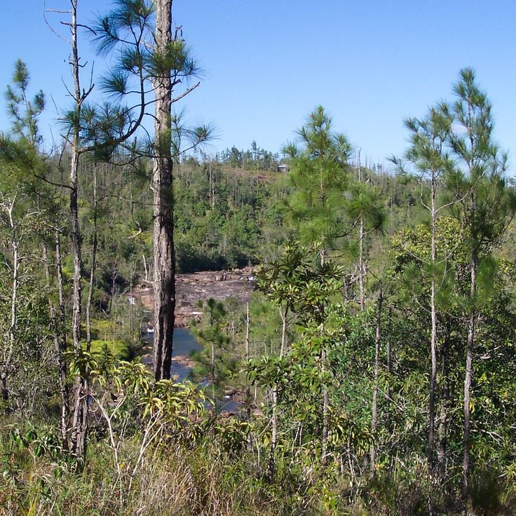
This forested reserve in Cayo District covers granite highlands where Caribbean pine grows instead of the rainforest vegetation typical of the region. The area includes several waterfalls, among them Thousand Foot Falls measuring more than 1,000 feet (300 meters) across, along with river courses that form natural swimming pools. A cave system with underground waterways runs through the formation and can be explored on guided tours.
South Water Caye sits in the Stann Creek District and forms a protected marine zone with coral reef, seagrass beds and mangroves. The area serves as a breeding ground for fish and seabirds and is part of the second largest coral reef system in the world. The island provides access to dive sites along the barrier and allows observation of marine biodiversity in reefs and mangrove zones.
Rio Bravo covers roughly 260,000 acres (105,000 hectares) of rainforest in northwestern Belize, connecting multiple ecosystems with swamps and wetlands. More than 400 bird species have been recorded in this conservation area, along with jaguars, pumas and tapirs. The forests contain over 70 Maya sites with temples, plazas and residential structures from the Classic and Preclassic periods. Rio Bravo serves as an important corridor linking protected areas in Belize, Guatemala and Mexico.
Mexico Rocks is a coral reef formation at 33 feet (10 meters) depth off the coast of Ambergris Caye, part of the Mesoamerican Barrier Reef. The shallow coral gardens host tropical fish species, nurse sharks, stingrays and sea turtles. The reef consists of multiple coral formations suitable for snorkeling and diving, with visibility ranging from 50 to 100 feet (15 to 30 meters) depending on conditions.
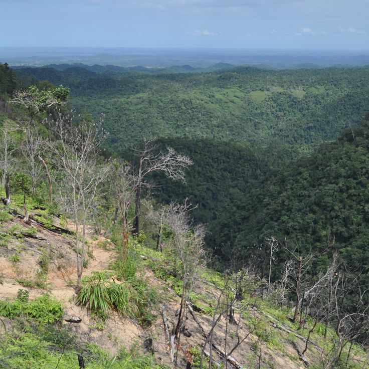
The Maya Mountains form a tropical rainforest-covered mountain range reaching 3,687 feet (1,124 meters) at its highest point. The slopes support jaguars, tapirs and toucans within a dense forest ecosystem that harbors a significant portion of the country's biodiversity and provides habitat for numerous other species.
These natural caves in the Cayo District are traversed by an underground river suitable for cave tubing. Visitors float on inner tubes through calm waters, observing limestone formations, stalactites and stalagmites along the way. Jaguar Paw Cave is part of a larger cave system shaped by water erosion over centuries. Guided tours lead through illuminated and unlit passages, with water depth and flow varying by season. The cave network sits within a forested area accessible via walking trails.
The Turneffe Atoll spans approximately 205 square miles (531 square kilometers) and comprises around 150 mangrove islands that provide habitat for over 500 fish species and 65 coral species, making it one of the most biodiverse marine ecosystems in the Belize Barrier Reef system.
Blue Hole National Park covers two square miles of tropical rainforest with two cave systems and a natural freshwater pool. St Herman's Cave contains Maya artifacts and geological formations, while Crystal Cave features underground rivers. Hiking trails lead through the forest to the Blue Hole, a 25-foot-deep (7.6-meter) pool created by the collapse of an underground river. The park sits along the Hummingbird Highway between Belmopan and Dangriga.
This natural channel divides Caye Caulker into two sections and creates a swimming area with white sand beaches along both shores. The water remains shallow and calm, protected by the offshore reef. Locals and visitors use the spot for swimming, while restaurants and bars along the northern shore provide seating. The Split formed in 1961 when a hurricane cut a narrow passage through the island.
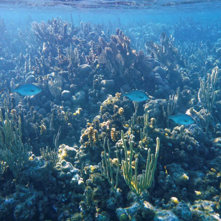
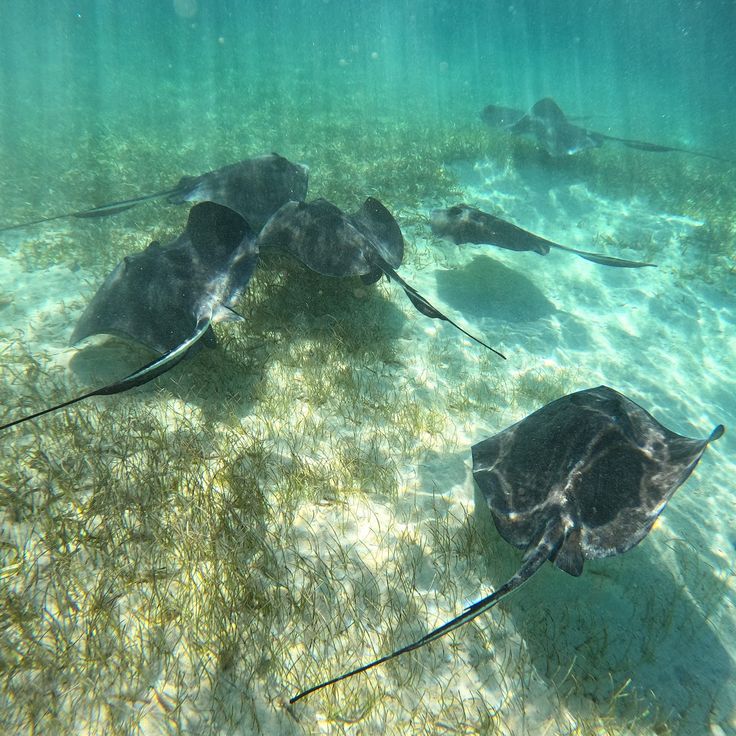
The Belize Barrier Reef extends 190 miles (300 kilometers) along the coast and supports 65 coral species and 500 fish species. The reef system includes three atolls, hundreds of sand cays and mangrove forests that serve as nurseries for marine life. Diving and snorkeling excursions lead to coral gardens, vertical walls and swim-throughs, while manatees, sea turtles and eagle rays inhabit the protected lagoons. The outer reef sections drop dramatically to depths exceeding 3,000 feet (900 meters).
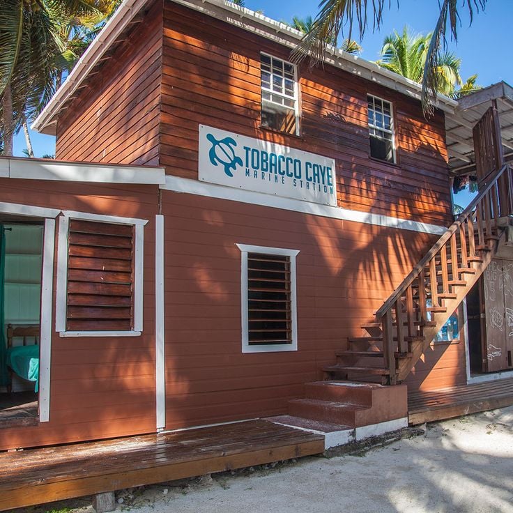
This small island of 4 acres (1.6 hectares) sits directly on the barrier reef and serves as a base for several marine research stations studying coral ecosystems. Tobacco Caye offers visitors basic accommodations and access to dive sites suitable for night diving, where visitors can observe nocturnal reef inhabitants. The island can be walked across in minutes and lies roughly 10 miles (16 kilometers) offshore.
This Maya archaeological complex in Orange Walk District extends along the New River Lagoon and includes temples, pyramids and ball courts dating back to 1500 BC. Lamanai was inhabited for over three thousand years and displays structures from various periods of Maya civilization, including the 108-foot (33-meter) High Temple pyramid. The waterside location enabled continuous settlement through trade and resource access, reflected in the diversity of preserved structures.
This marine sinkhole in Lighthouse Reef spans nearly 1,000 feet (300 meters) across and drops just over 400 feet (124 meters) deep. The formation developed during the Ice Age when a cave system stood above sea level and later flooded. The Grand Trou Bleu draws divers who observe stalactites at roughly 130 feet (40 meters) down and reef sharks in open water. The site lies some 40 miles (65 kilometers) east of Belize City and forms part of the coral reef reserve belonging to the second largest reef system in the Western Hemisphere.
Caracol ranks among the largest Maya cities in present-day Belize and reached its peak between the 6th and 7th centuries AD, when more than 100,000 people lived here. This archaeological site contains around 35,000 structures, including the 141-foot (43-meter) Caana pyramid, the tallest human-made structure in Belize. Visitors can explore residential complexes, plazas, ball courts and numerous stelae bearing Maya inscriptions that document significant historical events. The ruins sit deep within tropical rainforest and are accessible via a road through the Mountain Pine Ridge Forest Reserve, with the journey taking roughly two hours.
This rainforest reserve covers 150 square miles (390 square kilometers) of protected wilderness and serves as the world's first jaguar sanctuary, with over 300 bird species, pumas, ocelots and tapirs along trails and waterfalls throughout Cockscomb Basin.
The Belize Zoo maintains over 170 native animals across 29 acres (12 hectares) in habitats designed to resemble their natural environments, including jaguars, tapirs, ocelots and toucans. The facility functions as a rescue center for injured or orphaned wildlife and participates in educational programs about Central American fauna. Visitors follow trails through wooded grounds where interpretive signs explain each species' role in the country's ecosystems. The zoo sits along the Western Highway between Belize City and the capital Belmopan.
Xunantunich encompasses thirteen plazas and several Maya temples, dominated by the El Castillo pyramid that rises 130 feet (40 meters) above the central plaza and ranks among the country's significant Maya structures.
Ambergris Caye stretches 40 miles (64 kilometers) along the Mesoamerican Barrier Reef and forms Belize's largest island with San Pedro as its main town. This island provides direct access to diving sites within the reef system, mangrove channels along the western shore and sandy beaches on the eastern side. Several marine reserves protect coral formations and fish populations in the surrounding waters.
Caye Caulker is a 5-mile coral island in the Belize Barrier Reef, divided into two sections by a narrow channel. The island sits approximately 21 miles northeast of Belize City and serves as a base for diving and snorkeling trips to the surrounding reefs. Mangroves line the coastal areas while the waters around the island form part of the Belize Barrier Reef, home to sea turtles, rays and various fish species. The channel, known as The Split, was created by a hurricane and now functions as a swimming and recreation area.
This 18-square-mile (47-square-kilometer) marine reserve includes coral reefs and underwater channels along the coast of Belize District, contributing to the protection of the world's second largest barrier reef. Tropical fish move through the coral formations in shallow waters, while the channels serve as natural passages between reef and shore. The area protects various marine habitats and provides divers and snorkelers with access to the coral structures.
This cave system in Belize District extends three miles (5 kilometers) and leads through chambers containing ceremonial Maya objects, ceramics and calcified skeletons from the Late Classic period. Access follows a river route into multiple underground rooms where archaeological finds remain largely in their original positions. The Maya used the cave system for sacrificial rituals, and several human remains show evidence of ceremonial practices. Exploration requires swimming, climbing and crossing water at varying depths through the branching cave network.
The Green Iguana Conservation Project in San Ignacio focuses on studying and protecting green iguanas through breeding programs, egg incubation and research efforts aimed at preserving this reptile species within Belize's ecosystems.
Cahal Pech is a Maya ceremonial center established in 1200 BC with thirty-four limestone structures, terraces and a museum displaying funerary objects. The site sits on a hill above San Ignacio and provides insight into early Maya settlement in the region. Archaeologists have uncovered residential areas, plazas and temples that demonstrate sustained occupation. The museum displays ceramics, tools and ritual items recovered during excavations. A walking route leads through multiple levels of the site and illustrates architectural development over more than two thousand years.
Laughing Bird Caye is a 10-acre (4-hectare) island surrounded by coral reefs that support populations of tropical fish. The island features walking trails and swimming areas. Located about 11 miles (18 kilometers) offshore, it serves as a protected reserve within the Belize Barrier Reef system.
This Maya archaeological site covers 8 square miles (13 square kilometers) and contains thirteen temples, two main plazas, and burial chambers with significant jade artifacts, including the famous carved jade head of the sun god Kinich Ahau. The settlement was occupied between 200 BCE and 900 CE and served as a trading center between the coast and inland regions. The preserved structures document architectural development across several centuries of Maya civilization.
The Crooked Tree Wildlife Sanctuary protects 15,000 acres (6,000 hectares) of lagoons, swamps and wetlands that serve as habitat for migratory birds and support a significant population of jabiru storks, the largest flying birds in the Western Hemisphere, which nest here between November and May and feed on fish in the seasonal floodplains.
Nohoch Che'en is an underground cave system with rivers, stalactites and stalagmites suitable for cave tubing and speleology. The caves extend for several miles and form part of a larger network of geological formations. Visitors can float through the underground waterways on inner tubes while observing the limestone formations that have developed over thousands of years.
Half Moon Caye covers 18 hectares (44 acres) and supports a major colony of frigatebirds and red-footed boobies. The island lies within Lighthouse Reef and is surrounded by coral gardens hosting numerous tropical fish species. A nature trail crosses the vegetation to a bird observation tower that overlooks the nesting grounds. Coastal waters provide access to several dive sites featuring walls and reef formations.
Glover's Reef extends over 22 miles (35 kilometers) and forms an atoll with five islands and a central lagoon. The reef area contains more than 800 individual coral formations and supports diverse marine life including sharks, rays and tropical fish. The lagoon reaches depths between 33 and 49 feet (10 and 15 meters) while the outer walls drop to 984 feet (300 meters).
The Sapodilla Cayes form a cluster of fourteen islands in southern Belize, located approximately 40 miles (64 kilometers) offshore in the Gulf of Honduras. These islands are part of the Belize Barrier Reef Reserve System and lie within a marine reserve. White sand beaches alternate with mangrove forests and extensive seagrass beds that provide habitat for sea turtles, manatees, dolphins and various ray species. The surrounding coral reefs attract divers and snorkelers. Access is by boat from Punta Gorda, with crossings taking around two hours and subject to weather and sea conditions. Several islands remain uninhabited, while others offer basic accommodations for visitors.
This national park at the northern tip of Ambergris Caye protects 41 square miles (106 square kilometers) of terrestrial and marine ecosystems, including mangroves, lagoons and coral reefs. Archaeological sites document Maya settlement and their use of coastal resources. The research center monitors sea turtle nesting activities and coordinates conservation efforts for threatened species across the reef zones.
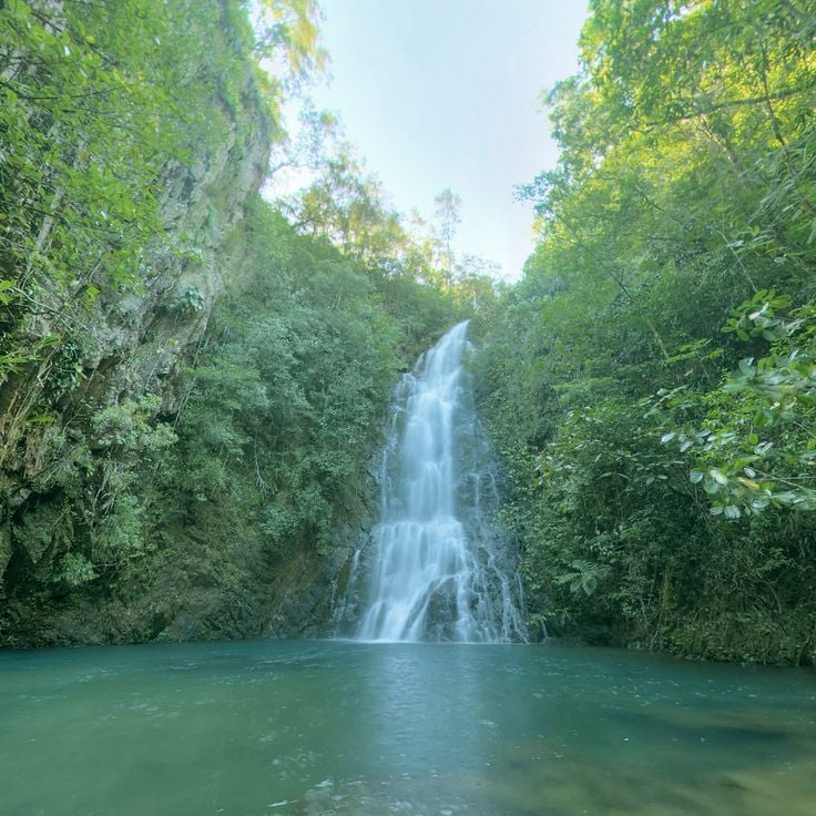
This forested reserve in Cayo District covers granite highlands where Caribbean pine grows instead of the rainforest vegetation typical of the region. The area includes several waterfalls, among them Thousand Foot Falls measuring more than 1,000 feet (300 meters) across, along with river courses that form natural swimming pools. A cave system with underground waterways runs through the formation and can be explored on guided tours.
South Water Caye sits in the Stann Creek District and forms a protected marine zone with coral reef, seagrass beds and mangroves. The area serves as a breeding ground for fish and seabirds and is part of the second largest coral reef system in the world. The island provides access to dive sites along the barrier and allows observation of marine biodiversity in reefs and mangrove zones.
Rio Bravo covers roughly 260,000 acres (105,000 hectares) of rainforest in northwestern Belize, connecting multiple ecosystems with swamps and wetlands. More than 400 bird species have been recorded in this conservation area, along with jaguars, pumas and tapirs. The forests contain over 70 Maya sites with temples, plazas and residential structures from the Classic and Preclassic periods. Rio Bravo serves as an important corridor linking protected areas in Belize, Guatemala and Mexico.
Mexico Rocks is a coral reef formation at 33 feet (10 meters) depth off the coast of Ambergris Caye, part of the Mesoamerican Barrier Reef. The shallow coral gardens host tropical fish species, nurse sharks, stingrays and sea turtles. The reef consists of multiple coral formations suitable for snorkeling and diving, with visibility ranging from 50 to 100 feet (15 to 30 meters) depending on conditions.
The Maya Mountains form a tropical rainforest-covered mountain range reaching 3,687 feet (1,124 meters) at its highest point. The slopes support jaguars, tapirs and toucans within a dense forest ecosystem that harbors a significant portion of the country's biodiversity and provides habitat for numerous other species.
These natural caves in the Cayo District are traversed by an underground river suitable for cave tubing. Visitors float on inner tubes through calm waters, observing limestone formations, stalactites and stalagmites along the way. Jaguar Paw Cave is part of a larger cave system shaped by water erosion over centuries. Guided tours lead through illuminated and unlit passages, with water depth and flow varying by season. The cave network sits within a forested area accessible via walking trails.
The Turneffe Atoll spans approximately 205 square miles (531 square kilometers) and comprises around 150 mangrove islands that provide habitat for over 500 fish species and 65 coral species, making it one of the most biodiverse marine ecosystems in the Belize Barrier Reef system.
Blue Hole National Park covers two square miles of tropical rainforest with two cave systems and a natural freshwater pool. St Herman's Cave contains Maya artifacts and geological formations, while Crystal Cave features underground rivers. Hiking trails lead through the forest to the Blue Hole, a 25-foot-deep (7.6-meter) pool created by the collapse of an underground river. The park sits along the Hummingbird Highway between Belmopan and Dangriga.
This natural channel divides Caye Caulker into two sections and creates a swimming area with white sand beaches along both shores. The water remains shallow and calm, protected by the offshore reef. Locals and visitors use the spot for swimming, while restaurants and bars along the northern shore provide seating. The Split formed in 1961 when a hurricane cut a narrow passage through the island.
The Belize Barrier Reef extends 190 miles (300 kilometers) along the coast and supports 65 coral species and 500 fish species. The reef system includes three atolls, hundreds of sand cays and mangrove forests that serve as nurseries for marine life. Diving and snorkeling excursions lead to coral gardens, vertical walls and swim-throughs, while manatees, sea turtles and eagle rays inhabit the protected lagoons. The outer reef sections drop dramatically to depths exceeding 3,000 feet (900 meters).
This small island of 4 acres (1.6 hectares) sits directly on the barrier reef and serves as a base for several marine research stations studying coral ecosystems. Tobacco Caye offers visitors basic accommodations and access to dive sites suitable for night diving, where visitors can observe nocturnal reef inhabitants. The island can be walked across in minutes and lies roughly 10 miles (16 kilometers) offshore.
This Maya archaeological complex in Orange Walk District extends along the New River Lagoon and includes temples, pyramids and ball courts dating back to 1500 BC. Lamanai was inhabited for over three thousand years and displays structures from various periods of Maya civilization, including the 108-foot (33-meter) High Temple pyramid. The waterside location enabled continuous settlement through trade and resource access, reflected in the diversity of preserved structures.
This marine sinkhole in Lighthouse Reef spans nearly 1,000 feet (300 meters) across and drops just over 400 feet (124 meters) deep. The formation developed during the Ice Age when a cave system stood above sea level and later flooded. The Grand Trou Bleu draws divers who observe stalactites at roughly 130 feet (40 meters) down and reef sharks in open water. The site lies some 40 miles (65 kilometers) east of Belize City and forms part of the coral reef reserve belonging to the second largest reef system in the Western Hemisphere.
Caracol ranks among the largest Maya cities in present-day Belize and reached its peak between the 6th and 7th centuries AD, when more than 100,000 people lived here. This archaeological site contains around 35,000 structures, including the 141-foot (43-meter) Caana pyramid, the tallest human-made structure in Belize. Visitors can explore residential complexes, plazas, ball courts and numerous stelae bearing Maya inscriptions that document significant historical events. The ruins sit deep within tropical rainforest and are accessible via a road through the Mountain Pine Ridge Forest Reserve, with the journey taking roughly two hours.
This rainforest reserve covers 150 square miles (390 square kilometers) of protected wilderness and serves as the world's first jaguar sanctuary, with over 300 bird species, pumas, ocelots and tapirs along trails and waterfalls throughout Cockscomb Basin.
The Belize Zoo maintains over 170 native animals across 29 acres (12 hectares) in habitats designed to resemble their natural environments, including jaguars, tapirs, ocelots and toucans. The facility functions as a rescue center for injured or orphaned wildlife and participates in educational programs about Central American fauna. Visitors follow trails through wooded grounds where interpretive signs explain each species' role in the country's ecosystems. The zoo sits along the Western Highway between Belize City and the capital Belmopan.
Xunantunich encompasses thirteen plazas and several Maya temples, dominated by the El Castillo pyramid that rises 130 feet (40 meters) above the central plaza and ranks among the country's significant Maya structures.
Ambergris Caye stretches 40 miles (64 kilometers) along the Mesoamerican Barrier Reef and forms Belize's largest island with San Pedro as its main town. This island provides direct access to diving sites within the reef system, mangrove channels along the western shore and sandy beaches on the eastern side. Several marine reserves protect coral formations and fish populations in the surrounding waters.
Caye Caulker is a 5-mile coral island in the Belize Barrier Reef, divided into two sections by a narrow channel. The island sits approximately 21 miles northeast of Belize City and serves as a base for diving and snorkeling trips to the surrounding reefs. Mangroves line the coastal areas while the waters around the island form part of the Belize Barrier Reef, home to sea turtles, rays and various fish species. The channel, known as The Split, was created by a hurricane and now functions as a swimming and recreation area.
This 18-square-mile (47-square-kilometer) marine reserve includes coral reefs and underwater channels along the coast of Belize District, contributing to the protection of the world's second largest barrier reef. Tropical fish move through the coral formations in shallow waters, while the channels serve as natural passages between reef and shore. The area protects various marine habitats and provides divers and snorkelers with access to the coral structures.
This cave system in Belize District extends three miles (5 kilometers) and leads through chambers containing ceremonial Maya objects, ceramics and calcified skeletons from the Late Classic period. Access follows a river route into multiple underground rooms where archaeological finds remain largely in their original positions. The Maya used the cave system for sacrificial rituals, and several human remains show evidence of ceremonial practices. Exploration requires swimming, climbing and crossing water at varying depths through the branching cave network.
The Green Iguana Conservation Project in San Ignacio focuses on studying and protecting green iguanas through breeding programs, egg incubation and research efforts aimed at preserving this reptile species within Belize's ecosystems.
Cahal Pech is a Maya ceremonial center established in 1200 BC with thirty-four limestone structures, terraces and a museum displaying funerary objects. The site sits on a hill above San Ignacio and provides insight into early Maya settlement in the region. Archaeologists have uncovered residential areas, plazas and temples that demonstrate sustained occupation. The museum displays ceramics, tools and ritual items recovered during excavations. A walking route leads through multiple levels of the site and illustrates architectural development over more than two thousand years.
Laughing Bird Caye is a 10-acre (4-hectare) island surrounded by coral reefs that support populations of tropical fish. The island features walking trails and swimming areas. Located about 11 miles (18 kilometers) offshore, it serves as a protected reserve within the Belize Barrier Reef system.
This Maya archaeological site covers 8 square miles (13 square kilometers) and contains thirteen temples, two main plazas, and burial chambers with significant jade artifacts, including the famous carved jade head of the sun god Kinich Ahau. The settlement was occupied between 200 BCE and 900 CE and served as a trading center between the coast and inland regions. The preserved structures document architectural development across several centuries of Maya civilization.
The Crooked Tree Wildlife Sanctuary protects 15,000 acres (6,000 hectares) of lagoons, swamps and wetlands that serve as habitat for migratory birds and support a significant population of jabiru storks, the largest flying birds in the Western Hemisphere, which nest here between November and May and feed on fish in the seasonal floodplains.
Nohoch Che'en is an underground cave system with rivers, stalactites and stalagmites suitable for cave tubing and speleology. The caves extend for several miles and form part of a larger network of geological formations. Visitors can float through the underground waterways on inner tubes while observing the limestone formations that have developed over thousands of years.
Half Moon Caye covers 18 hectares (44 acres) and supports a major colony of frigatebirds and red-footed boobies. The island lies within Lighthouse Reef and is surrounded by coral gardens hosting numerous tropical fish species. A nature trail crosses the vegetation to a bird observation tower that overlooks the nesting grounds. Coastal waters provide access to several dive sites featuring walls and reef formations.
Glover's Reef extends over 22 miles (35 kilometers) and forms an atoll with five islands and a central lagoon. The reef area contains more than 800 individual coral formations and supports diverse marine life including sharks, rays and tropical fish. The lagoon reaches depths between 33 and 49 feet (10 and 15 meters) while the outer walls drop to 984 feet (300 meters).
The Sapodilla Cayes form a cluster of fourteen islands in southern Belize, located approximately 40 miles (64 kilometers) offshore in the Gulf of Honduras. These islands are part of the Belize Barrier Reef Reserve System and lie within a marine reserve. White sand beaches alternate with mangrove forests and extensive seagrass beds that provide habitat for sea turtles, manatees, dolphins and various ray species. The surrounding coral reefs attract divers and snorkelers. Access is by boat from Punta Gorda, with crossings taking around two hours and subject to weather and sea conditions. Several islands remain uninhabited, while others offer basic accommodations for visitors.
This national park at the northern tip of Ambergris Caye protects 41 square miles (106 square kilometers) of terrestrial and marine ecosystems, including mangroves, lagoons and coral reefs. Archaeological sites document Maya settlement and their use of coastal resources. The research center monitors sea turtle nesting activities and coordinates conservation efforts for threatened species across the reef zones.
This forested reserve in Cayo District covers granite highlands where Caribbean pine grows instead of the rainforest vegetation typical of the region. The area includes several waterfalls, among them Thousand Foot Falls measuring more than 1,000 feet (300 meters) across, along with river courses that form natural swimming pools. A cave system with underground waterways runs through the formation and can be explored on guided tours.
South Water Caye sits in the Stann Creek District and forms a protected marine zone with coral reef, seagrass beds and mangroves. The area serves as a breeding ground for fish and seabirds and is part of the second largest coral reef system in the world. The island provides access to dive sites along the barrier and allows observation of marine biodiversity in reefs and mangrove zones.
Rio Bravo covers roughly 260,000 acres (105,000 hectares) of rainforest in northwestern Belize, connecting multiple ecosystems with swamps and wetlands. More than 400 bird species have been recorded in this conservation area, along with jaguars, pumas and tapirs. The forests contain over 70 Maya sites with temples, plazas and residential structures from the Classic and Preclassic periods. Rio Bravo serves as an important corridor linking protected areas in Belize, Guatemala and Mexico.
Mexico Rocks is a coral reef formation at 33 feet (10 meters) depth off the coast of Ambergris Caye, part of the Mesoamerican Barrier Reef. The shallow coral gardens host tropical fish species, nurse sharks, stingrays and sea turtles. The reef consists of multiple coral formations suitable for snorkeling and diving, with visibility ranging from 50 to 100 feet (15 to 30 meters) depending on conditions.
The Maya Mountains form a tropical rainforest-covered mountain range reaching 3,687 feet (1,124 meters) at its highest point. The slopes support jaguars, tapirs and toucans within a dense forest ecosystem that harbors a significant portion of the country's biodiversity and provides habitat for numerous other species.
These natural caves in the Cayo District are traversed by an underground river suitable for cave tubing. Visitors float on inner tubes through calm waters, observing limestone formations, stalactites and stalagmites along the way. Jaguar Paw Cave is part of a larger cave system shaped by water erosion over centuries. Guided tours lead through illuminated and unlit passages, with water depth and flow varying by season. The cave network sits within a forested area accessible via walking trails.
The Turneffe Atoll spans approximately 205 square miles (531 square kilometers) and comprises around 150 mangrove islands that provide habitat for over 500 fish species and 65 coral species, making it one of the most biodiverse marine ecosystems in the Belize Barrier Reef system.
Blue Hole National Park covers two square miles of tropical rainforest with two cave systems and a natural freshwater pool. St Herman's Cave contains Maya artifacts and geological formations, while Crystal Cave features underground rivers. Hiking trails lead through the forest to the Blue Hole, a 25-foot-deep (7.6-meter) pool created by the collapse of an underground river. The park sits along the Hummingbird Highway between Belmopan and Dangriga.
This natural channel divides Caye Caulker into two sections and creates a swimming area with white sand beaches along both shores. The water remains shallow and calm, protected by the offshore reef. Locals and visitors use the spot for swimming, while restaurants and bars along the northern shore provide seating. The Split formed in 1961 when a hurricane cut a narrow passage through the island.
The Belize Barrier Reef extends 190 miles (300 kilometers) along the coast and supports 65 coral species and 500 fish species. The reef system includes three atolls, hundreds of sand cays and mangrove forests that serve as nurseries for marine life. Diving and snorkeling excursions lead to coral gardens, vertical walls and swim-throughs, while manatees, sea turtles and eagle rays inhabit the protected lagoons. The outer reef sections drop dramatically to depths exceeding 3,000 feet (900 meters).
This small island of 4 acres (1.6 hectares) sits directly on the barrier reef and serves as a base for several marine research stations studying coral ecosystems. Tobacco Caye offers visitors basic accommodations and access to dive sites suitable for night diving, where visitors can observe nocturnal reef inhabitants. The island can be walked across in minutes and lies roughly 10 miles (16 kilometers) offshore.