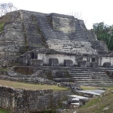
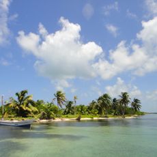
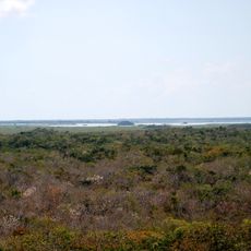
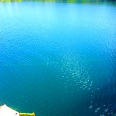
Mexico Rocks, Marine reserve at Ambergris Caye, Belize
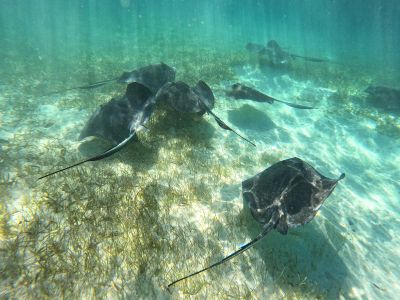
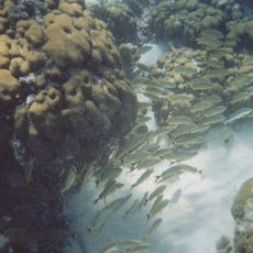
This site contains numerous patch reefs on a limestone ridge in shallow waters between 8 and 12 feet (2.4 to 3.7 meters) deep with extensive hard coral formations and seagrass beds supporting diverse marine life.
This reef system formed over several centuries in these shallow Caribbean waters and received official protection in 2015 as part of the expanded Hol Chan reserve managed by Belizean authorities.
Guides from San Pedro teach visitors about reef ecology and promote awareness of marine protection through supervised tours in these Caribbean waters off Ambergris Caye.
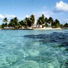
Boats leave from San Pedro for twenty-minute trips to these reefs where visitors snorkel in waters between 8 and 12 feet (2.4 to 3.7 meters) deep with a 15 USD entrance fee required.
Thirty different hard coral species inhabit this location, including rare boulder star coral of the Orbicella annularis type documented at only two sites throughout Belize.
Address: Mexico Rocks, Belize
GPS coordinates: 17.98333,-87.90000
Latest update: November 27, 2025 20:36
Belize protects over 300 miles of the second largest barrier reef in the Western Hemisphere and a substantial number of pre-Columbian Maya sites, many located deep within rainforests. The country combines marine protected areas, archaeological remains, and extensive nature reserves within a relatively compact territory. Visitors can explore the Great Blue Hole at Lighthouse Reef, a circular sinkhole roughly 1,000 feet (305 meters) across and 410 feet (125 meters) deep, one day and walk through the ruins of Caracol the next, the country's largest Maya site with pyramids rising over 140 feet (43 meters). The islands of Ambergris Caye and Caye Caulker provide direct access to the reef and stretches of sandy shoreline. The Cockscomb Basin Wildlife Sanctuary preserves approximately 150 square miles (390 square kilometers) of rainforest as a protected area for jaguars and other mammals. Underwater protected areas like Hol Chan Marine Reserve and Turneffe Atoll Marine Reserve safeguard coral gardens, seagrass beds, and mangrove forests that support marine life. Archaeological sites such as Xunantunich, Lamanai, and Altun Ha showcase different building styles and periods of Maya civilization. Actun Tunichil Muknal cave combines geological formations with archaeological artifacts and is accessed by wading through underground rivers. The Mountain Pine Ridge Forest Reserve offers pine forests, waterfalls, and limestone formations in the western highlands.
Great Blue Hole
83.8 km
Belize Barrier Reef
81.9 km
Lamanai
84 km
Altun Ha
52.8 km
Taam ja’ Blue Hole
75.8 km
British Army Training Support Unit Belize
65.2 km
Turneffe islands
54.2 km
Hol Chan Marine Reserve
16.8 km
San Felipe Fortress
93.3 km
Swing Bridge
62.3 km
Crooked Tree Wildlife Sanctuary
74 km
Baron Bliss Light
62.4 km
Jardín Zoológico Payo Obispo
73.5 km
Museum of Belize
61.8 km
Bliss Institute
62.4 km
Shipstern
48.4 km
English Caye Light
74.7 km
Half Moon Caye Light
94.9 km
Mauger Caye Light
44 km
Blue Cenote
91.6 km
Zona Arqueológica Oxtankah
77.9 km
Robinson Point Light
76.8 km
BlueKay Beach
84.9 km
Government House
62.9 km
Half Moon Caye Light
94.9 km
Banco Chinchorro
83.9 km
Majahual Lighthouse
86.1 km
Friends of Swallow Caye
29.3 kmReviews
Visited this place? Tap the stars to rate it and share your experience / photos with the community! Try now! You can cancel it anytime.
Discover hidden gems everywhere you go!
From secret cafés to breathtaking viewpoints, skip the crowded tourist spots and find places that match your style. Our app makes it easy with voice search, smart filtering, route optimization, and insider tips from travelers worldwide. Download now for the complete mobile experience.
A unique approach to discovering new places❞
— Le Figaro
All the places worth exploring❞
— France Info
A tailor-made excursion in just a few clicks❞
— 20 Minutes