Chest opened
+${chestReward.xp} XP
Explorer
NOUVEAU ×${chestReward.collectible.quantity}
tapez pour fermer
Chest locked

Open chests in the app

Around Us is built for your phone — chests unlock when you walk, explore and capture nearby places.

Enable Location

We need your location to show you interesting places around you

Discover nearby places

Find interesting locations and hidden gems around you

Precise directions

Get accurate directions and distances to places

Your location is never shared with other users. It's only used when you tap the location button.

Lac Vieux Desert

Log in to your account

Start exploring — it's free

Trusted by 72,994 travelers worldwide

Continue with Google
Continue with Apple
or

We will send you a code to connect

By continuing, you accept our Terms and Conditions and our Privacy Policy

Check your inbox

We've sent a pincode in your inbox. Please enter the code below.

Lac Vieux Desert
Discussion Reviews 1 Photos
9.5k Popularity

Lac Vieux Desert, Lake in Vilas County and Gogebic County, United States

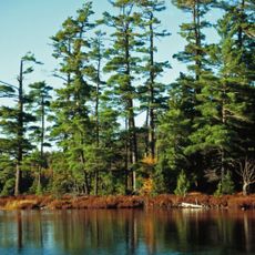
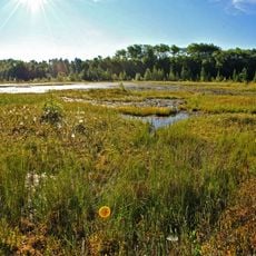
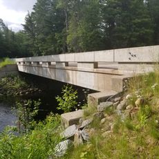
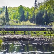
Lac Vieux Desert is a lake sitting on the border between Wisconsin and Michigan, shared by both states. It has several public boat launches, designated swimming areas, and nearby camping options that make it a year-round destination for outdoor activities.

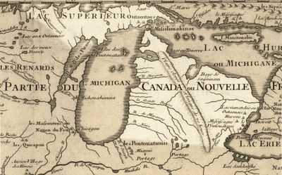
The Ojibwe people relied on these waters for fishing and food long before European settlers arrived in the region. Their presence shaped the area's early history and gave the lake its French name, which translates roughly to "old desert lake."

Fishing tournaments bring together people from both Wisconsin and Michigan, making the lake a shared gathering point across state lines. On any given day, boats and anglers line the water, giving the place a relaxed and community-driven feel.

The lake is accessible from both the Wisconsin and Michigan sides, with boat launches and swimming areas easy to find along the shore. Weather can shift quickly in this part of the country, so checking conditions before heading out on the water is a good idea.

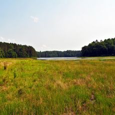
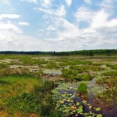
The Wisconsin River begins here, starting its long journey south from this lake. Several small islands are scattered across the water, giving it a layout that makes it look quite different from most lakes of similar size.

The community of curious travelers

AroundUs brings together thousands of curated places, local tips, and hidden gems, enriched daily by 60,000 contributors worldwide.

Start exploring
Location
Location
Elevation above the sea
513 m
GPS coordinates
46.13729,-89.11261
Latest update
March 3, 2026 08:19
Around this place
Bond Falls
United States of America

Bond Falls

30.4 km
Sylvania Wilderness
United States of America

Sylvania Wilderness

16.8 km
Iron County MRA
United States of America

Iron County MRA

47.5 km
Agate Falls Scenic Site
United States of America

Agate Falls Scenic Site

38.3 km
United States of America

Northern Highland-American Legion State Forest

43 km
Bewabic State Park
United States of America

Bewabic State Park

52.8 km
Headwaters Wilderness
United States of America

Headwaters Wilderness

38.1 km
Blackjack Springs Wilderness
United States of America

Blackjack Springs Wilderness

18.1 km
Eagle River Stadium
United States of America

Eagle River Stadium

26.4 km
Pioneer Park Historical Complex
United States of America

Pioneer Park Historical Complex

55.1 km
United States of America

O Kun de Kun Falls

57 km
Black Tern Bog State Natural Area
United States of America

Black Tern Bog State Natural Area

49 km
Sunset Point
United States of America

Sunset Point

26.9 km
Central School
United States of America

Central School

36.7 km
Wind Pudding Lake State Natural Area
United States of America

Wind Pudding Lake State Natural Area

58.1 km
Grandma Lake Wetlands State Natural Area
United States of America

Grandma Lake Wetlands State Natural Area

52.6 km
Franklin Lake Campground
United States of America

Franklin Lake Campground

24.7 km
Rice Creek State Natural Area
United States of America

Rice Creek State Natural Area

49.1 km
Forest Route 157–Tamarack River Bridge
United States of America

Forest Route 157–Tamarack River Bridge

16 km
Anvil Lake Campground Shelter
United States of America

Anvil Lake Campground Shelter

22.6 km
Bose Lake Hemlock Hardwoods
United States of America

Bose Lake Hemlock Hardwoods

25.3 km
Torpy Park Beach
United States of America

Torpy Park Beach

54.7 km
Finnerud Forest Scientific Area
United States of America

Finnerud Forest Scientific Area

58.1 km
Chicagon Mine Road–Chicagon Creek Bridge
United States of America

Chicagon Mine Road–Chicagon Creek Bridge

46.8 km
Lake Gogebic State Park Beach
United States of America

Lake Gogebic State Park Beach

49.9 km
Lake Gogebic State Park
United States of America

Lake Gogebic State Park

50.4 km
Lake Gogebic
United States of America

Lake Gogebic

54.2 km
M 189 / W 139 Highway Bridge over Brule River
United States of America

M 189 / W 139 Highway Bridge over Brule River

39.3 km
Show the full map
Reviews
Share your experience

No review yet

Discussions
Start a discussion...

No discussion yet

« Lac Vieux Desert - Lake in Vilas County and Gogebic County, United States » is provided by Around Us (aroundus.com). Images and texts are derived from Wikimedia project under a Creative Commons license. You are allowed to copy, distribute, and modify copies of this page, under the conditions set by the license, as long as this note is clearly visible.

Discover hidden gems everywhere you go!

From secret cafés to breathtaking viewpoints, skip the crowded tourist spots and find places that match your style. Our app makes it easy with voice search, smart filtering, route optimization, and insider tips from travelers worldwide. Download now for the complete mobile experience.

Around Us App Screenshot

A unique approach to discovering new places

Le Figaro

All the places worth exploring

France Info

A tailor-made excursion in just a few clicks

20 Minutes

Around Us
Travel Guide & Maps
Download

Send to your phone

QR Code
1

Open the camera app on your mobile.

2

Point at the QR code with your camera. A notification will appear.

3

Tap the notification to open the link.