Chest opened
+${chestReward.xp} XP
Explorer
NOUVEAU ×${chestReward.collectible.quantity}
tapez pour fermer
Chest locked

Open chests in the app

Around Us is built for your phone — chests unlock when you walk, explore and capture nearby places.

Enable Location

We need your location to show you interesting places around you

Discover nearby places

Find interesting locations and hidden gems around you

Precise directions

Get accurate directions and distances to places

Your location is never shared with other users. It's only used when you tap the location button.

Log in to your account

Start exploring — it's free

Trusted by 72,979 travelers worldwide

Continue with Google
Continue with Apple
or

We will send you a code to connect

By continuing, you accept our Terms and Conditions and our Privacy Policy

Check your inbox

We've sent a pincode in your inbox. Please enter the code below.

National Remote Sensing Centre
Discussion Reviews Photo
24.3k Popularity

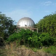
National Remote Sensing Centre, Space research facility in Hyderabad, India

The National Remote Sensing Centre is a government facility in Hyderabad that operates multiple satellites to collect data about land resources, forests, and water bodies. It provides satellite imagery and analytical tools through online portals for studying geographical changes across the country.

The Department of Space established this facility to strengthen India's capabilities in earth observation and environmental monitoring. Satellite technology enabled the country to develop its own infrastructure for tracking resources and landscape changes independently.

The center runs training programs for students and professionals interested in earth observation and space technology. These educational activities help build expertise across institutions and organizations throughout the country.

Organizations and researchers can access satellite imagery through online portals to analyze geographical changes and support planning decisions. The data serves multiple sectors including agriculture, water management, and environmental conservation.

The facility uses satellite data to predict natural disasters and enable rapid response across the subcontinent. This early-warning capacity has helped manage floods, droughts, and other emergencies across the region.

The community of curious travelers

AroundUs brings together thousands of curated places, local tips, and hidden gems, enriched daily by 60,000 contributors worldwide.

Start exploring
GPS coordinates
17.46773,78.44869
Latest update
December 20, 2025 12:49
Reviews
Share your experience

No review yet

Discussions
Start a discussion...

No discussion yet

« National Remote Sensing Centre - Space research facility in Hyderabad, India » is provided by Around Us (aroundus.com). Images and texts are derived from Wikimedia project under a Creative Commons license. You are allowed to copy, distribute, and modify copies of this page, under the conditions set by the license, as long as this note is clearly visible.

Discover hidden gems everywhere you go!

From secret cafés to breathtaking viewpoints, skip the crowded tourist spots and find places that match your style. Our app makes it easy with voice search, smart filtering, route optimization, and insider tips from travelers worldwide. Download now for the complete mobile experience.

Around Us App Screenshot

A unique approach to discovering new places

Le Figaro

All the places worth exploring

France Info

A tailor-made excursion in just a few clicks

20 Minutes

Around Us
Travel Guide & Maps
Download

Send to your phone

QR Code
1

Open the camera app on your mobile.

2

Point at the QR code with your camera. A notification will appear.

3

Tap the notification to open the link.