Chest opened
+${chestReward.xp} XP
Explorer
NOUVEAU ×${chestReward.collectible.quantity}
tapez pour fermer
Chest locked

Open chests in the app

Around Us is built for your phone — chests unlock when you walk, explore and capture nearby places.

Enable Location

We need your location to show you interesting places around you

Discover nearby places

Find interesting locations and hidden gems around you

Precise directions

Get accurate directions and distances to places

Your location is never shared with other users. It's only used when you tap the location button.

Log in to your account

Start exploring — it's free

Trusted by 72,883 travelers worldwide

Continue with Google
Continue with Apple
or

We will send you a code to connect

By continuing, you accept our Terms and Conditions and our Privacy Policy

Check your inbox

We've sent a pincode in your inbox. Please enter the code below.

Tamarack Swamp
Discussion Reviews Photo
2.1k Popularity

Tamarack Swamp, Wetland ecosystem in Clinton County, Pennsylvania, US.

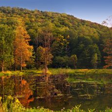
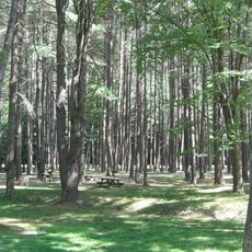
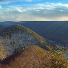
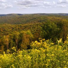
Tamarack Swamp is a wetland ecosystem in Clinton County within Sproul State Forest. The area supports diverse plant species adapted to wet conditions and serves as habitat for numerous bird and mammal species.

The swamp formed after the last ice age thousands of years ago and was first documented in the 1800s when settlers began exploring the region. Early records mentioned the presence of now-extinct large mammals in the area.

The establishment of the Kelly family settlement on the western edge of Tamarack Swamp in the early 1800s marked the first documented human presence.

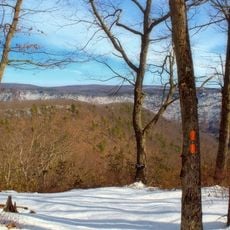
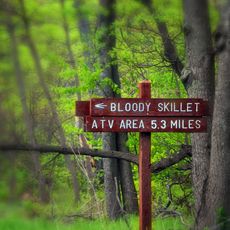
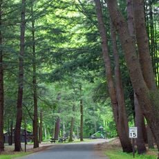
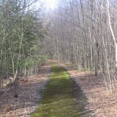
The site is accessible by forest trails that vary in difficulty depending on seasonal conditions and water levels. Sturdy footwear and weather-appropriate clothing are recommended, especially during wetter months when the ground is softer.

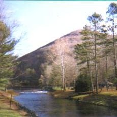
The swamp serves as the source of Drury Run stream and contains native tamarack trees that thrive in the wet conditions. These trees are uncommon further south and make this location special for forest ecology.

The community of curious travelers

AroundUs brings together thousands of curated places, local tips, and hidden gems, enriched daily by 60,000 contributors worldwide.

Start exploring
Location
GPS coordinates
41.42300,-77.84000
Latest update
December 13, 2025 17:04
Around this place
Cherry Springs State Park
United States of America

Cherry Springs State Park

26.7 km
Quehanna Wild Area
United States of America

Quehanna Wild Area

38.6 km
Upper Pine Bottom State Park
United States of America

Upper Pine Bottom State Park

36.8 km
Hyner View State Park
United States of America

Hyner View State Park

21 km
Ole Bull State Park
United States of America

Ole Bull State Park

16.5 km
Black Forest Trail
United States of America

Black Forest Trail

30.2 km
Sproul State Forest
United States of America

Sproul State Forest

13 km
Kettle Creek State Park
United States of America

Kettle Creek State Park

8.2 km
Lyman Run State Park
United States of America

Lyman Run State Park

33.7 km
Little Pine State Park
United States of America

Little Pine State Park

41.2 km
Sinnemahoning State Park
United States of America

Sinnemahoning State Park

17.7 km
Elk State Forest
United States of America

Elk State Forest

39 km
Hammersley Wild Area
United States of America

Hammersley Wild Area

10.6 km
Bucktail State Park Natural Area
United States of America

Bucktail State Park Natural Area

33.1 km
Denton Hill State Park
United States of America

Denton Hill State Park

38.4 km
Hyner Run State Park
United States of America

Hyner Run State Park

18.7 km
Sizerville State Park
United States of America

Sizerville State Park

35.2 km
Pennsylvania Lumber Museum
United States of America

Pennsylvania Lumber Museum

40 km
Patterson State Park
United States of America

Patterson State Park

30.7 km
Marion Brooks Natural Area
United States of America

Marion Brooks Natural Area

40.8 km
Golden Eagle Trail
United States of America

Golden Eagle Trail

27.6 km
Wykoff Run Natural Area
United States of America

Wykoff Run Natural Area

36.5 km
Forrest H. Duttlinger Natural Area
United States of America

Forrest H. Duttlinger Natural Area

6.2 km
Bridge in Brown Township
United States of America

Bridge in Brown Township

29.5 km
Farrandsville Iron Furnace
United States of America

Farrandsville Iron Furnace

38.8 km
Cameron County Courthouse
United States of America

Cameron County Courthouse

34.5 km
Cherry Springs Picnic Pavilion
United States of America

Cherry Springs Picnic Pavilion

26.6 km
Susquehannock State Forest
United States of America

Susquehannock State Forest

23.9 km
Show the full map
Reviews
Share your experience

No review yet

Discussions
Start a discussion...

No discussion yet

« Tamarack Swamp - Wetland ecosystem in Clinton County, Pennsylvania, US » is provided by Around Us (aroundus.com). Images and texts are derived from Wikimedia project under a Creative Commons license. You are allowed to copy, distribute, and modify copies of this page, under the conditions set by the license, as long as this note is clearly visible.

Discover hidden gems everywhere you go!

From secret cafés to breathtaking viewpoints, skip the crowded tourist spots and find places that match your style. Our app makes it easy with voice search, smart filtering, route optimization, and insider tips from travelers worldwide. Download now for the complete mobile experience.

Around Us App Screenshot

A unique approach to discovering new places

Le Figaro

All the places worth exploring

France Info

A tailor-made excursion in just a few clicks

20 Minutes

Around Us
Travel Guide & Maps
Download

Send to your phone

QR Code
1

Open the camera app on your mobile.

2

Point at the QR code with your camera. A notification will appear.

3

Tap the notification to open the link.