Vilcabamba District, Administrative district in La Convención Province, Peru
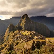
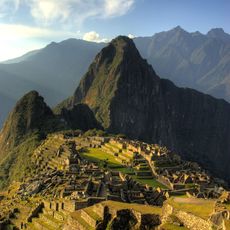
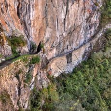
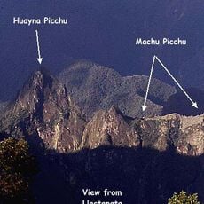
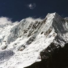
Vilcabamba District is an administrative territory in La Convención Province that encompasses diverse landscapes. The land transitions from thick forests at lower elevations to high mountain ranges rising above 5,000 meters.
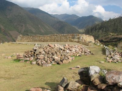
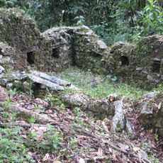
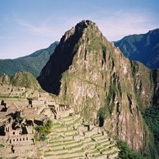
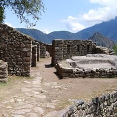
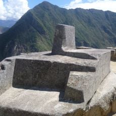
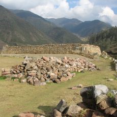
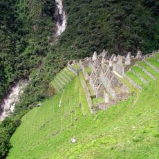
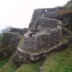
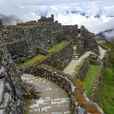
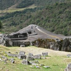
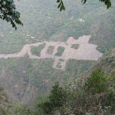
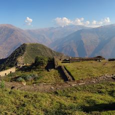
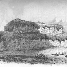
The district holds archaeological remains of Vitcos, a major city from the late Inca period. The settlement served as an important center of power from 1537 until 1572.
Quechua remains the main language spoken by people living in the district's communities. This linguistic heritage connects residents to the broader Andean cultural world that surrounds them.
The district capital is situated at 2,943 meters above sea level and functions as the main administrative hub. Visitors should prepare for high elevation and mountainous terrain, as access requires traveling through difficult passages.
The Apurímac River marks a natural boundary between the district and the Ayacucho Region nearby. This watercourse gathers flow from mountain tributaries and creates a striking geographic division that has shaped the area for centuries.
Location: La Convención Province
Inception: January 2, 1857
Capital city: Lucma
Elevation above the sea: 2,764 m
Shares border with: Villa Virgen District, Echarate District, Santa Ana District, Maranura District, Santa Teresa District, Huanipaca District, Inkawasi District, Chungui District, Kumpirushiato District
Website: https://gob.pe/munivilcabamba-cusco
GPS coordinates: -13.10783,-73.12137
Latest update: December 10, 2025 15:54
Machu Picchu
62.7 km
Vilcabamba
24.7 km
Historic Sanctuary of Machu Picchu
58.3 km
Huayna Picchu
62.6 km
Choquequirao
41.8 km
Temple of the Moon
62.5 km
Intipuncu
64.1 km
Intihuatana, Urubamba
62.7 km
Inca Bridge
63 km
Vitcos
21 km
Sayhuite
59.9 km
Wiñay Wayna
64.1 km
Llaqtapata
58.5 km
Ampay National Sanctuary
58.1 km
Suntur
57.7 km
Puyupatamarca
64.9 km
Puente Pachachaca
65 km
Sayacmarca
66.9 km
Ñusta Hisp'ana
21.4 km
Cañón del Apurímac
47.3 km
Choquequirao Regional Conservation Area
41.8 km
Inka Wasi
47.3 km
Ampay
54.2 km
Pumasillo
36.4 km
Virgin of the Rosary Cathedral, Abancay
64.6 km
Huaca Curamba
56.7 km
Sacsarayoc
36.1 km
Photowalk in Choquequirao de Pariachi taller antropología unmsm
41.8 kmVisited this place? Tap the stars to rate it and share your experience / photos with the community! Try now! You can cancel it anytime.
Discover hidden gems everywhere you go!
From secret cafés to breathtaking viewpoints, skip the crowded tourist spots and find places that match your style. Our app makes it easy with voice search, smart filtering, route optimization, and insider tips from travelers worldwide. Download now for the complete mobile experience.
A unique approach to discovering new places❞
— Le Figaro
All the places worth exploring❞
— France Info
A tailor-made excursion in just a few clicks❞
— 20 Minutes