Peixoto de Azevedo, Administrative municipality in Mato Grosso, Brazil.
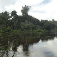
Peixoto de Azevedo is a municipality in northern Mato Grosso, located in central Brazil. The territory contains diverse landscapes and geographical features that characterize this region of the country.
The region was originally inhabited by the Panará people before being transformed by the gold rush of the 19th century. This period of resource extraction significantly shaped the area's development and settlement patterns.
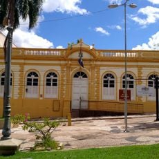
The annual 'Natal Peixoto' celebration brings the community together with performances and festivities that reflect local traditions. Residents and visitors alike experience how the municipality honors its cultural roots through these gatherings.
The municipality is located in an area with subtropical to tropical climate, experiencing humid conditions during the rainy season. Visitors should prepare with appropriate clothing and precautions depending on the time of year.
The geographic center point of Brazil is located within the municipality's boundaries, marking it as a site of national significance. This rare feature makes it a point of geographic interest within the country.
Location: Mato Grosso
Elevation above the sea: 382 m
Shares border with: Matupá, Marcelândia, Altamira, Nova Santa Helena, Santa Cruz do Xingu, São Félix do Xingu, São José do Xingu, Terra Nova do Norte
Website: http://peixotodeazevedo.mt.gov.br
GPS coordinates: -10.22889,-54.98278
Latest update: December 7, 2025 19:23
Kuhikugu
330.1 km
Chapada dos Guimarães National Park
573.1 km
Church of Our Lady of the Rosary and Saint Benedict
609.3 km
Cantão State Park
542.2 km
Mãe Bonifácia State Park
607.9 km
Cathedral Basilica of the Good Lord Jesus, Cuiabá
609.7 km
Araguaia Palace
728.5 km
Araguaia National Park
535 km
Carajás National Forest
704.4 km
Palácio Paiaguás
605.9 km
Igreja Nossa Senhora do Bom Despacho
610.2 km
Igreja de Nossa Senhora Auxiliadora
610.5 km
Museu do Morro da Caixa D'Água Velha
610 km
Juruena National Park
435.7 km
Museu Histórico do Tocantins
731.6 km
Mato Grosso Historical Museum
609.8 km
Cristalino State Park
107.3 km
Kayapó Indigenous Territory
444.7 km
Lajeado State Park
738.3 km
Serra do Pardo National Park
542.1 kmApyterewa Indigenous Territory
604.2 km
Jamanxim National Park
509 km
Rio Novo National Park
310.6 km
Museu Rondon
611 km
Gruta da Lagoa Azul State Park
495.4 km
Museu de Arte e de Cultura Popular
610.6 km
Caverna Aroe Jari
572.5 kmVisited this place? Tap the stars to rate it and share your experience / photos with the community! Try now! You can cancel it anytime.
Discover hidden gems everywhere you go!
From secret cafés to breathtaking viewpoints, skip the crowded tourist spots and find places that match your style. Our app makes it easy with voice search, smart filtering, route optimization, and insider tips from travelers worldwide. Download now for the complete mobile experience.
A unique approach to discovering new places❞
— Le Figaro
All the places worth exploring❞
— France Info
A tailor-made excursion in just a few clicks❞
— 20 Minutes