Enable Location

We need your location to show you interesting places around you

Discover nearby places

Find interesting locations and hidden gems around you

Precise directions

Get accurate directions and distances to places

Your location is never shared with other users. It's only used when you tap the location button.

Puncak Trikora

Log in to your account

Start exploring — it's free

Trusted by 64,868 travelers worldwide

Continue with Google
Continue with Apple
or

We will send you a code to connect

By continuing, you accept our Terms and Conditions and our Privacy Policy

Check your inbox

We've sent a pincode in your inbox. Please enter the code below.

Puncak Trikora
Discussion Reviews 1 Photos
8.8k Popularity

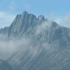
Puncak Trikora, Mountain summit in Papua, Indonesia

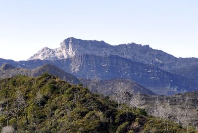
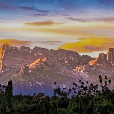
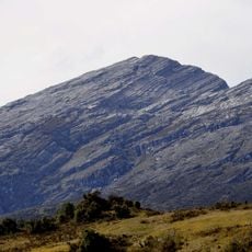
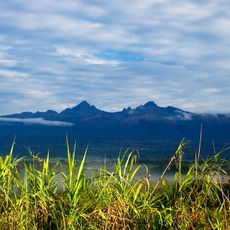
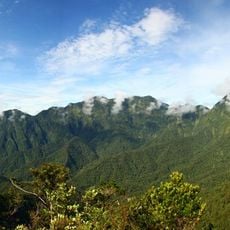
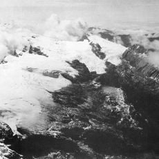
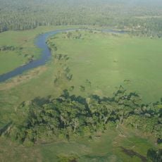
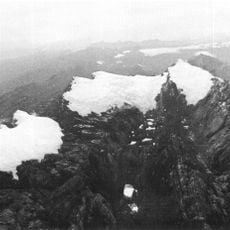
Puncak Trikora is a summit in the Sudirman Range, part of the Maoke Mountains in the Indonesian province of Papua, reaching around 4,750 meters above sea level. The peak is defined by steep limestone cliffs and exposed ridges that make the terrain considerably harder than other mountains at a similar elevation.

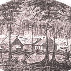
The first recorded ascent took place in 1913 as part of the Third South New Guinea Expedition, led by Alphons Franssen Herderschee. That expedition was part of a broader Dutch effort to explore the high mountain zones of western New Guinea, which were largely unknown to the outside world at the time.

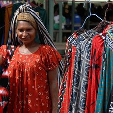
The Dani people who live near Lake Habbema call this peak Ettiakup, a name that reflects how deeply the mountain is woven into their daily surroundings. For them, it is not a distant goal to conquer but a familiar part of the land they have known for generations.

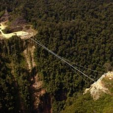
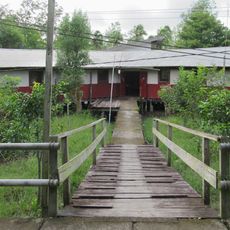
Getting to the summit requires a multi-day trek to Semalak Cave, used as a base camp, followed by a long climbing day over rocky and technical ground. Visitors should be ready for rapidly changing weather and cold nights, as conditions at this altitude can shift without warning.

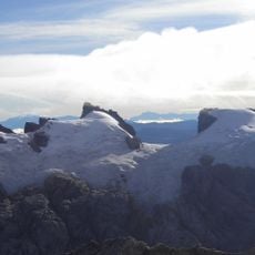
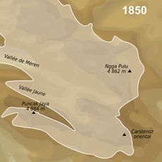
In the early 1900s, the summit was still covered by an ice cap, which disappeared entirely between 1936 and 1962. This makes Puncak Trikora one of the few places in the world where the retreat of glacial ice at this scale has been documented with such precision.

The community of curious travelers

AroundUs brings together thousands of curated places, local tips, and hidden gems, enriched daily by 60,000 contributors worldwide.

Start exploring
GPS coordinates
-4.26204,138.68166
Latest update
March 3, 2026 10:11
Reviews
Share your experience

No review yet

Discussions
Start a discussion...

No discussion yet

« Puncak Trikora - Mountain summit in Papua, Indonesia » is provided by Around Us (aroundus.com). Images and texts are derived from Wikimedia project under a Creative Commons license. You are allowed to copy, distribute, and modify copies of this page, under the conditions set by the license, as long as this note is clearly visible.

Discover hidden gems everywhere you go!

From secret cafés to breathtaking viewpoints, skip the crowded tourist spots and find places that match your style. Our app makes it easy with voice search, smart filtering, route optimization, and insider tips from travelers worldwide. Download now for the complete mobile experience.

Around Us App Screenshot

A unique approach to discovering new places

Le Figaro

All the places worth exploring

France Info

A tailor-made excursion in just a few clicks

20 Minutes

Around Us
Travel Guide & Maps
Download

Send to your phone

QR Code
1

Open the camera app on your mobile.

2

Point at the QR code with your camera. A notification will appear.

3

Tap the notification to open the link.