Warul Kawa Indigenous Protected Area, Indigenous Protected Area on Deliverance Island, Torres Strait, Australia
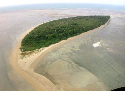
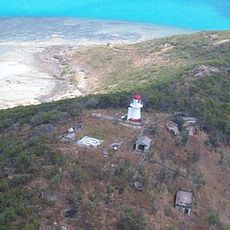
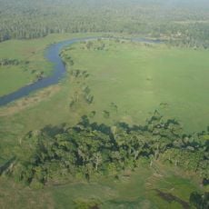
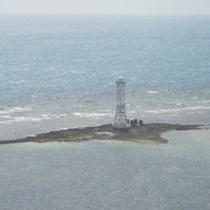
Warul Kawa is an Indigenous Protected Area on a sand cay located in the Torres Strait between Australia and Papua New Guinea. The reserve features shallow reef platforms with sandy patches that create diverse marine habitats in this region.
The area received official protected status in February 2001 and was integrated into Australia's National Reserve System. This designation brought traditional Indigenous land management practices into the country's formal conservation framework.
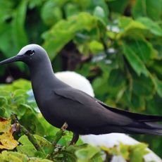
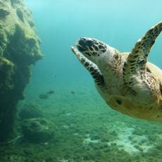
The name Warul Kawa means Island of Turtles in the language of Torres Strait Islanders, reflecting the place's importance as a major breeding ground. Visitors walking the sandy areas can observe how the landscape connects directly to the marine life that thrives in these waters.
Reaching this remote sand cay requires planning since regular transport connections are limited and special arrangements are needed. Visitors should contact local authorities before traveling, as the protected area has strict access guidelines.
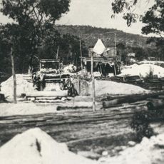
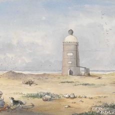
A Danish sailor called German Harry lived as a hermit on the island from 1888 to 1928 and later inspired a character in Somerset Maugham's writing. This unusual chapter reveals the long connection between this place and the people drawn to its isolation.
Location: Queensland
Inception: 2001
Part of: Torres Strait Islands
GPS coordinates: -9.51700,141.57200
Latest update: December 13, 2025 11:40
Mont Giluwe
463.4 km
Hegigio Gorge Pipeline Bridge
393.1 km
Mount Bosavi
351.6 km
Wasur National Park
130.5 km
Kutini-Payamu National Park
393.6 km
Apudthama National Park
235.1 km
Booby Island Light
126.6 km
All Saints Anglican Church, Darnley Island
240.7 km
Goods Island Light
132.9 km
Quetta Memorial Precinct
138.1 km
Our Lady of the Sacred Heart Church, Thursday Island
138.1 km
Tonda Wildlife Management Area
57.5 km
Piper Islands National Park
353.4 km
Wenlock Goldfield
424.9 km
Eborac Island Light
167.1 km
Raine Island Beacon
354.9 km
Wuthathi (Saunders Islands) National Park (Cape York Peninsula Aboriginal Land)
300.9 km
Wyborn Reef Light
195.9 km
Sir Charles Hardy Group National Park
336.6 km
Denham Group National Park
270.6 km
Thursday Island Customs House
138.5 km
Lockerbie Scrub
173.9 km
Gordon's Mine and Mill
402.8 km
Possession Island National Park
162.1 km
Green Hill Fort Coastal Artillery
137.9 km
Tuesday Islet Lighthouse
142.2 km
Trans-Fly Complex
175.3 km
Lion's Lookout
138.3 kmVisited this place? Tap the stars to rate it and share your experience / photos with the community! Try now! You can cancel it anytime.
Discover hidden gems everywhere you go!
From secret cafés to breathtaking viewpoints, skip the crowded tourist spots and find places that match your style. Our app makes it easy with voice search, smart filtering, route optimization, and insider tips from travelers worldwide. Download now for the complete mobile experience.
A unique approach to discovering new places❞
— Le Figaro
All the places worth exploring❞
— France Info
A tailor-made excursion in just a few clicks❞
— 20 Minutes