Chest opened
+${chestReward.xp} XP
Explorer
NOUVEAU ×${chestReward.collectible.quantity}
tapez pour fermer
Chest locked

Open chests in the app

Around Us is built for your phone — chests unlock when you walk, explore and capture nearby places.

Enable Location

We need your location to show you interesting places around you

Discover nearby places

Find interesting locations and hidden gems around you

Precise directions

Get accurate directions and distances to places

Your location is never shared with other users. It's only used when you tap the location button.

Bettles

Log in to your account

Start exploring — it's free

Trusted by 72,883 travelers worldwide

Continue with Google
Continue with Apple
or

We will send you a code to connect

By continuing, you accept our Terms and Conditions and our Privacy Policy

Check your inbox

We've sent a pincode in your inbox. Please enter the code below.

Discussion Reviews 2 Photos
19.8k Popularity

Bettles, city in Yukon-Koyukuk Census Area, Alaska, United States

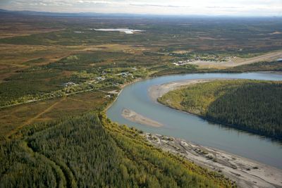
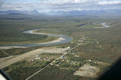
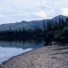
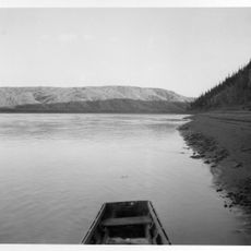
Bettles is a small settlement in Alaska situated along the Koyukuk River, about 5 miles above where the John River flows into it. The village includes a visitor center, ranger station, and a small airstrip that serve travelers heading to Gates of the Arctic National Park.

The region was originally inhabited by Alaska Native groups such as Koyukon Athabascans and Iñupiat peoples long before European explorers arrived. In the early 1900s, the gold rush drew prospectors to the Arctic, and the settlement developed around an early trading post.

The name Bettles comes from Gordon Bettles, a key figure in the region's early history. The settlement reflects the blend of Alaska Native traditions with the needs of travelers and adventurers who pass through.

Most of the year Bettles is not accessible by road, with an ice road only forming in winter to connect to the Dalton Highway. Most visitors arrive by scheduled flights from Fairbanks and use the local airstrip as a base for wilderness activities.

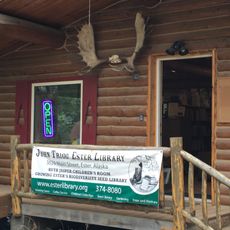
The settlement functions as a passport-stamping station for national park visitors and rents bear-proof food containers to protect provisions in the wilderness. This practical role makes it an essential stop for anyone exploring the Arctic region.

The community of curious travelers

AroundUs brings together thousands of curated places, local tips, and hidden gems, enriched daily by 60,000 contributors worldwide.

Start exploring
Inception
1896
Elevation above the sea
200 m
GPS coordinates
66.91330,-151.52300
Latest update
February 16, 2026 22:20
Around this place
Fairbanks Gold Rush
United States of America

Fairbanks Gold Rush

280.2 km
Mears Memorial Bridge
United States of America

Mears Memorial Bridge

284 km
University of Alaska Museum of the North
United States of America

University of Alaska Museum of the North

283.3 km
E. L. Patton Yukon River Bridge
United States of America

E. L. Patton Yukon River Bridge

141 km
Gates of the Arctic Wilderness
United States of America

Gates of the Arctic Wilderness

147.6 km
West Valley High School
United States of America

West Valley High School

284.5 km
Goldstream Dredge No. 8
United States of America

Goldstream Dredge No. 8

281.4 km
Yukon Flats National Wildlife Refuge
United States of America

Yukon Flats National Wildlife Refuge

252.2 km
Mount Igikpak
United States of America

Mount Igikpak

158.7 km
Arrigetch Peaks
United States of America

Arrigetch Peaks

127.9 km
White Mountains National Recreation Area
United States of America

White Mountains National Recreation Area

237 km
Kanuti National Wildlife Refuge
United States of America

Kanuti National Wildlife Refuge

56.9 km
John River
United States of America

John River

63.9 km
Koyukuk National Wildlife Refuge
United States of America

Koyukuk National Wildlife Refuge

267.7 km
Chena Pump House
United States of America

Chena Pump House

284.7 km
Nowitna National Wildlife Refuge
United States of America

Nowitna National Wildlife Refuge

274.4 km
Georgeson Botanical Garden
United States of America

Georgeson Botanical Garden

283.1 km
Elmer E. Rasmuson Library
United States of America

Elmer E. Rasmuson Library

284.1 km
North Fork Koyukuk River
United States of America

North Fork Koyukuk River

67.5 km
Itkillik River
United States of America

Itkillik River

262.8 km
Constitution Hall
United States of America

Constitution Hall

284 km
Walker Lake
United States of America

Walker Lake

125.7 km
Kanuti River
United States of America

Kanuti River

76.6 km
Discovery Claim on Pedro Creek
United States of America

Discovery Claim on Pedro Creek

279.6 km
John Trigg Ester Library
United States of America

John Trigg Ester Library

279.9 km
Rainey's Cabin
United States of America

Rainey's Cabin

283.6 km
Rampart Canyon
United States of America

Rampart Canyon

175.6 km
Dall River
United States of America

Dall River

118.4 km
Show the full map
Reviews
Share your experience

No review yet

Discussions
Start a discussion...

No discussion yet

« Bettles - city in Yukon-Koyukuk Census Area, Alaska, United States » is provided by Around Us (aroundus.com). Images and texts are derived from Wikimedia project under a Creative Commons license. You are allowed to copy, distribute, and modify copies of this page, under the conditions set by the license, as long as this note is clearly visible.

Discover hidden gems everywhere you go!

From secret cafés to breathtaking viewpoints, skip the crowded tourist spots and find places that match your style. Our app makes it easy with voice search, smart filtering, route optimization, and insider tips from travelers worldwide. Download now for the complete mobile experience.

Around Us App Screenshot

A unique approach to discovering new places

Le Figaro

All the places worth exploring

France Info

A tailor-made excursion in just a few clicks

20 Minutes

Around Us
Travel Guide & Maps
Download

Send to your phone

QR Code
1

Open the camera app on your mobile.

2

Point at the QR code with your camera. A notification will appear.

3

Tap the notification to open the link.