Chest opened
+${chestReward.xp} XP
Explorer
NOUVEAU ×${chestReward.collectible.quantity}
tapez pour fermer
Chest locked

Open chests in the app

Around Us is built for your phone — chests unlock when you walk, explore and capture nearby places.

Enable Location

We need your location to show you interesting places around you

Discover nearby places

Find interesting locations and hidden gems around you

Precise directions

Get accurate directions and distances to places

Your location is never shared with other users. It's only used when you tap the location button.

Canoga Park

Log in to your account

Start exploring — it's free

Trusted by 72,877 travelers worldwide

Continue with Google
Continue with Apple
or

We will send you a code to connect

By continuing, you accept our Terms and Conditions and our Privacy Policy

Check your inbox

We've sent a pincode in your inbox. Please enter the code below.

Discussion Reviews 2 Photos
69.4k Popularity

Canoga Park, Residential neighborhood in San Fernando Valley, Los Angeles, US.

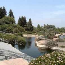
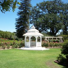
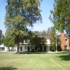
Canoga Park is a residential area in the San Fernando Valley, Los Angeles, US, where single-family homes line quiet streets alongside larger commercial roads. The layout follows a grid pattern with shopping centers, schools and parks spread throughout the neighborhood.

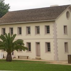
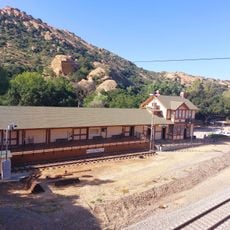
The area was named Owensmouth until 1931 and developed into a community after farmers planted fruit orchards in the early 20th century. Annexation by Los Angeles occurred in 1917 and brought new infrastructure and urban growth to the region.

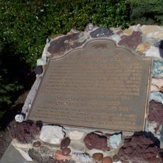
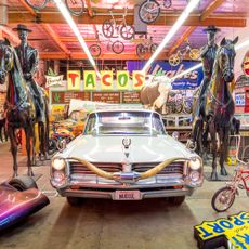
The neighborhood maintains connections to Native American heritage through archaeological sites and historical records of Tongva-Fernandeño and Chumash-Venturaño settlements in the region.

Bus stops run along major roads and provide connections to other parts of the valley. Stores and supermarkets are scattered throughout the area, making most errands walkable or a short drive away.

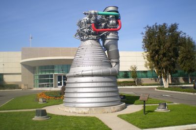
A facility in this neighborhood produced engines for space missions, including those that carried astronauts to the moon. Parts of the site have since been repurposed, but the connection to aerospace history remains well known.

The community of curious travelers

AroundUs brings together thousands of curated places, local tips, and hidden gems, enriched daily by 60,000 contributors worldwide.

Start exploring
Location
Inception
1912
GPS coordinates
34.20111,-118.59722
Latest update
March 5, 2026 21:06
Around this place
Spahn Ranch
United States of America

Spahn Ranch

8.3 km
Mulholland Drive
United States of America

Mulholland Drive

12.6 km
Sepulveda Dam
United States of America

Sepulveda Dam

12.1 km
Corriganville Movie Ranch
United States of America

Corriganville Movie Ranch

8.7 km
Leonis Adobe
United States of America

Leonis Adobe

6.3 km
Santa Susana Pass State Historic Park
United States of America

Santa Susana Pass State Historic Park

7.3 km
Topanga State Park
United States of America

Topanga State Park

12.6 km
Bel Air Presbyterian Church
United States of America

Bel Air Presbyterian Church

13 km
The Japanese Garden
United States of America

The Japanese Garden

10.9 km
Shepherd of the Hills Church
United States of America

Shepherd of the Hills Church

8.7 km
Grandma Prisbrey's Bottle Village
United States of America

Grandma Prisbrey's Bottle Village

13.2 km
Upper Las Virgenes Canyon Open Space Preserve
United States of America

Upper Las Virgenes Canyon Open Space Preserve

9.8 km
Orcutt Ranch Horticulture Center
United States of America

Orcutt Ranch Horticulture Center

4.4 km
Los Encinos State Historic Park
United States of America

Los Encinos State Historic Park

10.1 km
Matadome
United States of America

Matadome

8 km
Chatsworth Nature Preserve
United States of America

Chatsworth Nature Preserve

4.5 km
Topanga Canyon
United States of America

Topanga Canyon

11 km
Shadow Ranch
United States of America

Shadow Ranch

2.2 km
Valley Beth Shalom
United States of America

Valley Beth Shalom

12.2 km
California State University Northridge Botanic Garden
United States of America

California State University Northridge Botanic Garden

7.7 km
Minnie Hill Palmer House
United States of America

Minnie Hill Palmer House

6.9 km
Cathedral of St. Mary Byzantine Catholic Church
United States of America

Cathedral of St. Mary Byzantine Catholic Church

12.6 km
Las Llajas Canyon
United States of America

Las Llajas Canyon

13.1 km
Old Trapper's Lodge
United States of America

Old Trapper's Lodge

2.2 km
Eagle Rock
United States of America

Eagle Rock

10.7 km
Valley Relics Museum
United States of America

Valley Relics Museum

9.1 km
Santa Susana Railroad Depot & Museum
United States of America

Santa Susana Railroad Depot & Museum

8.9 km
Leonis Adobe
United States of America

Leonis Adobe

6.3 km
Show the full map
Reviews
Share your experience

No review yet

Discussions
Start a discussion...

No discussion yet

« Canoga Park - Residential neighborhood in San Fernando Valley, Los Angeles, US » is provided by Around Us (aroundus.com). Images and texts are derived from Wikimedia project under a Creative Commons license. You are allowed to copy, distribute, and modify copies of this page, under the conditions set by the license, as long as this note is clearly visible.

Discover hidden gems everywhere you go!

From secret cafés to breathtaking viewpoints, skip the crowded tourist spots and find places that match your style. Our app makes it easy with voice search, smart filtering, route optimization, and insider tips from travelers worldwide. Download now for the complete mobile experience.

Around Us App Screenshot

A unique approach to discovering new places

Le Figaro

All the places worth exploring

France Info

A tailor-made excursion in just a few clicks

20 Minutes

Around Us
Travel Guide & Maps
Download

Send to your phone

QR Code
1

Open the camera app on your mobile.

2

Point at the QR code with your camera. A notification will appear.

3

Tap the notification to open the link.