Enable Location

We need your location to show you interesting places around you

Discover nearby places

Find interesting locations and hidden gems around you

Precise directions

Get accurate directions and distances to places

Your location is never shared with other users. It's only used when you tap the location button.

Mecca Hills

Log in to your account

Start exploring — it's free

Trusted by 61,990 travelers worldwide

Continue with Google
Continue with Apple
or

We will send you a code to connect

By continuing, you accept our Terms and Conditions and our Privacy Policy

Check your inbox

We've sent a pincode in your inbox. Please enter the code below.

Mecca Hills

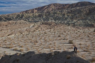
Mecca Hills, Mountain range in Riverside County, California, United States.

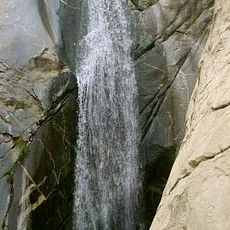
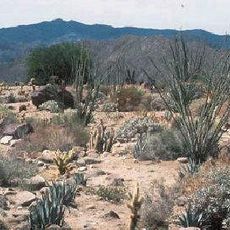
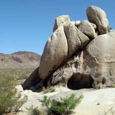
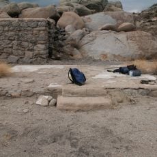
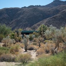
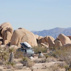
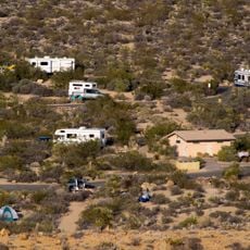
Mecca Hills is a mountain range in Riverside County's desert landscape characterized by narrow canyons, steep rock walls, and complex eroded formations. The terrain displays layered badlands with winding passages that challenge explorers navigating through the wilderness.

Congress designated this area as part of the National Wilderness Preservation System in 1994, placing it under Bureau of Land Management protection. The designation recognized the region's geological and ecological importance in the desert landscape.

The California desert wilderness area serves as an outdoor laboratory for scientists studying the effects of earthquakes on the Earth's crust along the San Andreas Fault.

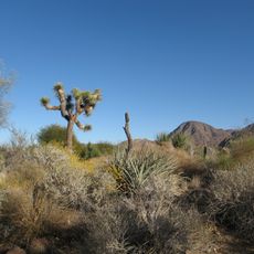
Early morning and late afternoon visits are best for comfortable exploration, when temperatures are lower and sunlight is less intense. Bring plenty of water, protective clothing, and a map since the desert setting offers minimal shade.

The exposed rock layers here showcase formations over 600 million years old, shaped by tectonic movements along the San Andreas Fault. Scientists use these natural exposures as a living laboratory to understand how earthquakes have altered the Earth's surface over time.

The community of curious travelers

AroundUs brings together thousands of curated places, local tips, and hidden gems, enriched daily by 60,000 contributors worldwide.

Start exploring
Location
GPS coordinates
33.62860,-116.01700
Latest update
December 6, 2025 17:44
Alternative destinations in California

California offers more than its well-traveled routes. Across the state, locations exist that few visitors reach, even though they show landscapes and histories found nowhere else. This collection includes natural areas, abandoned structures, and stretches of coast that lie beyond the usual travel...

Around this place
United States of America

Humana Challenge

22.3 km
Sunnylands
United States of America

Sunnylands

40.1 km
Living Desert Zoo and Gardens
United States of America

Living Desert Zoo and Gardens

31.9 km
Tahquitz Canyon
United States of America

Tahquitz Canyon

30.5 km
Spotlight 29 Casino
United States of America

Spotlight 29 Casino

17.9 km
General George S. Patton Memorial Museum
United States of America

General George S. Patton Memorial Museum

27.6 km
La Quinta Resort and Club
United States of America

La Quinta Resort and Club

27.5 km
Coachella Valley National Wildlife Refuge
United States of America

Coachella Valley National Wildlife Refuge

33.7 km
Salton Sea State Recreation Area
United States of America

Salton Sea State Recreation Area

20.9 km
North Shore Beach and Yacht Club
United States of America

North Shore Beach and Yacht Club

15.4 km
Shields Date Gardens
United States of America

Shields Date Gardens

24.8 km
Santa Rosa Wilderness
United States of America

Santa Rosa Wilderness

29.5 km
Toro Peak
United States of America

Toro Peak

39.7 km
Malapai Hill
United States of America

Malapai Hill

35.2 km
Kenaston House
United States of America

Kenaston House

39.9 km
Martinez Canyon Rockhouse
United States of America

Martinez Canyon Rockhouse

31.8 km
Sunnylands Center & Gardens
United States of America

Sunnylands Center & Gardens

40 km
Ruby Lee Mill Site
United States of America

Ruby Lee Mill Site

29.3 km
College of the Desert Arboretum
United States of America

College of the Desert Arboretum

36.2 km
Jack Nicklaus Resort Golf Course
United States of America

Jack Nicklaus Resort Golf Course

22.1 km
Classic Club
United States of America

Classic Club

34.4 km
Cottonwood Visitor Center
United States of America

Cottonwood Visitor Center

22.3 km
Santa Rosa & San Jacinto Mountains National Monument Visitor Center
United States of America

Santa Rosa & San Jacinto Mountains National Monument Visitor Center

36.6 km
White Tank Campground
United States of America

White Tank Campground

39.7 km
Jumbo Rocks Campground
United States of America

Jumbo Rocks Campground

40.7 km
Cottonwood Campground Amphitheater
United States of America

Cottonwood Campground Amphitheater

22.8 km
Cottonwood Campground
United States of America

Cottonwood Campground

22.6 km
Jumbo Rocks Campground Amphitheater
United States of America

Jumbo Rocks Campground Amphitheater

40.7 km
Show the full map
« Mecca Hills - Mountain range in Riverside County, California, United States » is provided by Around Us (aroundus.com). Images and texts are derived from Wikimedia project under a Creative Commons license. You are allowed to copy, distribute, and modify copies of this page, under the conditions set by the license, as long as this note is clearly visible.

Discover hidden gems everywhere you go!

From secret cafés to breathtaking viewpoints, skip the crowded tourist spots and find places that match your style. Our app makes it easy with voice search, smart filtering, route optimization, and insider tips from travelers worldwide. Download now for the complete mobile experience.

Around Us App Screenshot

A unique approach to discovering new places

Le Figaro

All the places worth exploring

France Info

A tailor-made excursion in just a few clicks

20 Minutes

Around Us
Travel Guide & Maps
Download

Send to your phone

QR Code
1

Open the camera app on your mobile.

2

Point at the QR code with your camera. A notification will appear.

3

Tap the notification to open the link.