Chest opened
+${chestReward.xp} XP
Explorer
NOUVEAU ×${chestReward.collectible.quantity}
tapez pour fermer
Chest locked

Open chests in the app

Around Us is built for your phone — chests unlock when you walk, explore and capture nearby places.

Enable Location

We need your location to show you interesting places around you

Discover nearby places

Find interesting locations and hidden gems around you

Precise directions

Get accurate directions and distances to places

Your location is never shared with other users. It's only used when you tap the location button.

Transverse Ranges

Log in to your account

Start exploring — it's free

Trusted by 72,886 travelers worldwide

Continue with Google
Continue with Apple
or

We will send you a code to connect

By continuing, you accept our Terms and Conditions and our Privacy Policy

Check your inbox

We've sent a pincode in your inbox. Please enter the code below.

Transverse Ranges
Discussion Reviews 1 Photos
44.6k Popularity

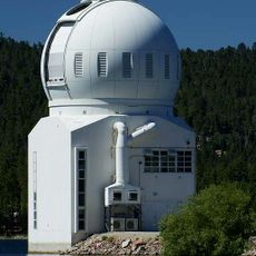
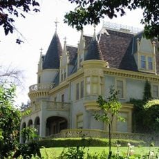
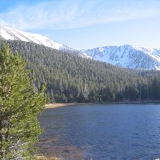
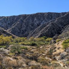
Transverse Ranges, Mountain range in Southern California, United States.

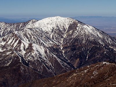
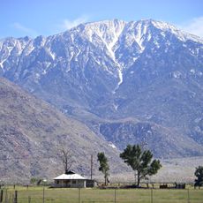
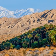
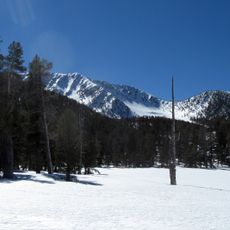
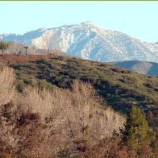
The Transverse Ranges form a mountain system in Southern California stretching from Santa Barbara County to San Bernardino County with multiple parallel ridges reaching heights between 3,000 and 8,000 feet. The range comprises distinct sections where rock types shift from sedimentary formations in the west to granitic rocks in the east.

This mountain system formed during the late Cenozoic Era through tectonic movements that created an unusual east-west orientation. This direction differs markedly from other mountain ranges in California which typically run north to south.

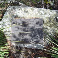
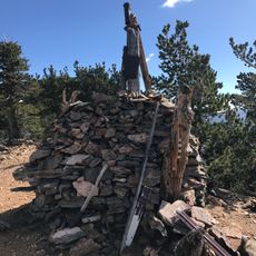
Indigenous peoples lived in these mountains and created trade routes through the passes connecting different regions. You can still see traces of their presence at certain locations throughout the range.

An Adventure Pass is required for parking at day-use areas within Los Padres, Angeles, and San Bernardino National Forests across the range. Visitors should check regulations for specific locations before traveling since parking requirements can differ depending on where you plan to spend time.

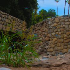
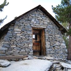
The western section features sedimentary rocks while the eastern portion consists primarily of granite, creating a noticeable geological shift across the range. This difference in rock composition reveals the complex formation history and is visible at many points while exploring.

The community of curious travelers

AroundUs brings together thousands of curated places, local tips, and hidden gems, enriched daily by 60,000 contributors worldwide.

Start exploring
Location
GPS coordinates
34.09920,-116.82500
Latest update
December 14, 2025 20:33
Around this place
Cabazon Dinosaurs
United States of America

Cabazon Dinosaurs

20.5 km
San Jacinto Peak
United States of America

San Jacinto Peak

34.4 km
San Gorgonio Mountain
United States of America

San Gorgonio Mountain

10 m
Big Bear Lake
United States of America

Big Bear Lake

21.2 km
San Bernardino National Forest
United States of America

San Bernardino National Forest

74 km
San Gorgonio Pass
United States of America

San Gorgonio Pass

21.4 km
Sand to Snow National Monument
United States of America

Sand to Snow National Monument

12.2 km
Big Bear Solar Observatory
United States of America

Big Bear Solar Observatory

19.8 km
Kimberly Crest
United States of America

Kimberly Crest

32.8 km
San Gorgonio Wilderness
United States of America

San Gorgonio Wilderness

11.9 km
Big Morongo Canyon Preserve
United States of America

Big Morongo Canyon Preserve

26.8 km
Big Bear Discovery Center
United States of America

Big Bear Discovery Center

19.7 km
Mill Creek Zanja
United States of America

Mill Creek Zanja

27.8 km
Redlands Santa Fe Depot District
United States of America

Redlands Santa Fe Depot District

33.3 km
A. K. Smiley Public Library
United States of America

A. K. Smiley Public Library

33.5 km
Gilman Ranch
United States of America

Gilman Ranch

19.2 km
Smiley Park Historic District
United States of America

Smiley Park Historic District

33.4 km
Goode Solar Telescope
United States of America

Goode Solar Telescope

19.8 km
James Reserve
United States of America

James Reserve

32.7 km
Auerbacher Home
United States of America

Auerbacher Home

31.3 km
Jepson Peak
United States of America

Jepson Peak

1.9 km
Beverly Ranch
United States of America

Beverly Ranch

34 km
Henry Washington Survey Marker
United States of America

Henry Washington Survey Marker

9.9 km
Arboreto Heaps Peak
United States of America

Arboreto Heaps Peak

32.8 km
Lincoln Memorial Shrine
United States of America

Lincoln Memorial Shrine

33.4 km
Peak Shelter Cabin
United States of America

Peak Shelter Cabin

34.5 km
Yucaipa Regional Park
United States of America

Yucaipa Regional Park

21.1 km
Keller Peak Lookout
United States of America

Keller Peak Lookout

23.3 km
Show the full map
Reviews
Share your experience

No review yet

Discussions
Start a discussion...

No discussion yet

« Transverse Ranges - Mountain range in Southern California, United States » is provided by Around Us (aroundus.com). Images and texts are derived from Wikimedia project under a Creative Commons license. You are allowed to copy, distribute, and modify copies of this page, under the conditions set by the license, as long as this note is clearly visible.

Discover hidden gems everywhere you go!

From secret cafés to breathtaking viewpoints, skip the crowded tourist spots and find places that match your style. Our app makes it easy with voice search, smart filtering, route optimization, and insider tips from travelers worldwide. Download now for the complete mobile experience.

Around Us App Screenshot

A unique approach to discovering new places

Le Figaro

All the places worth exploring

France Info

A tailor-made excursion in just a few clicks

20 Minutes

Around Us
Travel Guide & Maps
Download

Send to your phone

QR Code
1

Open the camera app on your mobile.

2

Point at the QR code with your camera. A notification will appear.

3

Tap the notification to open the link.