Chest opened
+${chestReward.xp} XP
Explorer
NOUVEAU ×${chestReward.collectible.quantity}
tapez pour fermer
Chest locked

Open chests in the app

Around Us is built for your phone — chests unlock when you walk, explore and capture nearby places.

Enable Location

We need your location to show you interesting places around you

Discover nearby places

Find interesting locations and hidden gems around you

Precise directions

Get accurate directions and distances to places

Your location is never shared with other users. It's only used when you tap the location button.

Log in to your account

Start exploring — it's free

Trusted by 72,891 travelers worldwide

Continue with Google
Continue with Apple
or

We will send you a code to connect

By continuing, you accept our Terms and Conditions and our Privacy Policy

Check your inbox

We've sent a pincode in your inbox. Please enter the code below.

Centennial Wash
Discussion Reviews Photo
1.3k Popularity

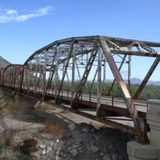
Centennial Wash, Desert tributary in Maricopa County, Arizona, United States

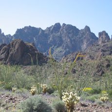
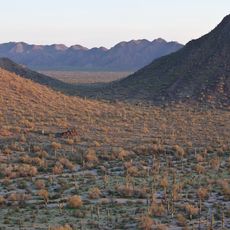
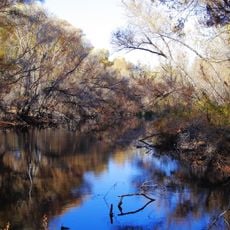
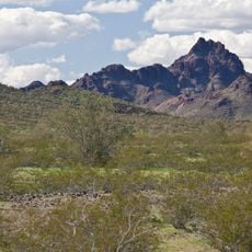
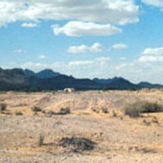
Centennial Wash is a drainage channel in Maricopa County that cuts through the desert landscape as part of the broader Gila River system. The sandy bed reveals the path water takes during rare rainfall events in this arid environment.

This channel formed over thousands of years as water erosion carved through the desert landscape and established connections to the Gila River. Its development reflects the geological history of central Arizona.

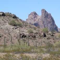
Local communities traditionally depended on this wash for water access and as a landmark for traveling through the desert. Today, the channel remains a visible reminder of how people adapted to life in an arid region.

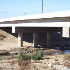
Check weather conditions before visiting, especially during monsoon season from June to September when flash floods can occur in the wash. Exploring the dry channel is safer and more rewarding during other months.

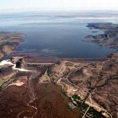
The channel serves as the final drainage section of the Gila River before it turns southward through Arizona. Its position makes it a key element in how water moves across the wider region.

The community of curious travelers

AroundUs brings together thousands of curated places, local tips, and hidden gems, enriched daily by 60,000 contributors worldwide.

Start exploring
Location
GPS coordinates
33.39370,-113.12600
Latest update
December 14, 2025 18:14
Around this place
State Farm Stadium
United States of America

State Farm Stadium

81.6 km
Phoenix Raceway
United States of America

Phoenix Raceway

75.8 km
Desert Sky Pavilion
United States of America

Desert Sky Pavilion

83.4 km
White Tank Mountains
United States of America

White Tank Mountains

54.7 km
Kofa National Wildlife Refuge
United States of America

Kofa National Wildlife Refuge

82.5 km
Sonoran Desert National Monument
United States of America

Sonoran Desert National Monument

72.4 km
Wildlife World Zoo
United States of America

Wildlife World Zoo

68.4 km
Painted Rock Petroglyph Site
United States of America

Painted Rock Petroglyph Site

41.9 km
White Tank Mountain Regional Park
United States of America

White Tank Mountain Regional Park

55.7 km
Painted Rock Dam
United States of America

Painted Rock Dam

37.2 km
Gillespie Dam Highway Bridge
United States of America

Gillespie Dam Highway Bridge

38 km
Hassayampa River Preserve
United States of America

Hassayampa River Preserve

72.3 km
Sugarloaf Mountain
United States of America

Sugarloaf Mountain

32.4 km
Eagletail Mountains Wilderness
United States of America

Eagletail Mountains Wilderness

25.9 km
Sun Bowl Amphitheatre
United States of America

Sun Bowl Amphitheatre

80.2 km
Gatlin Site
United States of America

Gatlin Site

60.1 km
Hassayampa Bridge
United States of America

Hassayampa Bridge

38 km
Garcia School
United States of America

Garcia School

73.9 km
PopStroke
United States of America

PopStroke

81.6 km
Urban Air Trampoline and Adventure Park
United States of America

Urban Air Trampoline and Adventure Park

68.9 km
Wigwam Resort
United States of America

Wigwam Resort

73 km
Old Brick Post Office
United States of America

Old Brick Post Office

73.8 km
Sterling Grove Golf Course
United States of America

Sterling Grove Golf Course

67.6 km
Sonic
United States of America

Sonic

79.4 km
Sonic
United States of America

Sonic

75.1 km
Gila Bend Visitor Center and Museum
United States of America

Gila Bend Visitor Center and Museum

62.1 km
Avon Theatre
United States of America

Avon Theatre

72.4 km
Stout's Hotel
United States of America

Stout's Hotel

62.7 km
Show the full map
Reviews
Share your experience

No review yet

Discussions
Start a discussion...

No discussion yet

« Centennial Wash - Desert tributary in Maricopa County, Arizona, United States » is provided by Around Us (aroundus.com). Images and texts are derived from Wikimedia project under a Creative Commons license. You are allowed to copy, distribute, and modify copies of this page, under the conditions set by the license, as long as this note is clearly visible.

Discover hidden gems everywhere you go!

From secret cafés to breathtaking viewpoints, skip the crowded tourist spots and find places that match your style. Our app makes it easy with voice search, smart filtering, route optimization, and insider tips from travelers worldwide. Download now for the complete mobile experience.

Around Us App Screenshot

A unique approach to discovering new places

Le Figaro

All the places worth exploring

France Info

A tailor-made excursion in just a few clicks

20 Minutes

Around Us
Travel Guide & Maps
Download

Send to your phone

QR Code
1

Open the camera app on your mobile.

2

Point at the QR code with your camera. A notification will appear.

3

Tap the notification to open the link.