Chest opened
+${chestReward.xp} XP
Explorer
NOUVEAU ×${chestReward.collectible.quantity}
tapez pour fermer
Chest locked

Open chests in the app

Around Us is built for your phone — chests unlock when you walk, explore and capture nearby places.

Enable Location

We need your location to show you interesting places around you

Discover nearby places

Find interesting locations and hidden gems around you

Precise directions

Get accurate directions and distances to places

Your location is never shared with other users. It's only used when you tap the location button.

Log in to your account

Start exploring — it's free

Trusted by 72,881 travelers worldwide

Continue with Google
Continue with Apple
or

We will send you a code to connect

By continuing, you accept our Terms and Conditions and our Privacy Policy

Check your inbox

We've sent a pincode in your inbox. Please enter the code below.

Discussion Reviews Photo
10.8k Popularity

St. David, Rural settlement in Cochise County, Arizona, United States.

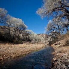
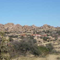
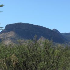
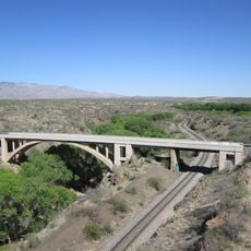
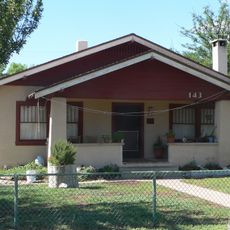
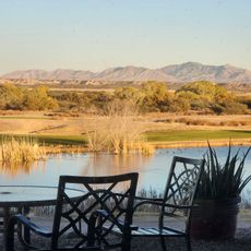
St. David is a census-designated place in southeastern Arizona, located in Cochise County along the San Pedro River. The settlement sits on flat agricultural land surrounded by open fields and low hills, with buildings spread widely apart.

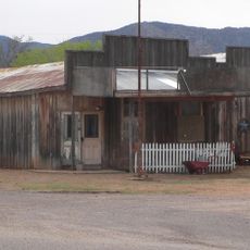
St. David was founded in 1877 by Mormon settlers who followed the route of the Mormon Battalion, a group that had crossed the San Pedro Valley back in 1846. The first families came to farm the river land and built a tight-knit agricultural community.

The San Pedro Valley Fair takes place each year on the local high school grounds, bringing together farmers, craftspeople, and neighbors from across the region. The event gives visitors a direct look at rural traditions that have been kept alive since the 1930s.

The settlement is reached by State Route 80, a road that runs through the San Pedro Valley and connects to nearby towns. Services are very limited locally, so it is worth stopping in a larger town before or after visiting.

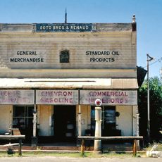
During the Great Depression, St. David kept going by supplying timber from local operations to Fort Huachuca and nearby mining towns, at a time when most small communities had little to fall back on. That local resource helped the settlement stay on its feet while others did not.

The community of curious travelers

AroundUs brings together thousands of curated places, local tips, and hidden gems, enriched daily by 60,000 contributors worldwide.

Start exploring
Location
Inception
1877
Elevation above the sea
1,125 m
GPS coordinates
31.89810,-110.21800
Latest update
March 3, 2026 08:21
Around this place
The Thing?
United States of America

The Thing?

26 km
Kartchner Caverns State Park
United States of America

Kartchner Caverns State Park

14 km
Bird Cage Theatre
United States of America

Bird Cage Theatre

25.3 km
Empire Ranch
United States of America

Empire Ranch

42 km
Texas Canyon
United States of America

Texas Canyon

21.2 km
Colossal Cave
United States of America

Colossal Cave

43.2 km
Schieffelin Hall
United States of America

Schieffelin Hall

25.1 km
Tombstone Courthouse
United States of America

Tombstone Courthouse

25 km
Murray Springs Clovis Site
United States of America

Murray Springs Clovis Site

36.7 km
San Pedro Riparian National Conservation Area
United States of America

San Pedro Riparian National Conservation Area

36 km
Las Cienegas National Conservation Area
United States of America

Las Cienegas National Conservation Area

38.8 km
Tombstone Historic District
United States of America

Tombstone Historic District

25.2 km
Presidio Santa Cruz de Terrenate
United States of America

Presidio Santa Cruz de Terrenate

16.5 km
Amerind Foundation
United States of America

Amerind Foundation

21 km
Apache Peak
United States of America

Apache Peak

21.6 km
Gleeson Jail
United States of America

Gleeson Jail

41.2 km
Cochise Hotel
United States of America

Cochise Hotel

36.2 km
Ciénega Bridge
United States of America

Ciénega Bridge

42.6 km
United States of America

Mae West Peaks

24.2 km
J.H. Smith Grocery Store and Filling Station
United States of America

J.H. Smith Grocery Store and Filling Station

22.3 km
United States of America

Lime Peak

26.5 km
United States of America

Our Lady of Victory Catholic Church

37.4 km
Pearce General Store
United States of America

Pearce General Store

37.5 km
Benson Railroad Historic District
United States of America

Benson Railroad Historic District

10.8 km
Apache Powder Historic Residential District
United States of America

Apache Powder Historic Residential District

10.9 km
San Pedro Golf Course
United States of America

San Pedro Golf Course

11 km
San Pedro River Railroad Bridge
United States of America

San Pedro River Railroad Bridge

9.4 km
Fairbank Railroad Bridge
United States of America

Fairbank Railroad Bridge

18.8 km
Show the full map
Reviews
Share your experience

No review yet

Discussions
Start a discussion...

No discussion yet

« St. David - Rural settlement in Cochise County, Arizona, United States » is provided by Around Us (aroundus.com). Images and texts are derived from Wikimedia project under a Creative Commons license. You are allowed to copy, distribute, and modify copies of this page, under the conditions set by the license, as long as this note is clearly visible.

Discover hidden gems everywhere you go!

From secret cafés to breathtaking viewpoints, skip the crowded tourist spots and find places that match your style. Our app makes it easy with voice search, smart filtering, route optimization, and insider tips from travelers worldwide. Download now for the complete mobile experience.

Around Us App Screenshot

A unique approach to discovering new places

Le Figaro

All the places worth exploring

France Info

A tailor-made excursion in just a few clicks

20 Minutes

Around Us
Travel Guide & Maps
Download

Send to your phone

QR Code
1

Open the camera app on your mobile.

2

Point at the QR code with your camera. A notification will appear.

3

Tap the notification to open the link.