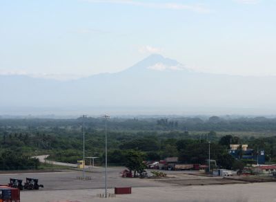
Volcán Tacaná, Stratovolcano at Guatemala-Mexico border.
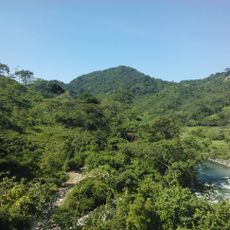
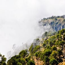
Volcán Tacaná is a stratovolcano on the border between Guatemala and Mexico in the Sierra Madre de Chiapas. At 4092 meters, it is the second highest peak in Central America and features both active fumaroles and vegetation up to the tree line.
A major explosive eruption occurred around the year 70 and shaped the region for centuries. Smaller phreatic eruptions were recorded between 1986 and 1988, showing the ongoing activity of the volcano.
Communities on both sides of the border use the mountain as a landmark for their settlements and farming areas. The name comes from the Nahuatl language and means "place of the bull," a designation still in use today.
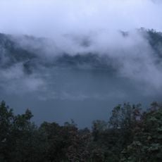
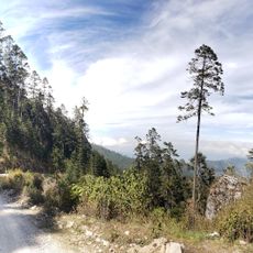
Climbing routes begin either in Unión Juárez on the Mexican side or in Sibinal in Guatemala and take two days to reach the summit. Local mountain guides are necessary for navigation in fog and along changing paths.
From the summit in clear weather, you can see the entire Central American Volcanic Arc stretching from Guatemala into Mexico. The Pacific Ocean appears on the horizon as a dark line beneath the sky.
Location: San Marcos Department
Elevation above the sea: 4,064 m
GPS coordinates: 15.13248,-92.10842
Latest update: December 5, 2025 22:22
Santa María
73 km
Volcán Tajumulco
24.2 km
Takalik Abaj
67.4 km
Santiaguito
72.5 km
Zaculeu
69.8 km
Almolonga
73.4 km
La Encrucijada
70.5 km
Xetulul
80.2 km
Quetzaltenango Municipal Theatre
71.4 km
Chicabal
61.9 km
Plaza de Armas
71.7 km
Estadio Mario Camposeco
71.3 km
Cerro Quiac
78.9 km
Holy Spirit Cathedral, Quetzaltenango
71.5 km
Puente Rodolfo Robles
50.9 km
Quetzaltenango Guatemala Temple
69 km
Ujuxte
66.6 km
Chapel of the Conqueress of the Immaculate Conception
75.2 km
Shelter of Jesus the Good Shepherd for the Poor and Migrant
35.9 km
Minerva
69.6 km
Santa María Hydroelectric Dam
79.3 km
Volcán Tacaná Biosphere Reserve
7.6 km
Avalancha
80.1 km
Takalik Abaj
68.4 km
Range Rear Ocos Lighthouse
67.8 km
House of Justo Rufino Barrios
41.1 km
Sendero Puerta del Cielo
72 km
Río Agua Zarca
19.5 kmReviews
Visited this place? Tap the stars to rate it and share your experience / photos with the community! Try now! You can cancel it anytime.
Discover hidden gems everywhere you go!
From secret cafés to breathtaking viewpoints, skip the crowded tourist spots and find places that match your style. Our app makes it easy with voice search, smart filtering, route optimization, and insider tips from travelers worldwide. Download now for the complete mobile experience.
A unique approach to discovering new places❞
— Le Figaro
All the places worth exploring❞
— France Info
A tailor-made excursion in just a few clicks❞
— 20 Minutes