Enable Location

We need your location to show you interesting places around you

Discover nearby places

Find interesting locations and hidden gems around you

Precise directions

Get accurate directions and distances to places

Your location is never shared with other users. It's only used when you tap the location button.

Upala Canton

Log in to your account

Start exploring — it's free

Trusted by 62,090 travelers worldwide

Continue with Google
Continue with Apple
or

We will send you a code to connect

By continuing, you accept our Terms and Conditions and our Privacy Policy

Check your inbox

We've sent a pincode in your inbox. Please enter the code below.

Upala Canton, Administrative canton in Alajuela Province, Costa Rica

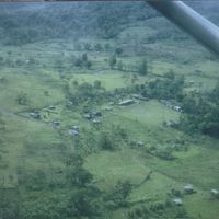
Upala Canton is an administrative region in Alajuela Province composed of eight districts spread across the landscape, each with its own center and surrounding areas. These communities are linked by a network of roads that form the backbone of local travel and commerce.

The territory became an independent administrative canton in 1970, separating from the larger region and establishing its own governmental structure. This change allowed the area to develop local governance and manage its own affairs.

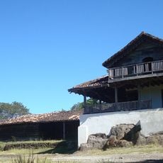
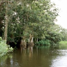
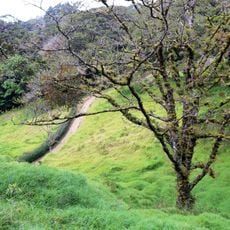
The region's identity is shaped by farming practices, particularly rice growing and cattle raising, which remain central to how people live and work in the communities here.

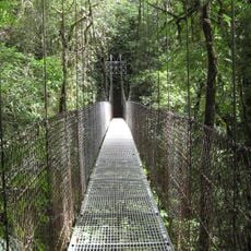
Visitors can travel between the districts on well-maintained roads that connect the entire region, making local transportation straightforward. The dry season offers better road conditions for getting around and exploring the different communities.

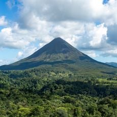
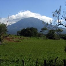
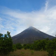
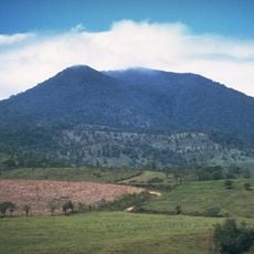
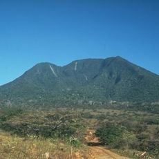
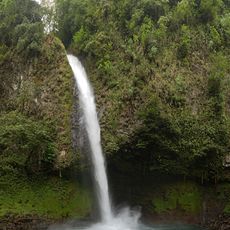
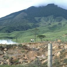
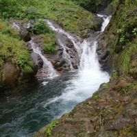
The southern edge is marked by four volcanoes—Rincón de la Vieja, Santa María, Miravalles, and Tenorio—that create a natural geological boundary. These volcanic peaks shape the landscape and remind visitors of the natural forces that have molded the region over time.

The community of curious travelers

AroundUs brings together thousands of curated places, local tips, and hidden gems, enriched daily by 60,000 contributors worldwide.

Start exploring
Inception
March 17, 1970
Capital city
Upala
Elevation above the sea
457 m
Shares border with
Guatuso Canton, Cañas Canton, Los Chiles Canton, Bagaces Canton, Liberia Canton, La Cruz Canton
GPS coordinates
10.89780,-85.01310
Latest update
December 7, 2025 19:31
« Upala Canton - Administrative canton in Alajuela Province, Costa Rica » is provided by Around Us (aroundus.com). Images and texts are derived from Wikimedia project under a Creative Commons license. You are allowed to copy, distribute, and modify copies of this page, under the conditions set by the license, as long as this note is clearly visible.

Discover hidden gems everywhere you go!

From secret cafés to breathtaking viewpoints, skip the crowded tourist spots and find places that match your style. Our app makes it easy with voice search, smart filtering, route optimization, and insider tips from travelers worldwide. Download now for the complete mobile experience.

Around Us App Screenshot

A unique approach to discovering new places

Le Figaro

All the places worth exploring

France Info

A tailor-made excursion in just a few clicks

20 Minutes

Around Us
Travel Guide & Maps
Download

Send to your phone

QR Code
1

Open the camera app on your mobile.

2

Point at the QR code with your camera. A notification will appear.

3

Tap the notification to open the link.