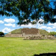
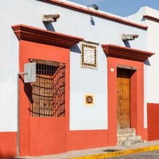
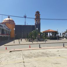
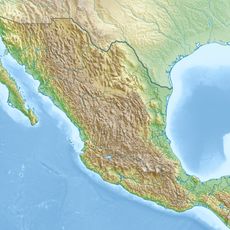
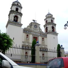
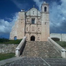
San Juan Bautista Coixtlahuaca, Municipality in Mixteca Region, Oaxaca, Mexico
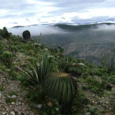
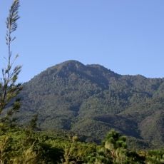
San Juan Bautista Coixtlahuaca is a municipality in the Mixteca Region of Oaxaca located at 2,294 meters (7,527 feet) in elevation. Three mountain ranges surround the area, creating diverse ecosystems of oak forests and grasslands.
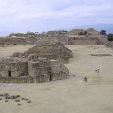
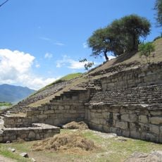
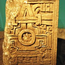
The name derives from the Nahuatl term 'Cōāīxtlahuacān', meaning 'In the plain of the snakes', which was given by the Aztecs in 1458. This designation reflects the region's long connection to pre-Columbian settlement.
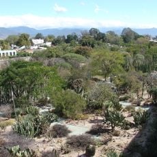
Residents speak Chocho and Mixtec languages and practice traditional farming methods like milpa and terrace cultivation. These languages and techniques shape daily agricultural life across the communities here.
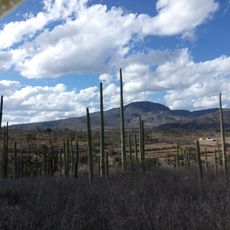
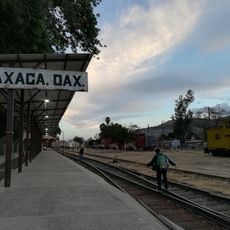
The area is accessible via a network of roads connecting different communities and regions. Visiting during the dry season makes traveling through the surrounding mountain areas easier and more comfortable.
Fossils and petrified marine shells found in La Estancia community show that this entire region was once submerged beneath the sea thousands of years ago. These geological remnants tell a story of dramatic landscape changes over vast spans of time.
Location: Oaxaca
Capital city: San Juan Bautista Coixtlahuaca
Elevation above the sea: 2,294 m
GPS coordinates: 17.71667,-97.31667
Latest update: December 6, 2025 17:44
Oaxaca has archaeological sites like Monte Albán and Mitla, where zapotec and mixtec civilizations built temples and palaces many centuries before the Spanish arrived. The land stretches between mountains in the north and Pacific coasts in the south, with lagoons and beaches such as those at Mazunte...
Monte Albán
94.9 km
Tehuacán-Cuicatlán Biosphere Reserve
55.8 km
San José Mogote
81.9 km
Estadio Tecnológico de Oaxaca
93.2 km
Basilica of Our Lady of Solitude
95.7 km
Chevé Cave
56.7 km
Cathedral of Our Lady of the Assumption, Oaxaca
96.3 km
Auditorio Guelaguetza
95.3 km
Benito Juárez National Park
86.6 km
Cerro de las Minas
49.7 km
Jardín Etnobotánico de Oaxaca
96 km
San Juan Raya
73.8 km
Eduardo Vasconcelos Stadium
96.4 km
Church of San Pablo
93.4 km
Catedral de Huajuapan de León
49.7 km
Museo de Filatelia de Oaxaca
96.1 km
Archaeological Zone of Atzompa
90.9 km
Museo Del Ferrocarril Mexicano Del Sur
94.8 kmMixteca Alta Unesco Global Geopark
22.3 km
Library Fray Francisco de Burgoa
96 kmCentro Fotográfico Manuel Álvarez Bravo
96 km
Museo de Arte Prehispánico de México Rufino Tamayo
96 km
Museo de Sitio Casa Juárez
95.8 km
Presidencia Municipal De Vicente Guerrero, Puebla.
92.2 km
San Miguel Aloápam (munisipyo)
73.8 km
Cathedral of the Immaculate Conception in Tehuacán
83.3 km
Ex-Convento de Santo Domingo de Yanhuitlán
21.3 km
Estación del Ferrocarril
38.1 kmVisited this place? Tap the stars to rate it and share your experience / photos with the community! Try now! You can cancel it anytime.
Discover hidden gems everywhere you go!
From secret cafés to breathtaking viewpoints, skip the crowded tourist spots and find places that match your style. Our app makes it easy with voice search, smart filtering, route optimization, and insider tips from travelers worldwide. Download now for the complete mobile experience.
A unique approach to discovering new places❞
— Le Figaro
All the places worth exploring❞
— France Info
A tailor-made excursion in just a few clicks❞
— 20 Minutes