Enable Location

We need your location to show you interesting places around you

Discover nearby places

Find interesting locations and hidden gems around you

Precise directions

Get accurate directions and distances to places

Your location is never shared with other users. It's only used when you tap the location button.

Aqueduct of Padre Tembleque

Log in to your account

Start exploring — it's free

Trusted by 61,471 travelers worldwide

Continue with Google
Continue with Apple
or

We will send you a code to connect

By continuing, you accept our Terms and Conditions and our Privacy Policy

Check your inbox

We've sent a pincode in your inbox. Please enter the code below.

Aqueduct of Padre Tembleque

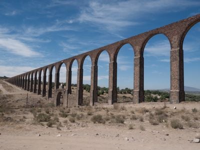
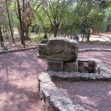
Aqueduct of Padre Tembleque, 16th century aqueduct in Zempoala and Otumba, Mexico.

Description

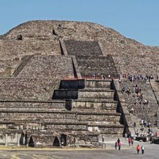
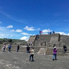
The Aqueduct of Padre Tembleque is a water transport system stretching roughly 45 kilometers between Zempoala and Otumba with three main arcade sections containing 126 arches total. It combines underground passages, surface-level canals, and elevated arches to carry water across multiple valleys from volcanic sources.

History

Franciscan friar Francisco de Tembleque began construction of this water system between 1553 and 1570 to supply fresh water to local communities in the region. The project was a major colonial undertaking that demonstrated how European engineering knowledge was applied in the New World.

Culture

The aqueduct shows how European building methods and local craftsmanship came together in one project. Walking along it today, you can see this blend of knowledge in the way every arch was constructed.

Practical

The main viewing area near Santiago Tepeyahualco is accessible by car, and the tallest arch section rises about 39 meters high. Wear sturdy shoes if you plan to explore on foot, as the ground around the structure can be uneven.

Did you know?

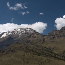
The water system draws from natural springs at Tecajete volcano and operates without pumps by relying on gravity and slope, a clever solution for moving water across uneven terrain. This approach ensured reliable water supply to settlements without requiring mechanical power.

Location
Length
4.297585×10⁰⁶ m
GPS coordinates
19.83639,-98.66222
Latest update
December 20, 2025 12:16

AroundUs brings together thousands of curated places, local tips, and hidden gems, enriched daily by 60,000 contributors worldwide. Discover all places nearby (Zempoala).

Natural and historical sites in Hidalgo Mexico

Hidalgo state sits northeast of Mexico City, connecting volcanic landscapes with more than two thousand years of human settlement. The region extends from high-altitude pine forests to semi-arid canyons, with geological processes having created basalt columns, cave systems with thermal springs, and...

« Aqueduct of Padre Tembleque - 16th century aqueduct in Zempoala and Otumba, Mexico » is provided by Around Us (aroundus.com). Images and texts are derived from Wikimedia project under a Creative Commons license. You are allowed to copy, distribute, and modify copies of this page, under the conditions set by the license, as long as this note is clearly visible.

Discover hidden gems everywhere you go!

From secret cafés to breathtaking viewpoints, skip the crowded tourist spots and find places that match your style. Our app makes it easy with voice search, smart filtering, route optimization, and insider tips from travelers worldwide. Download now for the complete mobile experience.

Around Us App Screenshot

A unique approach to discovering new places

Le Figaro

All the places worth exploring

France Info

A tailor-made excursion in just a few clicks

20 Minutes

Around Us
Travel Guide & Maps
Download

Send to your phone

QR Code
1

Open the camera app on your mobile.

2

Point at the QR code with your camera. A notification will appear.

3

Tap the notification to open the link.