Chest opened
+${chestReward.xp} XP
Explorer
NOUVEAU ×${chestReward.collectible.quantity}
tapez pour fermer

See the monuments around you in AR Open chests in the app

Around Us is built for your phone — point your camera at the streets and discover the monuments and places around you in augmented reality. Around Us is built for your phone — chests unlock when you walk, explore and capture nearby places.

•

Enable Location

We need your location to show you interesting places around you

Discover nearby places

Find interesting locations and hidden gems around you

Precise directions

Get accurate directions and distances to places

Your location is never shared with other users. It's only used when you tap the location button.

San Marcos Bridge

Log in to your account

Start exploring — it's free

Trusted by 93,762 travelers worldwide

Continue with Google
Continue with Apple
or

We will send you a code to connect

By continuing, you accept our Terms and Conditions and our Privacy Policy

Check your inbox

We've sent a pincode in your inbox. Please enter the code below.

San Marcos Bridge

San Marcos Bridge, Highway bridge in Xicotepec de Juárez, Puebla, Mexico

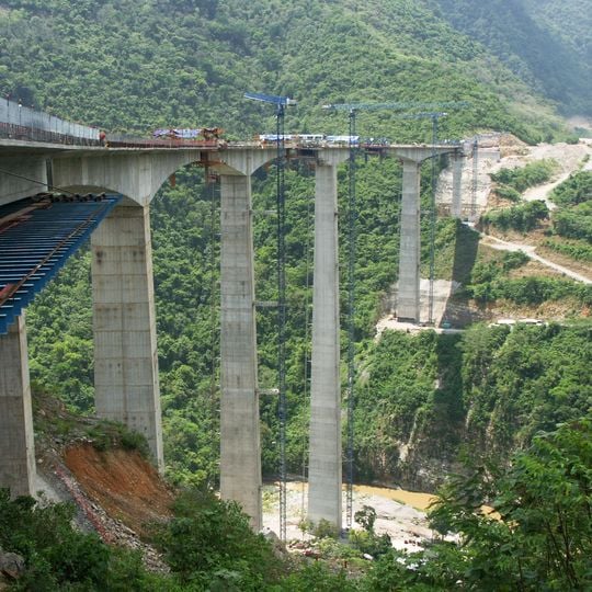
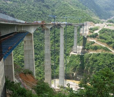
The San Marcos Bridge, officially Puente Ingeniero Gilberto Borja Navarrete, is a four-lane concrete box-girder bridge on Federal Highway 132D between Nuevo Necaxa and Villa Ávila Camacho. Its deck, 18.7 m wide, runs 850 m in a curve of 1150 m radius with a 5.8% grade, supported by seven spans and piers up to 208 m high above their foundations.

Construction began in 2009 and the bridge was finished in 2012; the Nuevo Necaxa–Tihuatlán stretch of Federal Highway 132D opened to traffic in 2014. The 37 km Nuevo Necaxa–Ávila Camacho section, with six tunnels and nine bridges, was the most demanding part of the route. Spanish firm FCC Construcción designed it, and FCC built it in a joint venture with Mexico's ICA.

The bridge is officially named Puente Ingeniero Gilberto Borja Navarrete after the engineer, though locals and maps use San Marcos, for the river it crosses. It carries the four-lane Carretera Federal 132D, part of the Mexico City–Tuxpan route, and its 2014 opening replaced the winding mountain road through Xicotepec with a 37 km section of six tunnels and nine bridges.

The bridge carries the four-lane Carretera Federal 132D on the Nuevo Necaxa–Tihuatlán stretch, curving with a constant radius of 1150 m and a 5.8% grade. It has no pedestrian walkway or viewpoint, so it is only crossed by vehicle. The road section opened to traffic in 2014.

Pier 4 stands 208 metres above its 7.5-metre foundation, making it the world's second-tallest bridge pier after Pier 2 of the Millau Viaduct in France. Its concrete base measures 17.53 by 13.55 metres and is anchored by 73 bored piles up to 25 metres deep. The pier was built with a PERI self-climbing formwork system.

The community of curious travelers

AroundUs brings together thousands of curated places, local tips, and hidden gems, enriched daily by 93,762 contributors worldwide.
Start exploring
Location
Height
225 m
Length
850 m
GPS coordinates
20.33981,-97.96033
Latest update
November 3, 2026 21:47
Reviews
Share your experience

No review yet

Discussions
Start a discussion...

No discussion yet

« San Marcos Bridge - Highway bridge in Xicotepec de Juárez, Puebla, Mexico » is provided by Around Us (aroundus.com). Images and texts are derived from Wikimedia project under a Creative Commons license. You are allowed to copy, distribute, and modify copies of this page, under the conditions set by the license, as long as this note is clearly visible.

Discover hidden gems everywhere you go!

From secret cafés to breathtaking viewpoints, skip the crowded tourist spots and find places that match your style. Our app makes it easy with voice search, smart filtering, route optimization, and insider tips from travelers worldwide. Download now for the complete mobile experience.

Around Us App Screenshot
❝

A unique approach to discovering new places❞

— Le Figaro

❝

All the places worth exploring❞

— France Info

❝

A tailor-made excursion in just a few clicks❞

— 20 Minutes

Around Us
Travel Guide & Maps
Download

Send to your phone

QR Code
1

Open the camera app on your mobile.

2

Point at the QR code with your camera. A notification will appear.

3

Tap the notification to open the link.