Chest opened
+${chestReward.xp} XP
Explorer
NOUVEAU ×${chestReward.collectible.quantity}
tapez pour fermer
Chest locked

Open chests in the app

Around Us is built for your phone — chests unlock when you walk, explore and capture nearby places.

Enable Location

We need your location to show you interesting places around you

Discover nearby places

Find interesting locations and hidden gems around you

Precise directions

Get accurate directions and distances to places

Your location is never shared with other users. It's only used when you tap the location button.

Simi Hills

Log in to your account

Start exploring — it's free

Trusted by 72,884 travelers worldwide

Continue with Google
Continue with Apple
or

We will send you a code to connect

By continuing, you accept our Terms and Conditions and our Privacy Policy

Check your inbox

We've sent a pincode in your inbox. Please enter the code below.

Simi Hills
Discussion Reviews 1 Photos
18.3k Popularity

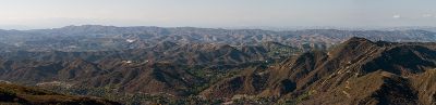
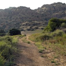
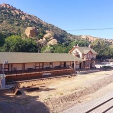
Simi Hills, Mountain range in Los Angeles and Ventura Counties, California.

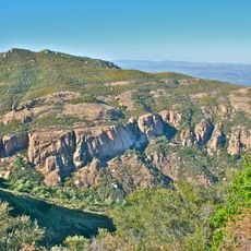
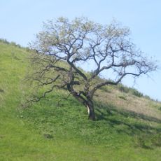
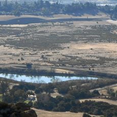
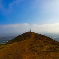
Simi Hills is a mountain range spanning Los Angeles and Ventura Counties with rolling slopes and open ridges. The terrain offers various hiking paths through chaparral shrubland and oak woodlands at different difficulty levels.

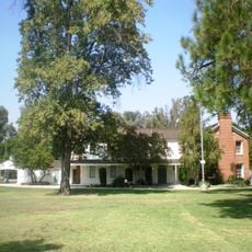
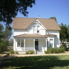
The area was home to Chumash and Venturaño peoples for thousands of years, who established settlements and used the landscape for survival. These early inhabitants left archaeological traces throughout the canyons and slopes.

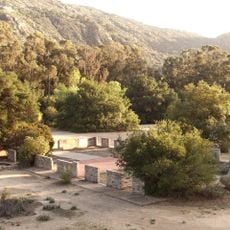
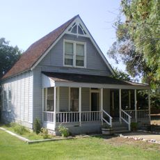
The hills serve as a retreat where residents and visitors spend time hiking and observing nature. Local communities gather here regularly to escape urban areas and enjoy outdoor activities.

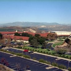
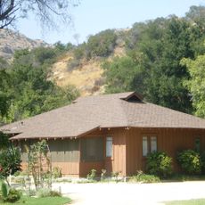
The area is accessible from several surrounding communities including Chatsworth, Simi Valley, and Thousand Oaks, which offer parking and entry points. Fall and winter offer the most comfortable conditions for hiking, with cooler temperatures and fewer crowds.

The hills function as a wildlife corridor connecting different animal populations between larger mountain ranges and providing habitat pathways. Rare predators like mountain lions regularly pass through the area, using it as a bridge between isolated regions.

The community of curious travelers

AroundUs brings together thousands of curated places, local tips, and hidden gems, enriched daily by 60,000 contributors worldwide.

Start exploring
Location
Shares border with
Moorpark, San Fernando, Hidden Hills
GPS coordinates
34.22440,-118.71700
Latest update
December 7, 2025 19:22
Around this place
Spahn Ranch
United States of America

Spahn Ranch

10.2 km
Ronald Reagan Presidential Library
United States of America

Ronald Reagan Presidential Library

10.2 km
Malibu Creek State Park
United States of America

Malibu Creek State Park

13.8 km
Corriganville Movie Ranch
United States of America

Corriganville Movie Ranch

7.8 km
Santa Monica Mountains National Recreation Area
United States of America

Santa Monica Mountains National Recreation Area

17 km
Leonis Adobe
United States of America

Leonis Adobe

10.3 km
Malibu Hindu Temple
United States of America

Malibu Hindu Temple

14.4 km
Jungleland USA
United States of America

Jungleland USA

13.3 km
Santa Susana Pass State Historic Park
United States of America

Santa Susana Pass State Historic Park

9.2 km
Grandma Prisbrey's Bottle Village
United States of America

Grandma Prisbrey's Bottle Village

6.2 km
Upper Las Virgenes Canyon Open Space Preserve
United States of America

Upper Las Virgenes Canyon Open Space Preserve

4.7 km
Orcutt Ranch Horticulture Center
United States of America

Orcutt Ranch Horticulture Center

7.1 km
Thousand Oaks Civic Arts Plaza
United States of America

Thousand Oaks Civic Arts Plaza

13.3 km
Chatsworth Nature Preserve
United States of America

Chatsworth Nature Preserve

8.1 km
The Rock Store
United States of America

The Rock Store

14.4 km
Joel McCrea Ranch
United States of America

Joel McCrea Ranch

12.7 km
Gardens of the World
United States of America

Gardens of the World

13.2 km
Shadow Ranch
United States of America

Shadow Ranch

9.5 km
Grant R. Brimhall Library
United States of America

Grant R. Brimhall Library

12.3 km
Mount McCoy
United States of America

Mount McCoy

9.1 km
Minnie Hill Palmer House
United States of America

Minnie Hill Palmer House

10.3 km
Simi Adobe-Strathearn House
United States of America

Simi Adobe-Strathearn House

9.5 km
Las Llajas Canyon
United States of America

Las Llajas Canyon

8.8 km
Old Trapper's Lodge
United States of America

Old Trapper's Lodge

13 km
Pederson House and Water Tower
United States of America

Pederson House and Water Tower

14.8 km
Woodlake Bowling
United States of America

Woodlake Bowling

10.6 km
Colony House
United States of America

Colony House

9.6 km
Santa Susana Railroad Depot & Museum
United States of America

Santa Susana Railroad Depot & Museum

6.5 km
Show the full map
Reviews
Share your experience

No review yet

Discussions
Start a discussion...

No discussion yet

« Simi Hills - Mountain range in Los Angeles and Ventura Counties, California » is provided by Around Us (aroundus.com). Images and texts are derived from Wikimedia project under a Creative Commons license. You are allowed to copy, distribute, and modify copies of this page, under the conditions set by the license, as long as this note is clearly visible.

Discover hidden gems everywhere you go!

From secret cafés to breathtaking viewpoints, skip the crowded tourist spots and find places that match your style. Our app makes it easy with voice search, smart filtering, route optimization, and insider tips from travelers worldwide. Download now for the complete mobile experience.

Around Us App Screenshot

A unique approach to discovering new places

Le Figaro

All the places worth exploring

France Info

A tailor-made excursion in just a few clicks

20 Minutes

Around Us
Travel Guide & Maps
Download

Send to your phone

QR Code
1

Open the camera app on your mobile.

2

Point at the QR code with your camera. A notification will appear.

3

Tap the notification to open the link.