Chest opened
+${chestReward.xp} XP
Explorer
NOUVEAU ×${chestReward.collectible.quantity}
tapez pour fermer
Chest locked

Open chests in the app

Around Us is built for your phone — chests unlock when you walk, explore and capture nearby places.

Enable Location

We need your location to show you interesting places around you

Discover nearby places

Find interesting locations and hidden gems around you

Precise directions

Get accurate directions and distances to places

Your location is never shared with other users. It's only used when you tap the location button.

Saint Malo

Log in to your account

Start exploring — it's free

Trusted by 72,888 travelers worldwide

Continue with Google
Continue with Apple
or

We will send you a code to connect

By continuing, you accept our Terms and Conditions and our Privacy Policy

Check your inbox

We've sent a pincode in your inbox. Please enter the code below.

Saint Malo
Discussion Reviews 1 Photos
23.5k Popularity

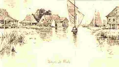
Saint Malo, human settlement in Louisiana, United States of America

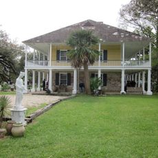
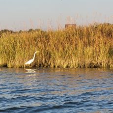
Saint Malo is a tiny village built on a small elevated area within Louisiana's swamplands, completely surrounded by water and marsh. The settlement contains only a handful of houses, boat sheds, and simple structures designed for water-based living and work.

The village formed in the early 1900s when French-Canadian families moved into the swamps to trap animals and harvest resources. The community developed and thrived during much of the 20th century but has declined significantly as traditional livelihoods became less viable.

The name comes from a French pirate and reflects the French-Canadian roots of those who settled here. The few remaining residents maintain deep connections to water-based work and swamp life through practices like trapping and hunting that continue to define daily routines.

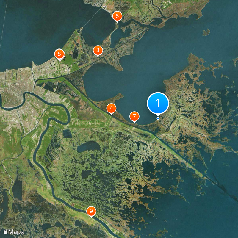
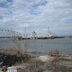
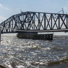
The settlement is only reachable by boat or airboat, as there are no roads through the swamps. Visitors should prepare for minimal facilities and bring supplies with them, since the area is remote and has little infrastructure.

The village has largely disappeared and today consists of only a few remaining houses and boat sheds, making it a rare window into a vanishing frontier community. Only adventurous visitors and historians now seek out the remnants of this once-active settlement.

The community of curious travelers

AroundUs brings together thousands of curated places, local tips, and hidden gems, enriched daily by 60,000 contributors worldwide.

Start exploring
Location
GPS coordinates
29.87810,-89.59690
Latest update
March 2, 2026 22:16
Around this place
Six Flags New Orleans
United States of America

Six Flags New Orleans

37.8 km
Fort Macomb
United States of America

Fort Macomb

28.8 km
Mississippi River – Gulf Outlet Canal
United States of America

Mississippi River – Gulf Outlet Canal

15.6 km
Fort Pike
United States of America

Fort Pike

34.8 km
The Jester
United States of America

The Jester

38.2 km
Fort Proctor
United States of America

Fort Proctor

7.9 km
Mega Zeph
United States of America

Mega Zeph

38.2 km
Woodland Plantation
United States of America

Woodland Plantation

39.6 km
Zydeco Scream
United States of America

Zydeco Scream

37.9 km
Fort Pike Bridge
United States of America

Fort Pike Bridge

35.2 km
Muskrat Scrambler
United States of America

Muskrat Scrambler

37.9 km
Kenilworth Plantation House
United States of America

Kenilworth Plantation House

21 km
St. Bernard State Park
United States of America

St. Bernard State Park

29.4 km
Mary Plantation House
United States of America

Mary Plantation House

39.8 km
Chef Menteur Bridge
United States of America

Chef Menteur Bridge

29.1 km
Judge Perez Bridge
United States of America

Judge Perez Bridge

39.8 km
CSX Rigolets Pass Bridge
United States of America

CSX Rigolets Pass Bridge

31 km
Bayou Sauvage National Wildlife Refuge
United States of America

Bayou Sauvage National Wildlife Refuge

33.5 km
West Rigolets Light
United States of America

West Rigolets Light

36 km
CSX Chef Menteur Pass Bridge
United States of America

CSX Chef Menteur Pass Bridge

28.6 km
East Rigolets Light
United States of America

East Rigolets Light

31.2 km
Green Bridge
United States of America

Green Bridge

35.9 km
Lake Borgne Light
United States of America

Lake Borgne Light

35.8 km
Los Isleños Museum Complex
United States of America

Los Isleños Museum Complex

25.4 km
Chalmette Unit of Jean Lafitte National Historical Park
United States of America

Chalmette Unit of Jean Lafitte National Historical Park

39 km
Versailles Arms
United States of America

Versailles Arms

35.3 km
Sebastopol Plantation
United States of America

Sebastopol Plantation

26.6 km
Thánh đường Các thánh tử đạo Việt Nam
United States of America

Thánh đường Các thánh tử đạo Việt Nam

35.2 km
Show the full map
Reviews
Share your experience

No review yet

Discussions
Start a discussion...

No discussion yet

« Saint Malo - human settlement in Louisiana, United States of America » is provided by Around Us (aroundus.com). Images and texts are derived from Wikimedia project under a Creative Commons license. You are allowed to copy, distribute, and modify copies of this page, under the conditions set by the license, as long as this note is clearly visible.

Discover hidden gems everywhere you go!

From secret cafés to breathtaking viewpoints, skip the crowded tourist spots and find places that match your style. Our app makes it easy with voice search, smart filtering, route optimization, and insider tips from travelers worldwide. Download now for the complete mobile experience.

Around Us App Screenshot

A unique approach to discovering new places

Le Figaro

All the places worth exploring

France Info

A tailor-made excursion in just a few clicks

20 Minutes

Around Us
Travel Guide & Maps
Download

Send to your phone

QR Code
1

Open the camera app on your mobile.

2

Point at the QR code with your camera. A notification will appear.

3

Tap the notification to open the link.