Chest opened
+${chestReward.xp} XP
Explorer
NOUVEAU ×${chestReward.collectible.quantity}
tapez pour fermer
Chest locked

Open chests in the app

Around Us is built for your phone — chests unlock when you walk, explore and capture nearby places.

Enable Location

We need your location to show you interesting places around you

Discover nearby places

Find interesting locations and hidden gems around you

Precise directions

Get accurate directions and distances to places

Your location is never shared with other users. It's only used when you tap the location button.

Log in to your account

Start exploring — it's free

Trusted by 72,888 travelers worldwide

Continue with Google
Continue with Apple
or

We will send you a code to connect

By continuing, you accept our Terms and Conditions and our Privacy Policy

Check your inbox

We've sent a pincode in your inbox. Please enter the code below.

Naval Facility Point Sur
Discussion Reviews Photo
6.6k Popularity

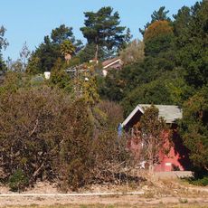
Naval Facility Point Sur, Cold War naval surveillance facility in Big Sur, California.

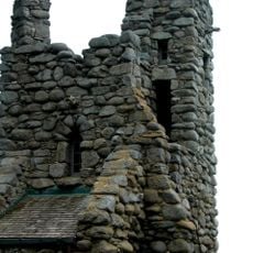
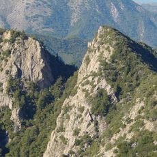
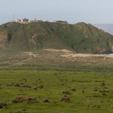
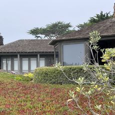
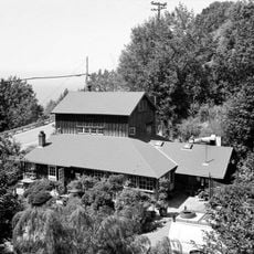
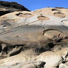
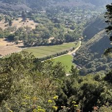
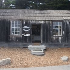
Naval Facility Point Sur was a military installation on California's coast south of Point Sur, consisting of administration buildings, operations facilities, and support structures spread across the coastal terrain. The site functioned as part of a broader network designed to monitor underwater activity in the Pacific.

Built in 1958, the facility used SOSUS technology to detect Soviet submarines during the Cold War as part of underwater surveillance operations. It closed in 1984 after computerized systems made the facility's onsite operations less necessary.

The facility maintained a cover story of conducting oceanographic research while operating as part of a classified network of submarine detection stations.

The site is located in a remote section of California's coast, and access may be limited due to its protected location. Check local conditions and any restrictions before planning a visit to this area.

In 1968 the facility helped locate Soviet submarine K-129, leading to a secret salvage operation that remained classified for decades. This achievement was one of the most significant intelligence successes of the Cold War era.

The community of curious travelers

AroundUs brings together thousands of curated places, local tips, and hidden gems, enriched daily by 60,000 contributors worldwide.

Start exploring
GPS coordinates
36.30417,-121.88833
Latest update
December 10, 2025 15:50
Around this place
Bixby Creek Bridge
United States of America

Bixby Creek Bridge

7.6 km
Mission San Carlos Borromeo de Carmelo
United States of America

Mission San Carlos Borromeo de Carmelo

26.7 km
McWay Falls
United States of America

McWay Falls

25.3 km
Julia Pfeiffer Burns State Park
United States of America

Julia Pfeiffer Burns State Park

24.8 km
Pfeiffer Big Sur State Park
United States of America

Pfeiffer Big Sur State Park

11.4 km
Point Sur Lighthouse
United States of America

Point Sur Lighthouse

927 m
Garrapata State Park
United States of America

Garrapata State Park

18.5 km
Andrew Molera State Park
United States of America

Andrew Molera State Park

5.5 km
Tor House and Hawk Tower
United States of America

Tor House and Hawk Tower

26.8 km
Ventana Wilderness
United States of America

Ventana Wilderness

20.8 km
Butterfly House
United States of America

Butterfly House

26.7 km
Carmel River State Beach
United States of America

Carmel River State Beach

25.6 km
Point Sur State Historic Park
United States of America

Point Sur State Historic Park

946 m
Pfeiffer Beach
United States of America

Pfeiffer Beach

9.7 km
Driftwood Cottage
United States of America

Driftwood Cottage

26.6 km
Rocky Creek Bridge
United States of America

Rocky Creek Bridge

8.5 km
Deetjen's Big Sur Inn
United States of America

Deetjen's Big Sur Inn

15.7 km
San Clemente Dam
United States of America

San Clemente Dam

21.8 km
Carmel River State Beach
United States of America

Carmel River State Beach

25.9 km
United States of America

Palo Corona Ranch

25.5 km
Geological history of Point Lobos
United States of America

Geological history of Point Lobos

24.2 km
Palo Corona Regional Park
United States of America

Palo Corona Regional Park

13.2 km
Whalers Cabin
United States of America

Whalers Cabin

24.2 km
Point Lobos State Reserve
United States of America

Point Lobos State Reserve

24.2 km
Monastery Beach
United States of America

Monastery Beach

24.7 km
Berwick Manor and Orchard
United States of America

Berwick Manor and Orchard

25.3 km
Keyhole Arch
United States of America

Keyhole Arch

9.7 km
Wreck Beach
United States of America

Wreck Beach

11.1 km
Show the full map
Reviews
Share your experience

No review yet

Discussions
Start a discussion...

No discussion yet

« Naval Facility Point Sur - Cold War naval surveillance facility in Big Sur, California » is provided by Around Us (aroundus.com). Images and texts are derived from Wikimedia project under a Creative Commons license. You are allowed to copy, distribute, and modify copies of this page, under the conditions set by the license, as long as this note is clearly visible.

Discover hidden gems everywhere you go!

From secret cafés to breathtaking viewpoints, skip the crowded tourist spots and find places that match your style. Our app makes it easy with voice search, smart filtering, route optimization, and insider tips from travelers worldwide. Download now for the complete mobile experience.

Around Us App Screenshot

A unique approach to discovering new places

Le Figaro

All the places worth exploring

France Info

A tailor-made excursion in just a few clicks

20 Minutes

Around Us
Travel Guide & Maps
Download

Send to your phone

QR Code
1

Open the camera app on your mobile.

2

Point at the QR code with your camera. A notification will appear.

3

Tap the notification to open the link.