Chest opened
+${chestReward.xp} XP
Explorer
NOUVEAU ×${chestReward.collectible.quantity}
tapez pour fermer
Chest locked

Open chests in the app

Around Us is built for your phone — chests unlock when you walk, explore and capture nearby places.

Enable Location

We need your location to show you interesting places around you

Discover nearby places

Find interesting locations and hidden gems around you

Precise directions

Get accurate directions and distances to places

Your location is never shared with other users. It's only used when you tap the location button.

Log in to your account

Start exploring — it's free

Trusted by 72,880 travelers worldwide

Continue with Google
Continue with Apple
or

We will send you a code to connect

By continuing, you accept our Terms and Conditions and our Privacy Policy

Check your inbox

We've sent a pincode in your inbox. Please enter the code below.

Discussion Reviews Photo
24.1k Popularity

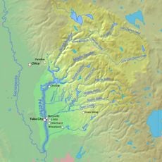
Westwood, Mountain census-designated place in Lassen County, California.

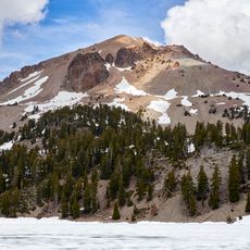
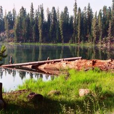
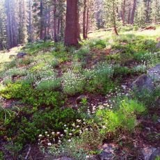
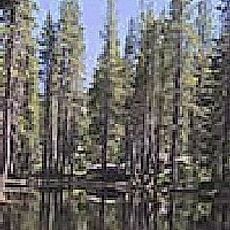
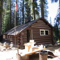
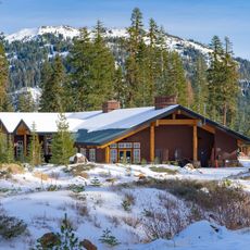
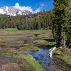
Westwood is a mountain community in Lassen County, California, situated at an elevation of about 5,100 feet amid dense forests and wooded terrain. The area features rolling landscapes surrounded by forestland typical of northern California's mountain region.

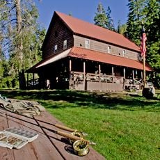
The Red River Lumber Company founded Westwood in 1913 as a company town, constructing one of the region's largest electrical sawmills. This mill became the economic center around which the entire settlement developed and grew.

The Paul Bunyan and Babe the Blue Ox statues in the town center reflect the logging tradition that shaped community life for generations. These figures serve as reminders of the workers who made the place their home.

The closest shops and services are located in nearby Susanville, so visitors should plan ahead for supplies or needs. The surrounding forests offer many hiking trails and fishing opportunities for those interested in outdoor recreation.

A local store owner pioneered cable television in the 1950s by developing a system using coaxial cables to deliver television signals to the entire community. This early network was a groundbreaking solution for bringing broadcasts to a remote mountain location.

The community of curious travelers

AroundUs brings together thousands of curated places, local tips, and hidden gems, enriched daily by 60,000 contributors worldwide.

Start exploring
Location
Elevation above the sea
1,563 m
GPS coordinates
40.30610,-121.00600
Latest update
December 20, 2025 13:09
Around this place
Lassen Peak
United States of America

Lassen Peak

46.9 km
Lake Almanor
United States of America

Lake Almanor

14.4 km
Cinder Cone and the Fantastic Lava Beds
United States of America

Cinder Cone and the Fantastic Lava Beds

37.9 km
Lassen National Forest
United States of America

Lassen National Forest

13.9 km
Geothermal areas in Lassen Volcanic National Park
United States of America

Geothermal areas in Lassen Volcanic National Park

45.3 km
Caribou Wilderness
United States of America

Caribou Wilderness

26.6 km
Bucks Lake Wilderness
United States of America

Bucks Lake Wilderness

41.8 km
Drakesbad Guest Ranch
United States of America

Drakesbad Guest Ranch

37.1 km
Antelope Dam
United States of America

Antelope Dam

36.6 km
United States of America

Bucks Lake

48.7 km
Nobles Emigrant Trail
United States of America

Nobles Emigrant Trail

44.5 km
Canyon Dam
United States of America

Canyon Dam

16.4 km
Hosselkus Limestone
United States of America

Hosselkus Limestone

36.6 km
Butte Creek Ecological Reserve
United States of America

Butte Creek Ecological Reserve

42.5 km
Mount Harkness Fire Lookout
United States of America

Mount Harkness Fire Lookout

28.7 km
Lassen Volcanic National Park Highway Historic District
United States of America

Lassen Volcanic National Park Highway Historic District

47.9 km
Roop's Fort
United States of America

Roop's Fort

32.3 km
Warner Valley Ranger Station
United States of America

Warner Valley Ranger Station

35.3 km
Horseshoe Lake Ranger Station
United States of America

Horseshoe Lake Ranger Station

33.2 km
Summit Lake Ranger Station
United States of America

Summit Lake Ranger Station

41.6 km
Lassen County Court House
United States of America

Lassen County Court House

31.6 km
Hot Rock
United States of America

Hot Rock

48.3 km
Sulphur Works
United States of America

Sulphur Works

47.7 km
Kohm Yah-mah-nee Visitor Center
United States of America

Kohm Yah-mah-nee Visitor Center

47.1 km
Bumpass Hell
United States of America

Bumpass Hell

45.4 km
Lassen Peak Trailhead
United States of America

Lassen Peak Trailhead

46.3 km
Lassen Volcanic Center
United States of America

Lassen Volcanic Center

47.3 km
Kings Creek
United States of America

Kings Creek

32 km
Show the full map
Reviews
Share your experience

No review yet

Discussions
Start a discussion...

No discussion yet

« Westwood - Mountain census-designated place in Lassen County, California » is provided by Around Us (aroundus.com). Images and texts are derived from Wikimedia project under a Creative Commons license. You are allowed to copy, distribute, and modify copies of this page, under the conditions set by the license, as long as this note is clearly visible.

Discover hidden gems everywhere you go!

From secret cafés to breathtaking viewpoints, skip the crowded tourist spots and find places that match your style. Our app makes it easy with voice search, smart filtering, route optimization, and insider tips from travelers worldwide. Download now for the complete mobile experience.

Around Us App Screenshot

A unique approach to discovering new places

Le Figaro

All the places worth exploring

France Info

A tailor-made excursion in just a few clicks

20 Minutes

Around Us
Travel Guide & Maps
Download

Send to your phone

QR Code
1

Open the camera app on your mobile.

2

Point at the QR code with your camera. A notification will appear.

3

Tap the notification to open the link.