Chest opened
+${chestReward.xp} XP
Explorer
NOUVEAU ×${chestReward.collectible.quantity}
tapez pour fermer
Chest locked

Open chests in the app

Around Us is built for your phone — chests unlock when you walk, explore and capture nearby places.

Enable Location

We need your location to show you interesting places around you

Discover nearby places

Find interesting locations and hidden gems around you

Precise directions

Get accurate directions and distances to places

Your location is never shared with other users. It's only used when you tap the location button.

D River

Log in to your account

Start exploring — it's free

Trusted by 72,877 travelers worldwide

Continue with Google
Continue with Apple
or

We will send you a code to connect

By continuing, you accept our Terms and Conditions and our Privacy Policy

Check your inbox

We've sent a pincode in your inbox. Please enter the code below.

D River
Discussion Reviews 2 Photos
26.4k Popularity

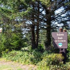
D River, River in Lincoln City, Oregon

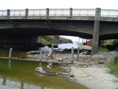
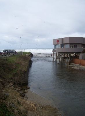
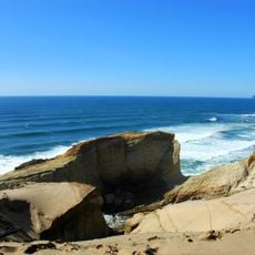
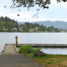
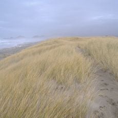
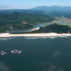
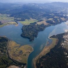
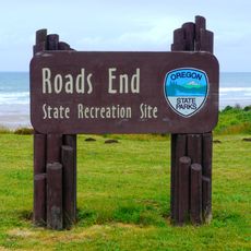
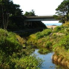
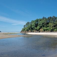
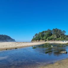
The D River is a short waterway in Lincoln City that connects Devils Lake to the Pacific Ocean. It cuts through the town before reaching the coast at a designated recreation site where both the river mouth and sandy beach are accessible.

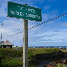
The waterway received its name in 1940 when a local chamber of commerce contest selected a single letter as the winner. This unusual naming approach made the location stand out from other geographic features.

Two annual kite festivals take place at D River State Recreation Site during summer and fall, drawing participants from across the country.

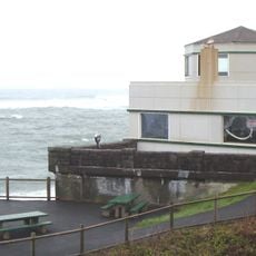
The recreation site has paved parking areas and restrooms nearby for visitor convenience. You can easily walk from the parking to reach both the water and the beach without difficulty.

The waterway held a Guinness World Record as the shortest river on Earth for a period. The recognition became disputed after measurement standards were questioned and other locations claimed similar status.

The community of curious travelers

AroundUs brings together thousands of curated places, local tips, and hidden gems, enriched daily by 60,000 contributors worldwide.

Start exploring
Location
Length
134 m
GPS coordinates
44.96722,-124.01528
Latest update
December 20, 2025 15:08
Around this place
Devils Punch Bowl State Natural Area
United States of America

Devils Punch Bowl State Natural Area

24.9 km
Cape Kiwanda State Natural Area
United States of America

Cape Kiwanda State Natural Area

28 km
Beverly Beach State Park
United States of America

Beverly Beach State Park

26.7 km
Chinook Winds Casino
United States of America

Chinook Winds Casino

3.5 km
Whale Watching Center
United States of America

Whale Watching Center

17.9 km
Devils Punchbowl State Natural Area
United States of America

Devils Punchbowl State Natural Area

24.8 km
H. B. Van Duzer Forest State Scenic Corridor
United States of America

H. B. Van Duzer Forest State Scenic Corridor

18.8 km
Boiler Bay State Scenic Viewpoint
United States of America

Boiler Bay State Scenic Viewpoint

16 km
Devil's Lake State Recreation Area
United States of America

Devil's Lake State Recreation Area

465 m
Bob Straub State Park
United States of America

Bob Straub State Park

24.4 km
Siletz Bay National Wildlife Refuge
United States of America

Siletz Bay National Wildlife Refuge

7.1 km
Salmon River
United States of America

Salmon River

15.2 km
D River State Recreation Site
United States of America

D River State Recreation Site

207 m
Neskowin Beach State Recreation Site
United States of America

Neskowin Beach State Recreation Site

15.2 km
Nestucca Bay National Wildlife Refuge
United States of America

Nestucca Bay National Wildlife Refuge

23.5 km
Devil's Punchbowl
United States of America

Devil's Punchbowl

24.8 km
Otter Crest State Scenic Viewpoint
United States of America

Otter Crest State Scenic Viewpoint

23.4 km
Roads End State Recreation Site
United States of America

Roads End State Recreation Site

4.6 km
Rocky Creek State Scenic Viewpoint
United States of America

Rocky Creek State Scenic Viewpoint

21.2 km
Fogarty Creek State Recreation Area
United States of America

Fogarty Creek State Recreation Area

14.1 km
Gleneden Beach State Recreation Site
United States of America

Gleneden Beach State Recreation Site

10.3 km
Depoe Bay Bridge
United States of America

Depoe Bay Bridge

17.9 km
Drift Creek Bridge
United States of America

Drift Creek Bridge

10.5 km
Rocky Creek Bridge
United States of America

Rocky Creek Bridge

21.5 km
Neskowin Beach
United States of America

Neskowin Beach

15.2 km
Whale Research EcoExcursions
United States of America

Whale Research EcoExcursions

18 km
Neskowin Beach
United States of America

Neskowin Beach

15.1 km
Kiwanda Beach
United States of America

Kiwanda Beach

20.8 km
Show the full map
Reviews
Share your experience

No review yet

Discussions
Start a discussion...

No discussion yet

« D River - River in Lincoln City, Oregon » is provided by Around Us (aroundus.com). Images and texts are derived from Wikimedia project under a Creative Commons license. You are allowed to copy, distribute, and modify copies of this page, under the conditions set by the license, as long as this note is clearly visible.

Discover hidden gems everywhere you go!

From secret cafés to breathtaking viewpoints, skip the crowded tourist spots and find places that match your style. Our app makes it easy with voice search, smart filtering, route optimization, and insider tips from travelers worldwide. Download now for the complete mobile experience.

Around Us App Screenshot

A unique approach to discovering new places

Le Figaro

All the places worth exploring

France Info

A tailor-made excursion in just a few clicks

20 Minutes

Around Us
Travel Guide & Maps
Download

Send to your phone

QR Code
1

Open the camera app on your mobile.

2

Point at the QR code with your camera. A notification will appear.

3

Tap the notification to open the link.