Enable Location

We need your location to show you interesting places around you

Discover nearby places

Find interesting locations and hidden gems around you

Precise directions

Get accurate directions and distances to places

Your location is never shared with other users. It's only used when you tap the location button.

Bob Straub State Park

Log in to your account

Start exploring — it's free

Trusted by 61,897 travelers worldwide

Continue with Google
Continue with Apple
or

We will send you a code to connect

By continuing, you accept our Terms and Conditions and our Privacy Policy

Check your inbox

We've sent a pincode in your inbox. Please enter the code below.

Bob Straub State Park

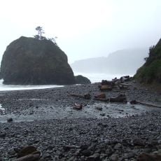
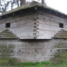
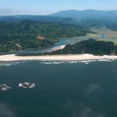
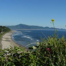
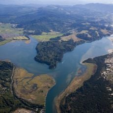
Bob Straub State Park, State park between Nestucca Bay and Pacific Ocean in Pacific City, Oregon.

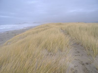
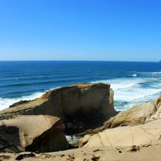
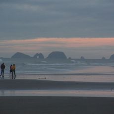
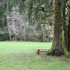
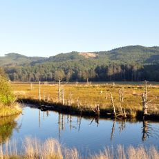
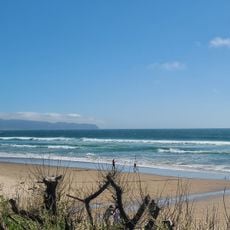
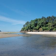
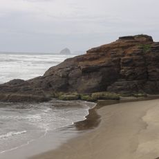
Bob Straub State Park is a natural preserve with a long sandy spit located between Nestucca Bay and the Pacific Ocean. The land features walking and riding trails that wind through open terrain with access to both river and ocean shorelines.

The land was assembled through purchases from private owners, the federal government, and the state between 1961 and 1964. A forest service land exchange in 1966 completed the formation of this coastal preserve.

The park honors Robert Straub, a former Oregon governor who fought to keep this coastal area from being developed into a highway. Walking across the open sands today, you can sense how his choice preserved something that might have been lost.

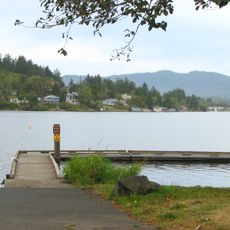
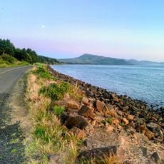
The park is accessible on foot and by horse, with equestrian facilities available at the adjacent boat launch area. Trails are straightforward to navigate, but coastal weather changes rapidly, so visitors should prepare for shifting conditions.

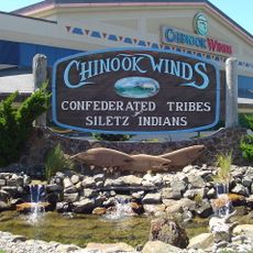
The Nestucca Bay area near the park holds a notable population of Chinook salmon, with some individuals reaching impressive size. Anglers are drawn to this location for the chance to encounter these powerful fish.

The community of curious travelers

AroundUs brings together thousands of curated places, local tips, and hidden gems, enriched daily by 60,000 contributors worldwide.

Start exploring
Location
GPS coordinates
45.18316,-123.96512
Latest update
December 12, 2025 12:03
Around this place
Tillamook Air Museum
United States of America

Tillamook Air Museum

29.3 km
Spirit Mountain Casino
United States of America

Spirit Mountain Casino

33.2 km
Cape Kiwanda State Natural Area
United States of America

Cape Kiwanda State Natural Area

3.8 km
Cape Lookout State Park
United States of America

Cape Lookout State Park

18.9 km
Chinook Winds Casino
United States of America

Chinook Winds Casino

20.9 km
Cape Meares Lighthouse
United States of America

Cape Meares Lighthouse

33.8 km
Three Arch Rocks National Wildlife Refuge
United States of America

Three Arch Rocks National Wildlife Refuge

31.1 km
Short Beach
United States of America

Short Beach

32.5 km
Fort Yamhill
United States of America

Fort Yamhill

33.5 km
H. B. Van Duzer Forest State Scenic Corridor
United States of America

H. B. Van Duzer Forest State Scenic Corridor

20 km
Naval Air Station Tillamook
United States of America

Naval Air Station Tillamook

29 km
Devil's Lake State Recreation Area
United States of America

Devil's Lake State Recreation Area

23.9 km
Munson Creek Falls State Natural Site
United States of America

Munson Creek Falls State Natural Site

25.2 km
Siletz Bay National Wildlife Refuge
United States of America

Siletz Bay National Wildlife Refuge

31.5 km
Salmon River
United States of America

Salmon River

20.6 km
D River State Recreation Site
United States of America

D River State Recreation Site

24.4 km
Neskowin Beach State Recreation Site
United States of America

Neskowin Beach State Recreation Site

9.2 km
Oceanside Beach State Recreation Site
United States of America

Oceanside Beach State Recreation Site

30.9 km
Nestucca Bay National Wildlife Refuge
United States of America

Nestucca Bay National Wildlife Refuge

1.9 km
Oceanside Beach State Recreation Site

Oceanside Beach State Recreation Site

31.1 km
Roads End State Recreation Site
United States of America

Roads End State Recreation Site

19.8 km
Drift Creek Bridge
United States of America

Drift Creek Bridge

22 km
Neskowin Beach
United States of America

Neskowin Beach

9.2 km
Wilson Beach
United States of America

Wilson Beach

27.3 km
McPhillips Beach
United States of America

McPhillips Beach

5.1 km
Hangar B
United States of America

Hangar B

29.2 km
NAS Tillamook dirigible hangars
United States of America

NAS Tillamook dirigible hangars

28.9 km
Kiwanda Beach
United States of America

Kiwanda Beach

3.6 km
Show the full map
« Bob Straub State Park - State park between Nestucca Bay and Pacific Ocean in Pacific City, Oregon » is provided by Around Us (aroundus.com). Images and texts are derived from Wikimedia project under a Creative Commons license. You are allowed to copy, distribute, and modify copies of this page, under the conditions set by the license, as long as this note is clearly visible.

Discover hidden gems everywhere you go!

From secret cafés to breathtaking viewpoints, skip the crowded tourist spots and find places that match your style. Our app makes it easy with voice search, smart filtering, route optimization, and insider tips from travelers worldwide. Download now for the complete mobile experience.

Around Us App Screenshot

A unique approach to discovering new places

Le Figaro

All the places worth exploring

France Info

A tailor-made excursion in just a few clicks

20 Minutes

Around Us
Travel Guide & Maps
Download

Send to your phone

QR Code
1

Open the camera app on your mobile.

2

Point at the QR code with your camera. A notification will appear.

3

Tap the notification to open the link.