Enable Location

We need your location to show you interesting places around you

Discover nearby places

Find interesting locations and hidden gems around you

Precise directions

Get accurate directions and distances to places

Your location is never shared with other users. It's only used when you tap the location button.

Salmon River

Log in to your account

Start exploring — it's free

Trusted by 61,895 travelers worldwide

Continue with Google
Continue with Apple
or

We will send you a code to connect

By continuing, you accept our Terms and Conditions and our Privacy Policy

Check your inbox

We've sent a pincode in your inbox. Please enter the code below.

Salmon River

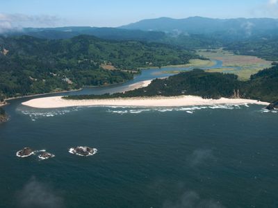
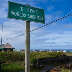
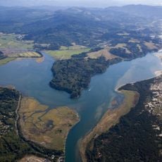
Salmon River, Brook in Polk County, United States

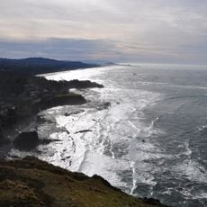
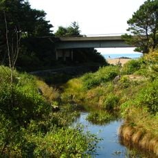
Salmon River is a brook in Polk County with forested banks and clean water that supports diverse fish species and aquatic life. The waterway maintains consistent flow throughout the seasons, creating stable habitat for the local ecosystem.

Indigenous communities settled in this area long ago, relying on the water and fish populations as food sources. Their presence shaped how the land was used for many generations.

Local environmental groups organize educational programs about water conservation and aquatic ecosystems, focusing on the brook's ecological importance.

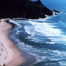
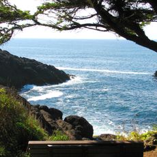
The brook is accessible from its banks where you can watch fish and water birds throughout the year. Stable water conditions make it suitable for visits during any season without surprises.

Scientists monitor this watercourse as an indicator of regional watershed health, collecting data about water quality and fish populations.

The community of curious travelers

AroundUs brings together thousands of curated places, local tips, and hidden gems, enriched daily by 60,000 contributors worldwide.

Start exploring
Location
GPS coordinates
45.02149,-123.83847
Latest update
December 12, 2025 14:23
Around this place
Devils Punch Bowl State Natural Area
United States of America

Devils Punch Bowl State Natural Area

35.5 km
Cape Kiwanda State Natural Area
United States of America

Cape Kiwanda State Natural Area

24.1 km
Cascade Head
United States of America

Cascade Head

19.6 km
Chinook Winds Casino
United States of America

Chinook Winds Casino

13.7 km
Whale Watching Center
United States of America

Whale Watching Center

29.4 km
Devils Punchbowl State Natural Area
United States of America

Devils Punchbowl State Natural Area

35.4 km
Fort Yamhill
United States of America

Fort Yamhill

21.8 km
H. B. Van Duzer Forest State Scenic Corridor
United States of America

H. B. Van Duzer Forest State Scenic Corridor

3.8 km
Boiler Bay State Scenic Viewpoint
United States of America

Boiler Bay State Scenic Viewpoint

28 km
Devil's Lake State Recreation Area
United States of America

Devil's Lake State Recreation Area

14.8 km
Bob Straub State Park
United States of America

Bob Straub State Park

20.6 km
Siletz Bay National Wildlife Refuge
United States of America

Siletz Bay National Wildlife Refuge

19.4 km
D River State Recreation Site
United States of America

D River State Recreation Site

15.4 km
Neskowin Beach State Recreation Site
United States of America

Neskowin Beach State Recreation Site

14.6 km
Nestucca Bay National Wildlife Refuge
United States of America

Nestucca Bay National Wildlife Refuge

18.9 km
Devil's Punchbowl
United States of America

Devil's Punchbowl

35.4 km
Otter Crest State Scenic Viewpoint
United States of America

Otter Crest State Scenic Viewpoint

34.2 km
Roads End State Recreation Site
United States of America

Roads End State Recreation Site

13.5 km
Rocky Creek State Scenic Viewpoint
United States of America

Rocky Creek State Scenic Viewpoint

32.4 km
Fogarty Creek State Recreation Area
United States of America

Fogarty Creek State Recreation Area

25.8 km
Gleneden Beach State Recreation Site
United States of America

Gleneden Beach State Recreation Site

22.4 km
Depoe Bay Bridge
United States of America

Depoe Bay Bridge

29.4 km
Drift Creek Bridge
United States of America

Drift Creek Bridge

4.9 km
Rocky Creek Bridge
United States of America

Rocky Creek Bridge

32.7 km
Sheridan Bridge
United States of America

Sheridan Bridge

35.9 km
Neskowin Beach
United States of America

Neskowin Beach

14.7 km
Whale Research EcoExcursions
United States of America

Whale Research EcoExcursions

29.5 km
Kiwanda Beach
United States of America

Kiwanda Beach

18 km
Show the full map
« Salmon River - Brook in Polk County, United States » is provided by Around Us (aroundus.com). Images and texts are derived from Wikimedia project under a Creative Commons license. You are allowed to copy, distribute, and modify copies of this page, under the conditions set by the license, as long as this note is clearly visible.

Discover hidden gems everywhere you go!

From secret cafés to breathtaking viewpoints, skip the crowded tourist spots and find places that match your style. Our app makes it easy with voice search, smart filtering, route optimization, and insider tips from travelers worldwide. Download now for the complete mobile experience.

Around Us App Screenshot

A unique approach to discovering new places

Le Figaro

All the places worth exploring

France Info

A tailor-made excursion in just a few clicks

20 Minutes

Around Us
Travel Guide & Maps
Download

Send to your phone

QR Code
1

Open the camera app on your mobile.

2

Point at the QR code with your camera. A notification will appear.

3

Tap the notification to open the link.