Chest opened
+${chestReward.xp} XP
Explorer
NOUVEAU ×${chestReward.collectible.quantity}
tapez pour fermer
Chest locked

Open chests in the app

Around Us is built for your phone — chests unlock when you walk, explore and capture nearby places.

Enable Location

We need your location to show you interesting places around you

Discover nearby places

Find interesting locations and hidden gems around you

Precise directions

Get accurate directions and distances to places

Your location is never shared with other users. It's only used when you tap the location button.

Metolius River

Log in to your account

Start exploring — it's free

Trusted by 72,878 travelers worldwide

Continue with Google
Continue with Apple
or

We will send you a code to connect

By continuing, you accept our Terms and Conditions and our Privacy Policy

Check your inbox

We've sent a pincode in your inbox. Please enter the code below.

Metolius River
Discussion Reviews 1 Photos
13k Popularity

Metolius River, Spring-fed river in Central Oregon, United States

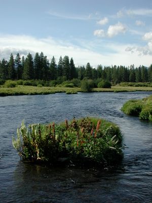
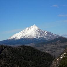
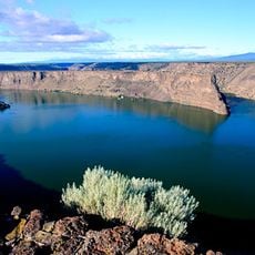
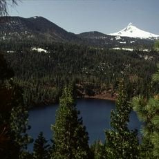
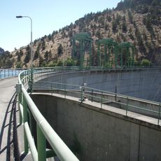
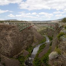
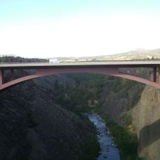
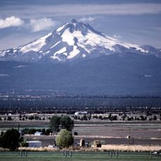
The Metolius River emerges fully formed from underground springs near Black Butte and flows northward through the landscape. The waterway cuts through several gorges before merging with Lake Billy Chinook.

The name derives from 'mitula,' a word from the Warm Springs language referring to the light-colored Chinook salmon that once inhabited these waters. This linguistic connection reflects the deep historical bond between Indigenous peoples and the river.

The Warm Springs Tribe practices traditional customs along the lower reaches, keeping their ancestral ties to the water alive in everyday activities. Visitors can observe how local communities continue to use the river in culturally meaningful ways.

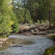
Fishing requires a valid permit, which is necessary for accessing the rainbow and bull trout throughout the waterway. Access points are available along the upper and middle sections, where the best fishing is typically found.

The water maintains consistent levels year-round because the river is fed directly by underground springs rather than snowmelt. This reliability makes it a dependable fishing destination regardless of the season.

The community of curious travelers

AroundUs brings together thousands of curated places, local tips, and hidden gems, enriched daily by 60,000 contributors worldwide.

Start exploring
Location
GPS coordinates
44.59760,-121.28700
Latest update
December 7, 2025 20:42
Around this place
Smith Rock State Park
United States of America

Smith Rock State Park

28 km
Mount Jefferson
United States of America

Mount Jefferson

41.5 km
Lake Billy Chinook
United States of America

Lake Billy Chinook

6.3 km
Black Butte
United States of America

Black Butte

35.4 km
The Cove Palisades State Park
United States of America

The Cove Palisades State Park

1.1 km
Petersen Rock Garden
United States of America

Petersen Rock Garden

44 km
Mount Jefferson Wilderness
United States of America

Mount Jefferson Wilderness

41.4 km
Cline Falls State Scenic Viewpoint
United States of America

Cline Falls State Scenic Viewpoint

36.7 km
Crooked River High Bridge
United States of America

Crooked River High Bridge

24 km
Blue Lake Crater
United States of America

Blue Lake Crater

43.9 km
Peter Skene Ogden State Scenic Viewpoint
United States of America

Peter Skene Ogden State Scenic Viewpoint

24.1 km
Crooked River Railroad Bridge
United States of America

Crooked River Railroad Bridge

24.1 km
Pelton Dam
United States of America

Pelton Dam

11.6 km
Crooked River Gorge
United States of America

Crooked River Gorge

20.6 km
Sisters State Park
United States of America

Sisters State Park

39.9 km
Skylight Cave
United States of America

Skylight Cave

43.9 km
Rex T. Barber Veterans Memorial Bridge
United States of America

Rex T. Barber Veterans Memorial Bridge

23.9 km
Milton Odem House
United States of America

Milton Odem House

37.3 km
The Museum at Warm Springs
United States of America

The Museum at Warm Springs

18.6 km
New Redmond Hotel
United States of America

New Redmond Hotel

37.3 km
First Presbyterian Church of Redmond
United States of America

First Presbyterian Church of Redmond

37 km
Grizzly Mountain
United States of America

Grizzly Mountain

31.7 km
Sisters High School
United States of America

Sisters High School

39.8 km
Camp Sherman Community Hall
United States of America

Camp Sherman Community Hall

33.7 km
Jefferson Park Glacier
United States of America

Jefferson Park Glacier

42.2 km
Whitewater Glacier
United States of America

Whitewater Glacier

41 km
Max and Ollie Lueddemann House
United States of America

Max and Ollie Lueddemann House

13.5 km
Pilot Butte Canal Downtown Redmond Segment
United States of America

Pilot Butte Canal Downtown Redmond Segment

35.7 km
Show the full map
Reviews
Share your experience

No review yet

Discussions
Start a discussion...

No discussion yet

« Metolius River - Spring-fed river in Central Oregon, United States » is provided by Around Us (aroundus.com). Images and texts are derived from Wikimedia project under a Creative Commons license. You are allowed to copy, distribute, and modify copies of this page, under the conditions set by the license, as long as this note is clearly visible.

Discover hidden gems everywhere you go!

From secret cafés to breathtaking viewpoints, skip the crowded tourist spots and find places that match your style. Our app makes it easy with voice search, smart filtering, route optimization, and insider tips from travelers worldwide. Download now for the complete mobile experience.

Around Us App Screenshot

A unique approach to discovering new places

Le Figaro

All the places worth exploring

France Info

A tailor-made excursion in just a few clicks

20 Minutes

Around Us
Travel Guide & Maps
Download

Send to your phone

QR Code
1

Open the camera app on your mobile.

2

Point at the QR code with your camera. A notification will appear.

3

Tap the notification to open the link.