Enable Location

We need your location to show you interesting places around you

Discover nearby places

Find interesting locations and hidden gems around you

Precise directions

Get accurate directions and distances to places

Your location is never shared with other users. It's only used when you tap the location button.

Cape Meares National Wildlife Refuge

Log in to your account

Start exploring — it's free

Trusted by 61,473 travelers worldwide

Continue with Google
Continue with Apple
or

We will send you a code to connect

By continuing, you accept our Terms and Conditions and our Privacy Policy

Check your inbox

We've sent a pincode in your inbox. Please enter the code below.

Cape Meares National Wildlife Refuge

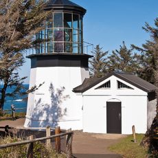
Cape Meares National Wildlife Refuge, National wildlife refuge on the Oregon coast, United States

Description

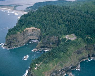
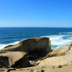
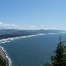
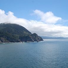
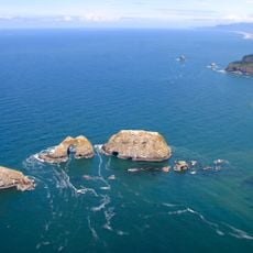
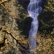
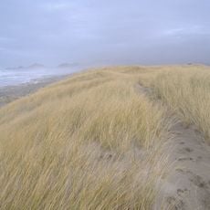
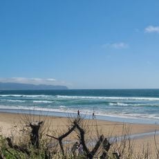
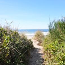
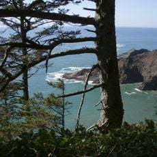
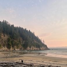
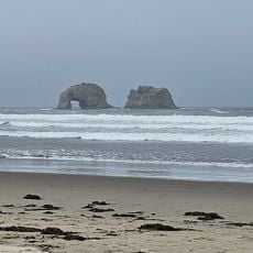
Cape Meares National Wildlife Refuge protects a stretch of the Oregon coast with dramatic cliffs and ancient forests meeting the Pacific Ocean. The reserve covers roughly 138 acres and offers walking routes that lead through wooded areas and past observation points overlooking the water.

History

The refuge was established in 1938 by the United States Fish and Wildlife Service to protect coastal habitats and nesting sites for seabirds. This action reflected growing efforts to preserve natural areas along the Pacific Northwest coast.

Culture

The refuge contributes to scientific research through its designation as a Research Natural Area, supporting studies of native ecosystems and wildlife populations.

Practical

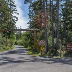
Plan your visit on clear days when ocean views are best and walking conditions are comfortable on the cliff trails. Four marked paths of varying lengths make it easy to choose a route that fits your energy level and time available.

Did you know?

The refuge contains a massive Sitka spruce known as the Cape Meares Giant that stands over 200 feet tall and ranks as Oregon's largest tree of its kind. Visitors are drawn to this towering giant to grasp the scale of old-growth forest specimens in this region.

Location
Inception
1938
GPS coordinates
45.48730,-123.96400
Latest update
December 12, 2025 17:47

AroundUs brings together thousands of curated places, local tips, and hidden gems, enriched daily by 60,000 contributors worldwide. Discover all places nearby (Oregon).

Around this place
Tillamook Air Museum
United States of America

Tillamook Air Museum

14.5 km
Cape Kiwanda State Natural Area
United States of America

Cape Kiwanda State Natural Area

30.2 km
Oswald West State Park
United States of America

Oswald West State Park

31.4 km
Nehalem Bay State Park
United States of America

Nehalem Bay State Park

23.6 km
Neahkahnie Mountain
United States of America

Neahkahnie Mountain

28.9 km
Cape Lookout State Park
United States of America

Cape Lookout State Park

15 km
Cape Meares Lighthouse
United States of America

Cape Meares Lighthouse

1.1 km
Three Arch Rocks National Wildlife Refuge
United States of America

Three Arch Rocks National Wildlife Refuge

3.4 km
Short Beach
United States of America

Short Beach

1.4 km
Naval Air Station Tillamook
United States of America

Naval Air Station Tillamook

14.7 km
Munson Creek Falls State Natural Site
United States of America

Munson Creek Falls State Natural Site

20.3 km
Bob Straub State Park
United States of America

Bob Straub State Park

33.9 km
Oceanside Beach State Recreation Site
United States of America

Oceanside Beach State Recreation Site

3 km
Oceanside Beach State Recreation Site

Oceanside Beach State Recreation Site

2.9 km
Manhattan Beach State Recreation Site
United States of America

Manhattan Beach State Recreation Site

17.4 km
Wilson River Bridge
United States of America

Wilson River Bridge

9.5 km
Harry F. Wentz Studio
United States of America

Harry F. Wentz Studio

27.4 km
Cape Falcon Marine Reserve
United States of America

Cape Falcon Marine Reserve

31.3 km
A. E. Doyle Cottage
United States of America

A. E. Doyle Cottage

27 km
Mary Frances Isom Cottage
United States of America

Mary Frances Isom Cottage

26.9 km
Sunset Beach
United States of America

Sunset Beach

25.7 km
Short Sand Beach
United States of America

Short Sand Beach

30.4 km
Hangar B
United States of America

Hangar B

14.5 km
Blumenthal Falls
United States of America

Blumenthal Falls

30.8 km
Latimer Quilt & Textile Center
United States of America

Latimer Quilt & Textile Center

9.9 km
NAS Tillamook dirigible hangars
United States of America

NAS Tillamook dirigible hangars

14.6 km
Mohler Bridge
United States of America

Mohler Bridge

26 km
Twin Rocks Turnaround
United States of America

Twin Rocks Turnaround

12.7 km
Show the full map
« Cape Meares National Wildlife Refuge - National wildlife refuge on the Oregon coast, United States » is provided by Around Us (aroundus.com). Images and texts are derived from Wikimedia project under a Creative Commons license. You are allowed to copy, distribute, and modify copies of this page, under the conditions set by the license, as long as this note is clearly visible.

Discover hidden gems everywhere you go!

From secret cafés to breathtaking viewpoints, skip the crowded tourist spots and find places that match your style. Our app makes it easy with voice search, smart filtering, route optimization, and insider tips from travelers worldwide. Download now for the complete mobile experience.

Around Us App Screenshot

A unique approach to discovering new places

Le Figaro

All the places worth exploring

France Info

A tailor-made excursion in just a few clicks

20 Minutes

Around Us
Travel Guide & Maps
Download

Send to your phone

QR Code
1

Open the camera app on your mobile.

2

Point at the QR code with your camera. A notification will appear.

3

Tap the notification to open the link.