Chest opened
+${chestReward.xp} XP
Explorer
NOUVEAU ×${chestReward.collectible.quantity}
tapez pour fermer
Chest locked

Open chests in the app

Around Us is built for your phone — chests unlock when you walk, explore and capture nearby places.

Enable Location

We need your location to show you interesting places around you

Discover nearby places

Find interesting locations and hidden gems around you

Precise directions

Get accurate directions and distances to places

Your location is never shared with other users. It's only used when you tap the location button.

Log in to your account

Start exploring — it's free

Trusted by 72,952 travelers worldwide

Continue with Google
Continue with Apple
or

We will send you a code to connect

By continuing, you accept our Terms and Conditions and our Privacy Policy

Check your inbox

We've sent a pincode in your inbox. Please enter the code below.

Discussion Reviews Photo
11.2k Popularity

Leona Valley, Agricultural census-designated place in Los Angeles County, United States.

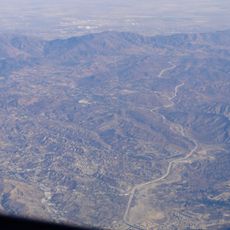
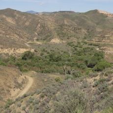
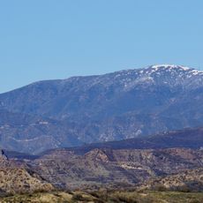
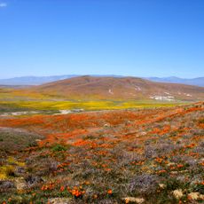
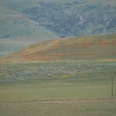
Leona Valley is an agricultural area with approximately 590 households located between the Sierra Pelona Mountains and the Mojave Desert. The community lies west of Palmdale in northern Los Angeles County and is shaped by its rural character and open landscape.

The area began as Spanish and Mexican ranching land before transforming into smaller farms during the 1800s. Settlers from Germany, France, and Nebraska arrived and established the agricultural traditions that continue today.

The annual Cherry Festival brings residents and visitors together to celebrate local agriculture through harvesting activities and food demonstrations. This gathering reflects how people here remain connected to their farming traditions.

The area is spread out across open terrain, so traveling between neighborhoods requires a car. Medical services can be found at the Antelope Valley Health Center in nearby Lancaster when needed.

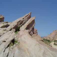
The San Andreas Fault creates Ritter Ridge, a visible ridge line that separates Leona Valley from the Antelope Valley. This geological feature forms a natural boundary between two distinct landscapes in the region.

The community of curious travelers

AroundUs brings together thousands of curated places, local tips, and hidden gems, enriched daily by 60,000 contributors worldwide.

Start exploring
GPS coordinates
34.61833,-118.28722
Latest update
December 8, 2025 13:42
Around this place
Willow Springs International Motorsports Park
United States of America

Willow Springs International Motorsports Park

28.7 km
Golden Oak Ranch
United States of America

Golden Oak Ranch

32.3 km
Antelope Valley California Poppy Reserve State Natural Reserve
United States of America

Antelope Valley California Poppy Reserve State Natural Reserve

15.7 km
Castaic Lake
United States of America

Castaic Lake

30.4 km
Shambala Preserve
United States of America

Shambala Preserve

20.1 km
Scaled Composites Triumph
United States of America

Scaled Composites Triumph

18.3 km
Joe Davies Heritage Airpark
United States of America

Joe Davies Heritage Airpark

18.3 km
Placerita Canyon State Park
United States of America

Placerita Canyon State Park

30.7 km
Soledad Canyon
United States of America

Soledad Canyon

31.8 km
Shea's Castle
United States of America

Shea's Castle

13.2 km
Saugus Speedway
United States of America

Saugus Speedway

31.5 km
Bouquet Reservoir
United States of America

Bouquet Reservoir

9.4 km
Arthur B. Ripley Desert Woodland State Park
United States of America

Arthur B. Ripley Desert Woodland State Park

25.2 km
Castaic Lake State Recreation Area
United States of America

Castaic Lake State Recreation Area

31.2 km
Dry Town Water Park
United States of America

Dry Town Water Park

21.9 km
Littlerock Dam
United States of America

Littlerock Dam

28.4 km
Dry Canyon Reservoir
United States of America

Dry Canyon Reservoir

26.7 km
Burnt Peak
United States of America

Burnt Peak

27.4 km
Fairmont Butte
United States of America

Fairmont Butte

18.3 km
Western Hotel
United States of America

Western Hotel

16.2 km
Willow Springs Canyon
United States of America

Willow Springs Canyon

11.9 km
Vasquez Rocks
United States of America

Vasquez Rocks

15.7 km
Blackbird Airpark
United States of America

Blackbird Airpark

18.5 km
Moah:cedar
United States of America

Moah:cedar

16.1 km
Elyze Clifford Interpretive Center
United States of America

Elyze Clifford Interpretive Center

10.2 km
Blackbird Airpark
United States of America

Blackbird Airpark

18.5 km
Vasquez Rocks Park
United States of America

Vasquez Rocks Park

15.6 km
Armstrong Aircraft Operations Facility
United States of America

Armstrong Aircraft Operations Facility

19.3 km
Show the full map
Reviews
Share your experience

No review yet

Discussions
Start a discussion...

No discussion yet

« Leona Valley - Agricultural census-designated place in Los Angeles County, United States » is provided by Around Us (aroundus.com). Images and texts are derived from Wikimedia project under a Creative Commons license. You are allowed to copy, distribute, and modify copies of this page, under the conditions set by the license, as long as this note is clearly visible.

Discover hidden gems everywhere you go!

From secret cafés to breathtaking viewpoints, skip the crowded tourist spots and find places that match your style. Our app makes it easy with voice search, smart filtering, route optimization, and insider tips from travelers worldwide. Download now for the complete mobile experience.

Around Us App Screenshot

A unique approach to discovering new places

Le Figaro

All the places worth exploring

France Info

A tailor-made excursion in just a few clicks

20 Minutes

Around Us
Travel Guide & Maps
Download

Send to your phone

QR Code
1

Open the camera app on your mobile.

2

Point at the QR code with your camera. A notification will appear.

3

Tap the notification to open the link.