Chest opened
+${chestReward.xp} XP
Explorer
NOUVEAU ×${chestReward.collectible.quantity}
tapez pour fermer
Chest locked

Open chests in the app

Around Us is built for your phone — chests unlock when you walk, explore and capture nearby places.

Enable Location

We need your location to show you interesting places around you

Discover nearby places

Find interesting locations and hidden gems around you

Precise directions

Get accurate directions and distances to places

Your location is never shared with other users. It's only used when you tap the location button.

Denio

Log in to your account

Start exploring — it's free

Trusted by 72,880 travelers worldwide

Continue with Google
Continue with Apple
or

We will send you a code to connect

By continuing, you accept our Terms and Conditions and our Privacy Policy

Check your inbox

We've sent a pincode in your inbox. Please enter the code below.

Discussion Reviews 1 Photos
11.2k Popularity

Denio, Census-designated place in Humboldt County, Nevada.

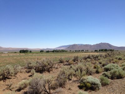
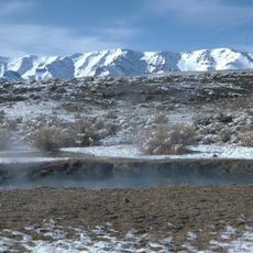
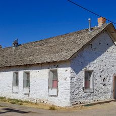
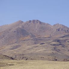
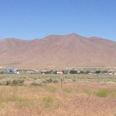
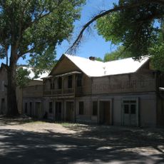
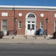
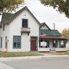
Denio is a small settlement in Humboldt County, Nevada, situated at an elevation of approximately 1,280 meters (4,200 feet) with essential facilities for its sparse population. The community maintains a post office, community center, library, and the Diamond Inn Bar as a social hub.

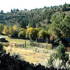
The settlement was founded in 1885 by Aaron Denio, who had spent 25 years working in mining, milling, and farming across Nevada and California. After World War II, local businesses relocated from Oregon to Nevada to take advantage of the state's lack of income tax and different regulatory environment.

The Diamond Inn Bar functions as the primary social gathering spot for residents, fostering connections among the small population of the area.

Essential services including fuel, groceries, food, and lodging are available at Denio Junction, located about 3 kilometers south of town. Visitors should plan ahead for this remote location and bring supplies, as nearby resources are limited.

Local businesses relocated from Oregon to Nevada after World War II to benefit from Nevada's absence of income tax and different regulations.

The community of curious travelers

AroundUs brings together thousands of curated places, local tips, and hidden gems, enriched daily by 60,000 contributors worldwide.

Start exploring
Location
Elevation above the sea
1,282 m
GPS coordinates
41.99000,-118.63306
Latest update
December 8, 2025 13:42
Around this place
Sheldon National Wildlife Refuge
United States of America

Sheldon National Wildlife Refuge

56.3 km
Hart Mountain National Antelope Refuge
United States of America

Hart Mountain National Antelope Refuge

104.8 km
Steens Mountain Wilderness
United States of America

Steens Mountain Wilderness

75.9 km
Black Rock Desert – High Rock Canyon Emigrant Trails National Conservation Area
United States of America

Black Rock Desert – High Rock Canyon Emigrant Trails National Conservation Area

125.2 km
Pete French Round Barn
United States of America

Pete French Round Barn

127.2 km
United States of America

Black Rock Desert Wilderness

86.7 km
Mickey Hot Springs
United States of America

Mickey Hot Springs

80 km
Fort McDermit
United States of America

Fort McDermit

83.7 km
David L. Shirk Ranch
United States of America

David L. Shirk Ranch

78.3 km
Frenchglen Hotel State Heritage Site
United States of America

Frenchglen Hotel State Heritage Site

96 km
Fandango Pass
United States of America

Fandango Pass

132.1 km
Greaser Petroglyph Site
United States of America

Greaser Petroglyph Site

99.4 km
P Ranch
United States of America

P Ranch

95.5 km
Camp Warner
United States of America

Camp Warner

102.8 km
High Rock Canyon Wilderness
United States of America

High Rock Canyon Wilderness

95.9 km
Riddle Ranch
United States of America

Riddle Ranch

120.8 km
Stone Bridge and the Oregon Central Military Wagon Road
United States of America

Stone Bridge and the Oregon Central Military Wagon Road

107.5 km
Granite Peak
United States of America

Granite Peak

93.7 km
Winnemucca Mountain
United States of America

Winnemucca Mountain

130.9 km
Winnemucca Hotel
United States of America

Winnemucca Hotel

135.5 km
Deep Creek Falls
United States of America

Deep Creek Falls

110.7 km
Paradise Valley Ranger Station
United States of America

Paradise Valley Ranger Station

107 km
Micca House
United States of America

Micca House

106.9 km
Winnemucca Main Post Office
United States of America

Winnemucca Main Post Office

135.8 km
W.C. Record House
United States of America

W.C. Record House

135.6 km
Humboldt River Bridge
United States of America

Humboldt River Bridge

135.3 km
Humboldt Museum
United States of America

Humboldt Museum

134.9 km
BLM Field Camp
United States of America

BLM Field Camp

55.3 km
Show the full map
Reviews
Share your experience

No review yet

Discussions
Start a discussion...

No discussion yet

« Denio - Census-designated place in Humboldt County, Nevada » is provided by Around Us (aroundus.com). Images and texts are derived from Wikimedia project under a Creative Commons license. You are allowed to copy, distribute, and modify copies of this page, under the conditions set by the license, as long as this note is clearly visible.

Discover hidden gems everywhere you go!

From secret cafés to breathtaking viewpoints, skip the crowded tourist spots and find places that match your style. Our app makes it easy with voice search, smart filtering, route optimization, and insider tips from travelers worldwide. Download now for the complete mobile experience.

Around Us App Screenshot

A unique approach to discovering new places

Le Figaro

All the places worth exploring

France Info

A tailor-made excursion in just a few clicks

20 Minutes

Around Us
Travel Guide & Maps
Download

Send to your phone

QR Code
1

Open the camera app on your mobile.

2

Point at the QR code with your camera. A notification will appear.

3

Tap the notification to open the link.