Enable Location

We need your location to show you interesting places around you

Discover nearby places

Find interesting locations and hidden gems around you

Precise directions

Get accurate directions and distances to places

Your location is never shared with other users. It's only used when you tap the location button.

Log in to your account

Start exploring — it's free

Trusted by 62,868 travelers worldwide

Continue with Google
Continue with Apple
or

We will send you a code to connect

By continuing, you accept our Terms and Conditions and our Privacy Policy

Check your inbox

We've sent a pincode in your inbox. Please enter the code below.

Antelope Reservoir

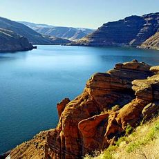
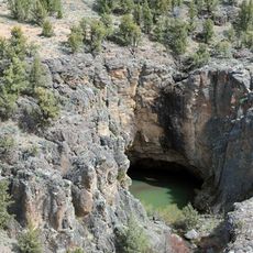
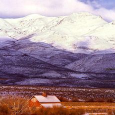
Antelope Reservoir, body of water

Antelope Reservoir is a large water storage area in southeastern Oregon, located about ten miles from the Idaho border near the small town of Jordan Valley. Water flows in through the Antelope Feeder Canal from Jordan Creek and supplies irrigation to about twelve thousand acres of farmland downstream.

The reservoir was constructed in 1913 and 1914 when a dam was built on Jack Creek to store water. The dam was later raised from its original 42 feet to 80 feet to hold greater amounts of water for irrigation purposes.

The reservoir is named after the Antelope Feeder Canal that brings water from Jordan Creek to fill it. It serves the local community as a gathering place for relaxation and spending time outdoors with family and friends.

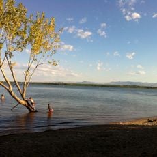
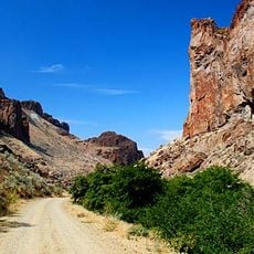
The site is accessible via a well-marked gravel road branching from US Highway 95 that is drivable by most vehicles. Visitors should know there is no drinking water supply and cell service is unreliable, so bringing supplies and planning for self-sufficiency is important.

The water contains elevated mercury levels from historical mining activities in the region, particularly from gold and silver processing in nearby Silver City, Idaho. This makes consuming fish from the water inadvisable, though the reservoir remains popular with anglers nonetheless.

The community of curious travelers

AroundUs brings together thousands of curated places, local tips, and hidden gems, enriched daily by 60,000 contributors worldwide.

Start exploring
Location
GPS coordinates
42.90670,-117.23600
Latest update
February 9, 2026 08:20
Around this place
Jump Creek Falls
United States of America

Jump Creek Falls

68.3 km
Owyhee Reservoir
United States of America

Owyhee Reservoir

62.3 km
Deer Flat National Wildlife Refuge
United States of America

Deer Flat National Wildlife Refuge

85.2 km
Northern Basin and Range ecoregion
United States of America

Northern Basin and Range ecoregion

21.9 km
Owyhee River Wilderness
United States of America

Owyhee River Wilderness

89.2 km
Lake Owyhee State Park
United States of America

Lake Owyhee State Park

79.4 km
De Lamar, Idaho
United States of America

De Lamar, Idaho

35.5 km
Our Lady, Queen of Heaven Church
United States of America

Our Lady, Queen of Heaven Church

70.2 km
Succor Creek State Natural Area
United States of America

Succor Creek State Natural Area

62.9 km
Pole Creek Wilderness
United States of America

Pole Creek Wilderness

73.2 km
Little Jacks Creek Wilderness
United States of America

Little Jacks Creek Wilderness

85.5 km
North Fork Owyhee Wilderness
United States of America

North Fork Owyhee Wilderness

46.8 km
Map Rock Petroglyphs Historic District
United States of America

Map Rock Petroglyphs Historic District

71.7 km
Nampa Historic District
United States of America

Nampa Historic District

92.8 km
Farmers and Merchants Bank
United States of America

Farmers and Merchants Bank

92.8 km
Sheep Ranch Fortified House
United States of America

Sheep Ranch Fortified House

25.3 km
Owyhee County Courthouse
United States of America

Owyhee County Courthouse

65.6 km
Nampa Department Store
United States of America

Nampa Department Store

93.6 km
Nampa and Meridian Irrigation District Office
United States of America

Nampa and Meridian Irrigation District Office

92.7 km
Nampa Presbyterian Church
United States of America

Nampa Presbyterian Church

92.7 km
Jacob P. Lockman House
United States of America

Jacob P. Lockman House

93.1 km
Guffey Butte–Black Butte Archaeological District
United States of America

Guffey Butte–Black Butte Archaeological District

72.7 km
Nampa American Legion Chateau
United States of America

Nampa American Legion Chateau

92.7 km
H. Orton Wiley House
United States of America

H. Orton Wiley House

91.1 km
Noble Horse Barn
United States of America

Noble Horse Barn

52.3 km
Silver City Historic District
United States of America

Silver City Historic District

42.8 km
Nampa Train Depot
United States of America

Nampa Train Depot

92.9 km
Owyhee Canyon
United States of America

Owyhee Canyon

45.8 km
Show the full map
« Antelope Reservoir - body of water » is provided by Around Us (aroundus.com). Images and texts are derived from Wikimedia project under a Creative Commons license. You are allowed to copy, distribute, and modify copies of this page, under the conditions set by the license, as long as this note is clearly visible.

Discover hidden gems everywhere you go!

From secret cafés to breathtaking viewpoints, skip the crowded tourist spots and find places that match your style. Our app makes it easy with voice search, smart filtering, route optimization, and insider tips from travelers worldwide. Download now for the complete mobile experience.

Around Us App Screenshot

A unique approach to discovering new places

Le Figaro

All the places worth exploring

France Info

A tailor-made excursion in just a few clicks

20 Minutes

Around Us
Travel Guide & Maps
Download

Send to your phone

QR Code
1

Open the camera app on your mobile.

2

Point at the QR code with your camera. A notification will appear.

3

Tap the notification to open the link.