Chest opened
+${chestReward.xp} XP
Explorer
NOUVEAU ×${chestReward.collectible.quantity}
tapez pour fermer
Chest locked

Open chests in the app

Around Us is built for your phone — chests unlock when you walk, explore and capture nearby places.

Enable Location

We need your location to show you interesting places around you

Discover nearby places

Find interesting locations and hidden gems around you

Precise directions

Get accurate directions and distances to places

Your location is never shared with other users. It's only used when you tap the location button.

Log in to your account

Start exploring — it's free

Trusted by 72,939 travelers worldwide

Continue with Google
Continue with Apple
or

We will send you a code to connect

By continuing, you accept our Terms and Conditions and our Privacy Policy

Check your inbox

We've sent a pincode in your inbox. Please enter the code below.

Lost Adams Diggings
Discussion Reviews Photo
12.4k Popularity

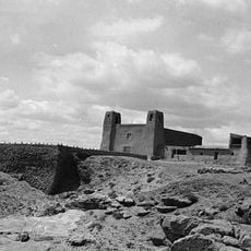
Lost Adams Diggings, Gold canyon legend in Catron County, United States

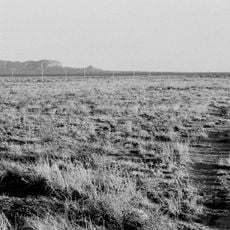
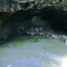
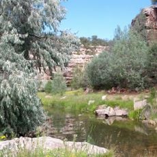
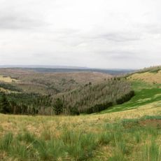
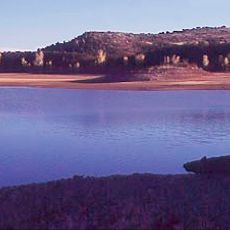
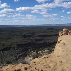
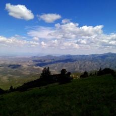
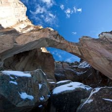
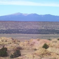
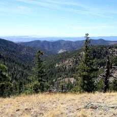
Lost Adams Diggings lies between two sugar-loaf-shaped mountain peaks near Catron County in New Mexico. Narrow passageways lead into a secluded canyon where gold deposits were reportedly discovered.

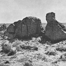
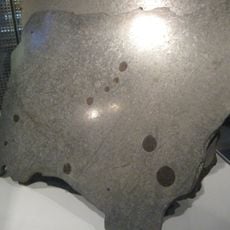
In 1864, John Brewer led a group of miners with Adams and a Pima-Mexican guide to a location where gold nuggets were found in an ancient Indian grinding basin. This discovery sparked decades of efforts to relocate the exact site.

Treasure hunters and adventurers visit the area guided by Adams' written accounts of the location. This story has become woven into Western folklore and continues to draw people seeking to solve the mystery.

The approximate coordinates are 34°28'10"N and 108°17'5"W, helping visitors locate the general area. It is important to be prepared for a lengthy search since the exact canyon is difficult to locate and careful planning is required.

In the 1990s, researcher Ron Jensen discovered military records confirming Dr. Sturgeon's existence, the person who received Adams' original gold map. These archival findings provided the first documentary evidence that Adams' story was based on real events.

The community of curious travelers

AroundUs brings together thousands of curated places, local tips, and hidden gems, enriched daily by 60,000 contributors worldwide.

Start exploring
Location
GPS coordinates
34.46944,-108.28472
Latest update
December 7, 2025 20:45
Around this place
Karl G. Jansky Very Large Array
United States of America

Karl G. Jansky Very Large Array

75.2 km
The Lightning Field
United States of America

The Lightning Field

17.2 km
Very Long Baseline Array
United States of America

Very Long Baseline Array

75.2 km
Hawikuh Ruins
United States of America

Hawikuh Ruins

82.3 km
Round Valley Ensphere
United States of America

Round Valley Ensphere

99.9 km
Bandera Volcano Ice Cave
United States of America

Bandera Volcano Ice Cave

61 km
Bluewater Lake State Park
United States of America

Bluewater Lake State Park

93.2 km
Escudilla Mountain
United States of America

Escudilla Mountain

96.2 km
United States of America

Enchanted Mesa

83.8 km
Lyman Reservoir
United States of America

Lyman Reservoir

100 km
Casa Malpaís
United States of America

Casa Malpaís

99.9 km
El Malpais National Conservation Area
United States of America

El Malpais National Conservation Area

49.6 km
San Estevan Del Rey Mission Church
United States of America

San Estevan Del Rey Mission Church

80 km
United States of America

Dowa Yalanne

79.8 km
Withington Wilderness
United States of America

Withington Wilderness

99.3 km
Cebolla Wilderness
United States of America

Cebolla Wilderness

45.7 km
Acoma Curio Shop
United States of America

Acoma Curio Shop

92.9 km
Datil-Mogollon Section
United States of America

Datil-Mogollon Section

97.3 km
Grant meteorite
United States of America

Grant meteorite

86.3 km
Bowlin's Old Crater Trading Post
United States of America

Bowlin's Old Crater Trading Post

94.7 km
Eagar Townsite Historic District
United States of America

Eagar Townsite Historic District

101 km
Eagar School
United States of America

Eagar School

101 km
Grants-Milan Flight Service Station
United States of America

Grants-Milan Flight Service Station

85.3 km
Charley's Automotive Service
United States of America

Charley's Automotive Service

85.5 km
Gallo Mountains
United States of America

Gallo Mountains

52.9 km
Sky City Cultural Center and Haak'u Museum

Sky City Cultural Center and Haak'u Museum

80 km
Shiva:Shiwana
United States of America

Shiva:Shiwana

75.2 km
Bracewell Radio Sundial
United States of America

Bracewell Radio Sundial

75.1 km
Show the full map
Reviews
Share your experience

No review yet

Discussions
Start a discussion...

No discussion yet

« Lost Adams Diggings - Gold canyon legend in Catron County, United States » is provided by Around Us (aroundus.com). Images and texts are derived from Wikimedia project under a Creative Commons license. You are allowed to copy, distribute, and modify copies of this page, under the conditions set by the license, as long as this note is clearly visible.

Discover hidden gems everywhere you go!

From secret cafés to breathtaking viewpoints, skip the crowded tourist spots and find places that match your style. Our app makes it easy with voice search, smart filtering, route optimization, and insider tips from travelers worldwide. Download now for the complete mobile experience.

Around Us App Screenshot

A unique approach to discovering new places

Le Figaro

All the places worth exploring

France Info

A tailor-made excursion in just a few clicks

20 Minutes

Around Us
Travel Guide & Maps
Download

Send to your phone

QR Code
1

Open the camera app on your mobile.

2

Point at the QR code with your camera. A notification will appear.

3

Tap the notification to open the link.