McKay Creek National Wildlife Refuge

Log in to your account

AroundUs is a community-driven map of interesting places, built by curious explorers like you. It grows with every review, story, and photo you share.
Connect to save your favorite spots, contribute locations, and create personalized routes.
By continuing, you accept our Terms and Conditions and our Privacy Policy

McKay Creek National Wildlife Refuge

Add to collection
Map
Suggest a change
Share

McKay Creek National Wildlife Refuge, National wildlife refuge in Umatilla County, Oregon.

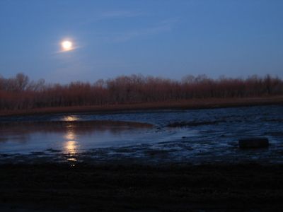
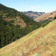
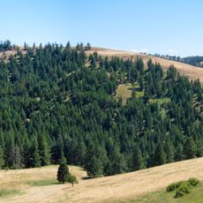
McKay Creek National Wildlife Refuge is a protected area in eastern Oregon that encompasses a reservoir and upland grasslands with diverse habitats for wildlife. The property extends between the Blue Mountains and open plains, supporting waterfowl, raptors, and other species throughout the year.

The refuge was established in 1927 to protect bird populations that had declined due to habitat loss and human activity. Its creation was part of a broader effort to restore wildlife habitats across the nation during that era.

This refuge serves as a gathering place for people who enjoy watching birds of prey, ducks, and other waterfowl in their natural setting. Visitors come regularly to photograph wildlife and observe the seasonal patterns of migration and breeding activity throughout the year.

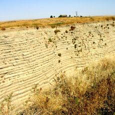
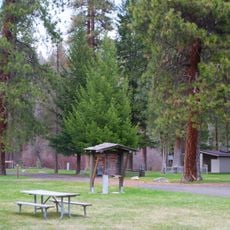
The refuge features trails and open areas that can be explored on foot or by vehicle, with accessibility varying by season. Visitors should be prepared for changing water levels and weather conditions that affect the best times for observation and outdoor activity.

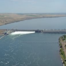
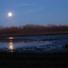
The reservoir doubles as an irrigation facility for the Umatilla River Basin and is managed by the Bureau of Reclamation. This dual function shows how wildlife protection can work alongside practical water resource management for agriculture.

Location: Umatilla County

Website: https://fws.gov/refuge/mcKay_creek

GPS coordinates: 45.60540,-118.79500

Latest update: December 13, 2025 11:47

Photos
Around this place
McNary Dam
United States of America

McNary Dam

53.6 km
Wallula Gap
United States of America

Wallula Gap

50.3 km
Fort Nez Percés
United States of America

Fort Nez Percés

54 km
Touchet Formation
United States of America

Touchet Formation

48.4 km
Emigrant Springs State Heritage Area
United States of America

Emigrant Springs State Heritage Area

26.8 km
Hat Rock State Park
United States of America

Hat Rock State Park

44.9 km
Lake Wallula
United States of America

Lake Wallula

53.7 km
North Fork Umatilla Wilderness
United States of America

North Fork Umatilla Wilderness

51.8 km
Tamástslikt Cultural Institute
United States of America

Tamástslikt Cultural Institute

11.6 km
McKay Reservoir
United States of America

McKay Reservoir

258 m
Cold Springs National Wildlife Refuge
United States of America

Cold Springs National Wildlife Refuge

39.8 km
Hilgard Junction State Recreation Area
United States of America

Hilgard Junction State Recreation Area

52.4 km
Red Bridge State Wayside
United States of America

Red Bridge State Wayside

50.4 km
Battle Mountain Forest State Scenic Corridor
United States of America

Battle Mountain Forest State Scenic Corridor

40.3 km
Pendleton Round-Up and Happy Canyon Hall of Fame
United States of America

Pendleton Round-Up and Happy Canyon Hall of Fame

7.1 km
Pendleton Center for the Arts
United States of America

Pendleton Center for the Arts

7.7 km
St. Peter's Roman Catholic Church
United States of America

St. Peter's Roman Catholic Church

34.9 km
John F. Kilkenny United States Post Office and Courthouse
United States of America

John F. Kilkenny United States Post Office and Courthouse

7.3 km
RiverBend Alternative Education School
United States of America

RiverBend Alternative Education School

52.5 km
Greasewood Finnish Apostolic Lutheran Church
United States of America

Greasewood Finnish Apostolic Lutheran Church

21.5 km
Echo Methodist Church
United States of America

Echo Methodist Church

34.7 km
James H. and Cynthia Koontz House
United States of America

James H. and Cynthia Koontz House

34.8 km
Bank of Echo Building
United States of America

Bank of Echo Building

34.6 km
Echo City Hall
United States of America

Echo City Hall

34.6 km
Pendleton Underground Tours Gift Shop
United States of America

Pendleton Underground Tours Gift Shop

7.3 km
Athena City Park
United States of America

Athena City Park

32.8 km
Centre Theatre
United States of America

Centre Theatre

7.3 km
Athena Public Library
United States of America

Athena Public Library

33.1 km
Show the full map
Reviews

Visited this place? Tap the stars to rate it and share your experience / photos with the community! Try now! You can cancel it anytime.

« McKay Creek National Wildlife Refuge - National wildlife refuge in Umatilla County, Oregon » is provided by Around Us (aroundus.com). Images and texts are derived from Wikimedia project under a Creative Commons license. You are allowed to copy, distribute, and modify copies of this page, under the conditions set by the license, as long as this note is clearly visible.

Discover hidden gems everywhere you go!

From secret cafés to breathtaking viewpoints, skip the crowded tourist spots and find places that match your style. Our app makes it easy with voice search, smart filtering, route optimization, and insider tips from travelers worldwide. Download now for the complete mobile experience.

Around Us App Screenshot

A unique approach to discovering new places

Le Figaro

All the places worth exploring

France Info

A tailor-made excursion in just a few clicks

20 Minutes