Enable Location

We need your location to show you interesting places around you

Discover nearby places

Find interesting locations and hidden gems around you

Precise directions

Get accurate directions and distances to places

Your location is never shared with other users. It's only used when you tap the location button.

McKay Reservoir

Log in to your account

Start exploring — it's free

Trusted by 62,304 travelers worldwide

Continue with Google
Continue with Apple
or

We will send you a code to connect

By continuing, you accept our Terms and Conditions and our Privacy Policy

Check your inbox

We've sent a pincode in your inbox. Please enter the code below.

McKay Reservoir

McKay Reservoir, body of water

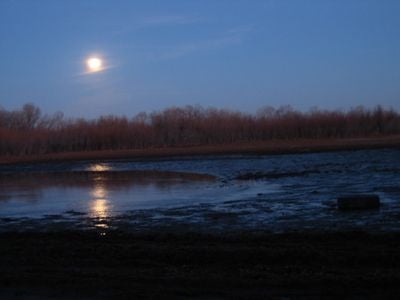
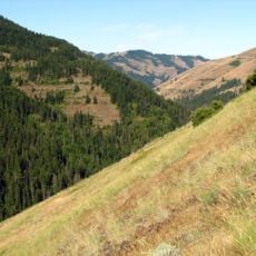
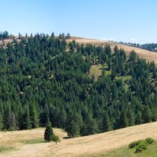
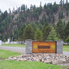
McKay Reservoir is a water storage area in eastern Oregon, located south of Pendleton near Highway 395. The dam creates a body of water covering about 1,200 acres with shallow marshes and open water, containing rainbow trout, crappie, bass, sunfish, and yellow perch.

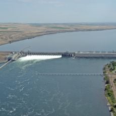
The reservoir was created as part of the Umatilla Project to store water for irrigation of farms in the region. Managed by the Bureau of Reclamation, it reflects the importance of water control for agriculture in Oregon's dry eastern landscape.

The name McKay Reservoir reflects its connection to water management in eastern Oregon and its importance for local farming communities. Today, the shallow wetlands and open waters draw people who seek a quiet connection with nature through fishing and bird watching.

The reservoir is open for fishing from March through September, with boat ramps on the north and south ends. Water levels drop significantly in summer months, revealing new shoreline areas and sometimes requiring short walks through vegetation to reach the water.

Ospreys and bald eagles hunt over the water while seasonal drops expose hidden mud flats and reveal fresh fishing spots. This visible transformation makes each visit feel different depending on when you arrive.

The community of curious travelers

AroundUs brings together thousands of curated places, local tips, and hidden gems, enriched daily by 60,000 contributors worldwide.

Start exploring
Location
GPS coordinates
45.60541,-118.79832
Latest update
February 9, 2026 08:22
Around this place
McNary Dam
United States of America

McNary Dam

53.4 km
Wallula Gap
United States of America

Wallula Gap

50.2 km
Fort Nez Percés
United States of America

Fort Nez Percés

54 km
Touchet Formation
United States of America

Touchet Formation

48.4 km
Emigrant Springs State Heritage Area
United States of America

Emigrant Springs State Heritage Area

27.1 km
Hat Rock State Park
United States of America

Hat Rock State Park

44.7 km
Lake Wallula
United States of America

Lake Wallula

53.5 km
North Fork Umatilla Wilderness
United States of America

North Fork Umatilla Wilderness

52 km
Tamástslikt Cultural Institute
United States of America

Tamástslikt Cultural Institute

11.8 km
Cold Springs National Wildlife Refuge
United States of America

Cold Springs National Wildlife Refuge

39.6 km
McKay Creek National Wildlife Refuge
United States of America

McKay Creek National Wildlife Refuge

258 m
Hilgard Junction State Recreation Area
United States of America

Hilgard Junction State Recreation Area

52.6 km
Red Bridge State Wayside
United States of America

Red Bridge State Wayside

50.5 km
Battle Mountain Forest State Scenic Corridor
United States of America

Battle Mountain Forest State Scenic Corridor

40.2 km
Pendleton Round-Up and Happy Canyon Hall of Fame
United States of America

Pendleton Round-Up and Happy Canyon Hall of Fame

7.1 km
Pendleton Center for the Arts
United States of America

Pendleton Center for the Arts

7.7 km
St. Peter's Roman Catholic Church
United States of America

St. Peter's Roman Catholic Church

34.7 km
John F. Kilkenny United States Post Office and Courthouse
United States of America

John F. Kilkenny United States Post Office and Courthouse

7.4 km
RiverBend Alternative Education School
United States of America

RiverBend Alternative Education School

52.7 km
Greasewood Finnish Apostolic Lutheran Church
United States of America

Greasewood Finnish Apostolic Lutheran Church

21.7 km
Echo Methodist Church
United States of America

Echo Methodist Church

34.4 km
James H. and Cynthia Koontz House
United States of America

James H. and Cynthia Koontz House

34.6 km
Bank of Echo Building
United States of America

Bank of Echo Building

34.4 km
Echo City Hall
United States of America

Echo City Hall

34.4 km
Pendleton Underground Tours Gift Shop
United States of America

Pendleton Underground Tours Gift Shop

7.3 km
Athena City Park
United States of America

Athena City Park

33 km
Centre Theatre
United States of America

Centre Theatre

7.4 km
Athena Public Library
United States of America

Athena Public Library

33.3 km
Show the full map
« McKay Reservoir - body of water » is provided by Around Us (aroundus.com). Images and texts are derived from Wikimedia project under a Creative Commons license. You are allowed to copy, distribute, and modify copies of this page, under the conditions set by the license, as long as this note is clearly visible.

Discover hidden gems everywhere you go!

From secret cafés to breathtaking viewpoints, skip the crowded tourist spots and find places that match your style. Our app makes it easy with voice search, smart filtering, route optimization, and insider tips from travelers worldwide. Download now for the complete mobile experience.

Around Us App Screenshot

A unique approach to discovering new places

Le Figaro

All the places worth exploring

France Info

A tailor-made excursion in just a few clicks

20 Minutes

Around Us
Travel Guide & Maps
Download

Send to your phone

QR Code
1

Open the camera app on your mobile.

2

Point at the QR code with your camera. A notification will appear.

3

Tap the notification to open the link.