Drumheller Channels National Natural Landmark, Natural geological formation in Othello, Washington, United States.
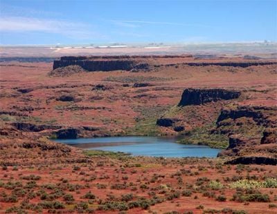
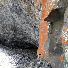
Drumheller Channels National Natural Landmark is a geological formation on the Columbia Plateau in Washington State, made up of steep-sided hills and dry stream channels cut through basalt rock. The channels run across a wide stretch of volcanic terrain, showing the full scale of erosion left behind by ancient water flows.
Toward the end of the last ice age, massive floods from Glacial Lake Missoula broke across the Columbia Plateau and cut these deep channels through the basalt. These floods happened repeatedly over thousands of years, leaving behind the layered, carved terrain visible today.
The name comes from a local farming family who hosted researcher J Harlen Bretz and his students in 1922. This connection to early scientific work is still part of how the place is known and talked about in the region.
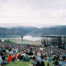
The area can be explored on foot along hiking trails, including a path that leads from wetland areas up to elevated viewpoints with open views over the channels. Spring and fall tend to offer the most comfortable conditions for a visit, as summer heat can be intense in this exposed terrain.
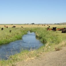
The landmark overlaps with Columbia National Wildlife Refuge, which shelters over 200 species of mammals and birds across eight different habitat types. This means that visitors walking through a landscape of bare rock and dry channels can also spot herons, beavers, and raptors within the same area.
The community of curious travelers
AroundUs brings together thousands of curated places, local tips, and hidden gems, enriched daily by 60,000 contributors worldwide.