Enable Location

We need your location to show you interesting places around you

Discover nearby places

Find interesting locations and hidden gems around you

Precise directions

Get accurate directions and distances to places

Your location is never shared with other users. It's only used when you tap the location button.

Potholes State Park

Log in to your account

Start exploring — it's free

Trusted by 62,870 travelers worldwide

Continue with Google
Continue with Apple
or

We will send you a code to connect

By continuing, you accept our Terms and Conditions and our Privacy Policy

Check your inbox

We've sent a pincode in your inbox. Please enter the code below.

Potholes State Park, State park with reservoir in Grant County, United States

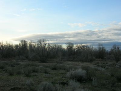
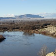
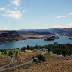
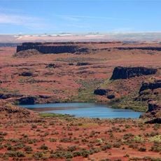
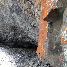
Potholes State Park is a protected landscape surrounding a reservoir in the high desert east of the Cascade Range. The park spans roughly 640 acres and combines open water, marsh vegetation, and semi-arid terrain along an extended shoreline.

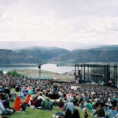
The reservoir was created in 1949 when the O'Sullivan Dam was built to store water for irrigation and hydroelectric power. The park was established afterward to provide public access and recreational opportunities around this water resource.

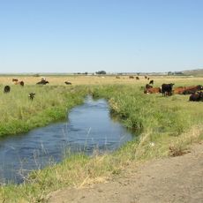
The park serves as a gathering place for anglers and boaters who value time on the water and in nature. These recreational traditions have shaped how people use this landscape throughout the year.

The park is open from sunrise to sunset and can be explored from the shoreline or by boat. A Discover Pass is required for parking and access to facilities.

Water levels in the reservoir fluctuate significantly between spring and fall, revealing different landscapes depending on the season. These changes affect which wildlife species are present and visible throughout the year.

The community of curious travelers

AroundUs brings together thousands of curated places, local tips, and hidden gems, enriched daily by 60,000 contributors worldwide.

Start exploring
Location
Operator
Washington State Parks and Recreation Commission
GPS coordinates
46.97944,-119.35083
Latest update
December 9, 2025 18:42
Around this place
The Gorge Amphitheatre
United States of America

The Gorge Amphitheatre

50.7 km
B Reactor
United States of America

B Reactor

45 km
Ginkgo Petrified Forest State Park
United States of America

Ginkgo Petrified Forest State Park

49.7 km
Moses Lake
United States of America

Moses Lake

17.5 km
Iron Horse State Park
United States of America

Iron Horse State Park

64.7 km
Rattlesnake Mountain
United States of America

Rattlesnake Mountain

66.8 km
Grandfather Cuts Loose the Ponies
United States of America

Grandfather Cuts Loose the Ponies

46.4 km
Sun Lakes-Dry Falls State Park
United States of America

Sun Lakes-Dry Falls State Park

68.7 km
Wanapum Dam
United States of America

Wanapum Dam

48.6 km
Potholes Reservoir
United States of America

Potholes Reservoir

4.5 km
Priest Rapids Dam
United States of America

Priest Rapids Dam

56.7 km
Wild Horse Wind and Solar Facility
United States of America

Wild Horse Wind and Solar Facility

65.8 km
Drumheller Channels National Natural Landmark
United States of America

Drumheller Channels National Natural Landmark

11.8 km
Crab Creek
United States of America

Crab Creek

62.1 km
Abraham Lincoln
United States of America

Abraham Lincoln

27.8 km
Vantage Bridge
United States of America

Vantage Bridge

47 km
Columbia National Wildlife Refuge
United States of America

Columbia National Wildlife Refuge

20.1 km
Lake Lenore Caves State Park
United States of America

Lake Lenore Caves State Park

55.7 km
Beverly Railroad Bridge
United States of America

Beverly Railroad Bridge

48.3 km
Priest Rapids
United States of America

Priest Rapids

53.5 km
Vernita Bridge
United States of America

Vernita Bridge

47.5 km
Wanapum Lake
United States of America

Wanapum Lake

48.7 km
Canada

Sentinel Gap

48.4 km
Surf 'n Slide Water Park
United States of America

Surf 'n Slide Water Park

17.2 km
Grant County Courthouse
United States of America

Grant County Courthouse

41.1 km
Grant County Fairgrounds
United States of America

Grant County Fairgrounds

18.4 km
Seivers Brothers Ranchhouse and Barn
United States of America

Seivers Brothers Ranchhouse and Barn

64.5 km
Moses Lake Museum & Art Center
United States of America

Moses Lake Museum & Art Center

17.8 km
Show the full map
« Potholes State Park - State park with reservoir in Grant County, United States » is provided by Around Us (aroundus.com). Images and texts are derived from Wikimedia project under a Creative Commons license. You are allowed to copy, distribute, and modify copies of this page, under the conditions set by the license, as long as this note is clearly visible.

Discover hidden gems everywhere you go!

From secret cafés to breathtaking viewpoints, skip the crowded tourist spots and find places that match your style. Our app makes it easy with voice search, smart filtering, route optimization, and insider tips from travelers worldwide. Download now for the complete mobile experience.

Around Us App Screenshot

A unique approach to discovering new places

Le Figaro

All the places worth exploring

France Info

A tailor-made excursion in just a few clicks

20 Minutes

Around Us
Travel Guide & Maps
Download

Send to your phone

QR Code
1

Open the camera app on your mobile.

2

Point at the QR code with your camera. A notification will appear.

3

Tap the notification to open the link.