
Cachoeira Tanga, Wasserfall in Brasilien
Location: Roraima
Elevation above the sea: 89 m
GPS coordinates: 1.33333,-62.45000
Latest update: June 12, 2025 09:00

Pico da Neblina
400.5 km
Pedra Pintada
331.9 km
Pico da Neblina National Park
405 km
Pico 31 de Março
400.2 km
Jaú National Park
390.5 km
Serranía La Neblina National Park
401.7 km
Jaua-Sarisariñama National Park
421.5 km
Parima-Tapirapecó National Park
335.1 km
Jasper Creek
425.8 km
Serra do Tepequém
283.5 km
Fuerte de São Joaquim do Rio Branco
289.5 km
Duida-Marahuaca National Park
419.5 km
Cachoeira do El Dorado
111.4 km
Cerro Duida
426.1 km
Central Amazon Conservation Complex
411.1 km
Pitinga mine
349.5 km
Serra da Mocidade National Park
68 km
Uatumã Biological Reserve
436.2 km
Serra do Aracá State Park
105.7 km
Viruá National Park
146.9 km
St. Helen's Cathedral
393.1 km
Yuruaní Falls
444.6 km
Reserva Extrativista do Rio Unini
348.8 km
União Operária Beneficente
258.3 km
Cerros Vinilla y Aratitiyope Natural Monument
352.8 km
Sierra Unturan Natural Monument
334.9 km
Sierra Marutani Natural Monument
272.9 km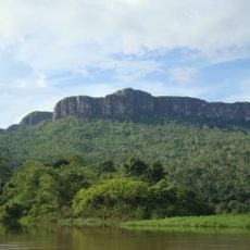
Cerros Tapirapecó y Tamacuari Natural Monument
257.5 kmVisited this place? Tap the stars to rate it and share your experience / photos with the community! Try now! You can cancel it anytime.
Discover hidden gems everywhere you go!
From secret cafés to breathtaking viewpoints, skip the crowded tourist spots and find places that match your style. Our app makes it easy with voice search, smart filtering, route optimization, and insider tips from travelers worldwide. Download now for the complete mobile experience.

A unique approach to discovering new places❞
— Le Figaro
All the places worth exploring❞
— France Info
A tailor-made excursion in just a few clicks❞
— 20 Minutes