Daman and Diu, Former administrative territory in Western India
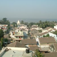
Daman and Diu were two separate coastal areas along the Arabian Sea that operated together as one administrative unit. Daman sits between Maharashtra and Gujarat, while Diu comprises an island and a small mainland strip south of the Kathiawar peninsula.
The Portuguese established trading posts in the 1530s and administered both areas until Indian annexation in December 1961. After independence, they remained a joint union territory until 2020, when they merged with Dadra and Nagar Haveli.
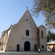
Catholic churches and colonial fortifications stand alongside Hindu temples, showing the area's mixed heritage. Fishing villages along the coast preserve techniques and customs passed down for centuries and still visible today.
The two parts lie roughly 650 kilometers apart, so travelers must plan longer journeys through Gujarat between them. The status changed in 2020, so administrative details now fall under the new combined unit.
Diu was the smallest union territory in India by area until 2020 and had one of the lowest population densities in the country. The island has a small airport shared with the Indian Navy that offers direct connections to major cities.
The community of curious travelers
AroundUs brings together thousands of curated places, local tips, and hidden gems, enriched daily by 92,353 contributors worldwide.