Enable Location

We need your location to show you interesting places around you

Discover nearby places

Find interesting locations and hidden gems around you

Precise directions

Get accurate directions and distances to places

Your location is never shared with other users. It's only used when you tap the location button.

Tapi district

Log in to your account

Start exploring — it's free

Trusted by 61,830 travelers worldwide

Continue with Google
Continue with Apple
or

We will send you a code to connect

By continuing, you accept our Terms and Conditions and our Privacy Policy

Check your inbox

We've sent a pincode in your inbox. Please enter the code below.

Tapi district

Tapi district, Administrative district in Gujarat, India

Description

Tapi district is an administrative region in Gujarat that consists of seven administrative subdivisions, including Vyara, Songadh, and Valod Taluka, spread across about 3,139 square kilometers. The area is home to ten colleges, four schools, and eight banks that serve a population of around 807,000 people.

History

The district was established in 2007 as an independent administrative division, marking a significant reorganization of Gujarat's territorial structure. Vyara was designated as the administrative center of the newly created district.

Culture

The people live in around 149 villages where community gatherings and local decision-making shape daily life. These scattered settlements preserve regional customs and maintain close-knit social bonds across the area.

Practical

The region is well-equipped with basic services and offers several options for getting help from different locations. Emergency services are accessible through established networks, and banks and educational institutions are distributed across the main settlements throughout the area.

Did you know?

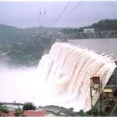
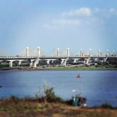
The Ukai Dam sits within the district and is one of the most important water management structures in the region. This facility controls water resources for irrigation and supply across the surrounding communities.

Location
Inception
2007
Capital city
Vyara
Shares border with
Narmada district, Dang district, Surat district, Navsari district
GPS coordinates
21.12000,73.40000
Latest update
December 7, 2025 19:28

AroundUs brings together thousands of curated places, local tips, and hidden gems, enriched daily by 60,000 contributors worldwide. Discover all places nearby (Gujarat).

« Tapi district - Administrative district in Gujarat, India » is provided by Around Us (aroundus.com). Images and texts are derived from Wikimedia project under a Creative Commons license. You are allowed to copy, distribute, and modify copies of this page, under the conditions set by the license, as long as this note is clearly visible.

Discover hidden gems everywhere you go!

From secret cafés to breathtaking viewpoints, skip the crowded tourist spots and find places that match your style. Our app makes it easy with voice search, smart filtering, route optimization, and insider tips from travelers worldwide. Download now for the complete mobile experience.

Around Us App Screenshot

A unique approach to discovering new places

Le Figaro

All the places worth exploring

France Info

A tailor-made excursion in just a few clicks

20 Minutes

Around Us
Travel Guide & Maps
Download

Send to your phone

QR Code
1

Open the camera app on your mobile.

2

Point at the QR code with your camera. A notification will appear.

3

Tap the notification to open the link.