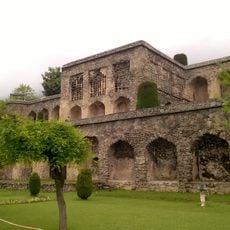
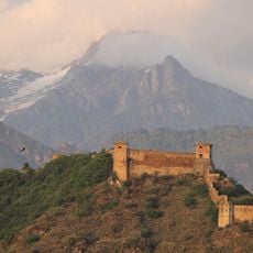
Harmukh Mountain, Sacred mountain summit in Ganderbal district, India
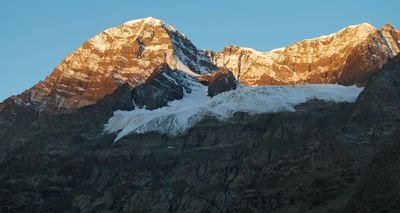
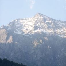
Harmukh Mountain is a summit in Ganderbal district that rises to 5,142 meters between the Sind and Kishanganga rivers. The peak displays a striking pyramid-like shape with steep slopes and a prominent eastern rock face.
The mountain was first climbed in 1899 when Dr. Ernest Neve and Geoffrey Millais reached the highest eastern peak after multiple attempts. This expedition marked an important moment in Western mountaineers' exploration of the Himalaya.
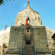
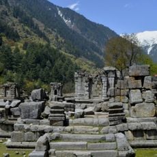
The mountain holds deep religious meaning for Hindus, who revere it as Haramukuta, meaning Shiva's crown. Pilgrims visit regularly to pray and connect with this sacred place in their spiritual practice.
The northwestern route from Arin Bandipore starts with a drive from Srinagar before reaching the mountain base. Visitors should prepare for varying elevations and weather conditions during their journey to this high-altitude location.
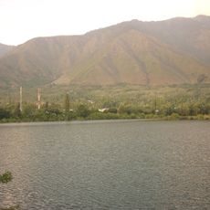
The mountain feeds Gangabal Lake at its northeastern foot with meltwater that flows through Nallah Sindh for regional irrigation. Few visitors notice the role this peak plays in the region's water supply.
Location: Ganderbal district
Elevation above the sea: 5,142 m
GPS coordinates: 34.40000,74.90833
Latest update: December 8, 2025 13:40
Shalimar Bagh
28 km
Dachigam National Park
30.7 km
Shankaracharya Temple, Srinagar
36.2 km
Nishat Bagh
30.7 km
Burzahom archaeological site
26 km
Hazratbal Shrine
30.8 km
Indira Gandhi Memorial Tulip Garden
33.9 km
Jamia Masjid
34.8 km
Kheer Bhawani
25.8 km
Pari Mahal
35.3 km
Salim Ali National Park
36.8 km
Chashme Shahi
35 km
Khanqah-e-Moula
35.6 km
Naseem Bagh
29.9 km
Pathar Masjid
35.6 km
Ziyarat Naqshband Sahab
34.9 km
Wangath Temple complex, Naranag
8.2 km
Zero Bridge
37.5 km
Jawaharlal Nehru Memorial Botanical Garden
34.3 km
Zeashta Devi Shrine
36 km
Aali Mosque
34.5 km
Holy Family Catholic Church
37.2 km
Shankaracharya hill
36.2 km
All Saints Church, Srinagar
37.1 km
Akhund Mulla Shah's Mosque
34 km
Hari Parbat Fort
33.8 km
Ancient Stupa, Chaitya and Monastery at Parihaspora
35.6 km
Thajiwas glacier
36.7 kmVisited this place? Tap the stars to rate it and share your experience / photos with the community! Try now! You can cancel it anytime.
Discover hidden gems everywhere you go!
From secret cafés to breathtaking viewpoints, skip the crowded tourist spots and find places that match your style. Our app makes it easy with voice search, smart filtering, route optimization, and insider tips from travelers worldwide. Download now for the complete mobile experience.
A unique approach to discovering new places❞
— Le Figaro
All the places worth exploring❞
— France Info
A tailor-made excursion in just a few clicks❞
— 20 Minutes