Log in to your account

AroundUs is a community-driven map of interesting places, built by curious explorers like you. It grows with every review, story, and photo you share.
Connect to save your favorite spots, contribute locations, and create personalized routes.
Continue with Google
Continue with Apple
Continue with X
Continue with Facebook
Continue with email
By continuing, you accept our Terms and Conditions and our Privacy Policy
Create an account

Medikonduru mandal

Add to collection
Map
Suggest a change
Share

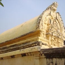
Medikonduru mandal, Administrative division in Guntur district, India.

Medikonduru is an administrative region in Guntur district in southeastern Andhra Pradesh made up of several villages. The area spans across gently undulating terrain at an elevation of around 75 meters (245 feet).

This area was established as an administrative unit when Andhra Pradesh was formed and has maintained its structure since then. The 13 villages within it, including Dokiparru and Korrapadu, have kept their basic administrative arrangements unchanged.

Telugu is the main language spoken here, and people organize community affairs through village councils that handle local matters. These traditional systems shape how daily life and governance function in the settlements.

The administrative center sits about 20 kilometers from Guntur city and handles local government work. You should know this is a working rural area, so some roads can be difficult to travel during the rainy season.

The area has a relatively balanced gender ratio with around 976 females for every 1000 males, which is notable for a rural region. This demographic makeup differs from many other administrative areas in India.

Location: Guntur district

Capital city: Medikonduru

Elevation above the sea: 75 m

GPS coordinates: 16.34600,80.29700

Latest update: December 13, 2025 12:22

Photos
Reviews

Visited this place? Tap the stars to rate it and share your experience / photos with the community! Try now! You can cancel it anytime.

« Medikonduru mandal - Administrative division in Guntur district, India » is provided by Around Us (aroundus.com). Images and texts are derived from Wikimedia project under a Creative Commons license. You are allowed to copy, distribute, and modify copies of this page, under the conditions set by the license, as long as this note is clearly visible.

Discover hidden gems everywhere you go!

From secret cafés to breathtaking viewpoints, skip the crowded tourist spots and find places that match your style. Our app makes it easy with voice search, smart filtering, route optimization, and insider tips from travelers worldwide. Download now for the complete mobile experience.

Around Us App Screenshot

A unique approach to discovering new places

Le Figaro

All the places worth exploring

France Info

A tailor-made excursion in just a few clicks

20 Minutes