Zham Chīna Sar, summit in Pakistan
Location: Federally Administered Tribal Areas
Elevation above the sea: 1,770 m
GPS coordinates: 32.85944,69.71944
Latest update: June 27, 2025 03:58
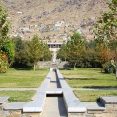
Gardens of Babur
190.2 km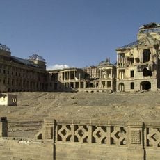
Darul Aman Palace
187.2 km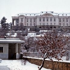
Tajbeg Palace
186.3 km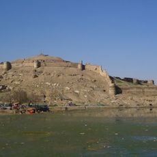
Bala Hissar
189.7 km
Ghazi Stadium
191 km
Forward Operating Base Chapman
57.7 km
National Museum of Afghanistan
187.4 km
Takht-e-Sulaiman
132.6 km
Forward Operating Base Fenty
186.1 km
Tapa Shotor
181.5 km
Gomal Zam Dam
86.1 km
Ghazni Minarets
143.2 km
Kafir Kot
156.4 km
Citadel of Ghazni
143.1 km
Kabul hoard
190.6 km
Kabul Zoo
190.9 km
Shah-Do Shamshira Mosque
191.2 km
Sikaram Sar
132.5 km
Id Gah Mosque
191 km
Palace of Sultan Mas'ud III
142.7 km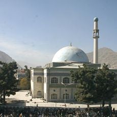
Pul-e Khishti Mosque
191 km
Camp Warehouse
191.1 km
Band E Sardeh Dam
112.3 km
Forward Operating Base Arian
141.5 km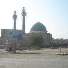
Abul Fazl Shrine
191.3 km
Bannu Cantonment
83.9 km
پارک آبی کابل
190.9 km
National Gallery of Afghanistan
191.4 kmReviews
Visited this place? Tap the stars to rate it and share your experience / photos with the community! Try now! You can cancel it anytime.
Discover hidden gems everywhere you go!
From secret cafés to breathtaking viewpoints, skip the crowded tourist spots and find places that match your style. Our app makes it easy with voice search, smart filtering, route optimization, and insider tips from travelers worldwide. Download now for the complete mobile experience.

A unique approach to discovering new places❞
— Le Figaro
All the places worth exploring❞
— France Info
A tailor-made excursion in just a few clicks❞
— 20 Minutes