Chest opened
+${chestReward.xp} XP
Explorer
NOUVEAU ×${chestReward.collectible.quantity}
tapez pour fermer
Chest locked

Open chests in the app

Around Us is built for your phone — chests unlock when you walk, explore and capture nearby places.

Enable Location

We need your location to show you interesting places around you

Discover nearby places

Find interesting locations and hidden gems around you

Precise directions

Get accurate directions and distances to places

Your location is never shared with other users. It's only used when you tap the location button.

Des Moines River

Log in to your account

Start exploring — it's free

Trusted by 72,880 travelers worldwide

Continue with Google
Continue with Apple
or

We will send you a code to connect

By continuing, you accept our Terms and Conditions and our Privacy Policy

Check your inbox

We've sent a pincode in your inbox. Please enter the code below.

Des Moines River
Discussion Reviews 2 Photos
26.7k Popularity

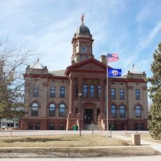
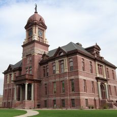
Des Moines River, Major tributary river system between Minnesota and Mississippi River, United States.

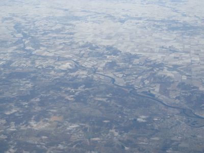
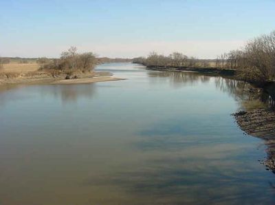
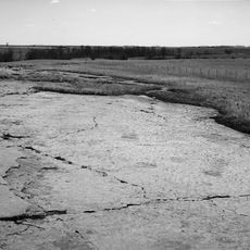
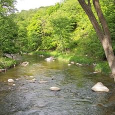
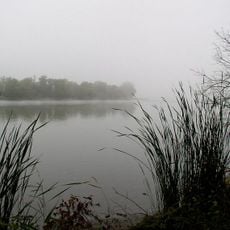
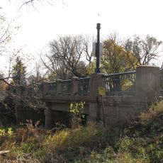
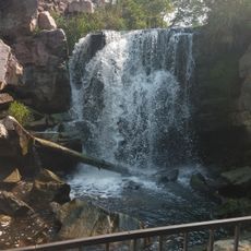
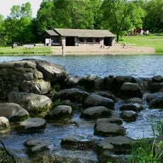
The Des Moines River is a major river system flowing from Minnesota through Iowa and emptying into the Mississippi River near Keokuk. The waterway ranges from 50 to 200 feet wide and supports paddling, fishing, and nature watching along its entire course.

Between the 1840s and 1890s, the waterway supported roughly 80 grain mills along its banks, making it the commercial heart of central Iowa. These mills processed crops from surrounding farms and turned the river into an essential industrial artery for the region.

The river takes its name from Moingona, a Native American village, filtered through French fur traders who worked the region centuries ago. Local communities today gather along its banks for fishing and watching wildlife, keeping the waterway part of their daily connection to the land.

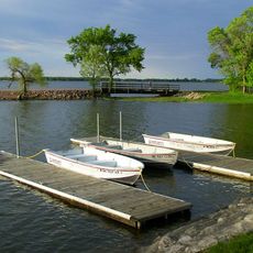
Multiple access points along the waterway allow visitors to launch boats or fish throughout the year. Spring and summer offer the most comfortable conditions, when water levels are stable and weather suits outdoor activities.

The waterway is controlled by two large reservoirs, Saylorsville Lake and Lake Red Rock, which manage flooding and regulate water levels across the entire basin. These impoundments serve a double purpose as both engineering solutions and recreational destinations for visitors.

The community of curious travelers

AroundUs brings together thousands of curated places, local tips, and hidden gems, enriched daily by 60,000 contributors worldwide.

Start exploring
Location
Location
Location
Location
Location
Location
Location
Location
Location
Location
Location
Location
Location
Location
Location
Location
Location
Location
Location
Location
Location
Location
Location
GPS coordinates
40.38120,-91.42240
Latest update
December 20, 2025 14:48
Around this place
Blue Mounds State Park
United States of America

Blue Mounds State Park

541.3 km
Calumet Hotel
United States of America

Calumet Hotel

570.2 km
Jeffers Petroglyphs
United States of America

Jeffers Petroglyphs

510 km
Lake Shetek State Park
United States of America

Lake Shetek State Park

543.4 km
Camden State Park
United States of America

Camden State Park

577.8 km
Danebod
United States of America

Danebod

580.8 km
Split Rock Creek State Park
United States of America

Split Rock Creek State Park

565.2 km
George D. Dayton House
United States of America

George D. Dayton House

499.2 km
Church of St. Kilian
United States of America

Church of St. Kilian

527.9 km
Pipestone Water Tower
United States of America

Pipestone Water Tower

569.9 km
Pipestone Indian School Superintendent's House
United States of America

Pipestone Indian School Superintendent's House

571.8 km
Hole in the Mountain Prairie
United States of America

Hole in the Mountain Prairie

586.9 km
Cottonwood County Courthouse
United States of America

Cottonwood County Courthouse

493.4 km
Old Masonic Temple
United States of America

Old Masonic Temple

577.5 km
Church of St. Adrian-Catholic
United States of America

Church of St. Adrian-Catholic

519.7 km
Pipestone County Courthouse
United States of America

Pipestone County Courthouse

569.9 km
Milroy State Bank Building
United States of America

Milroy State Bank Building

563.2 km
Bridge No. 5151-Marshall
United States of America

Bridge No. 5151-Marshall

577.6 km
St. Paul's Evangelical Lutheran Church & Parsonage
United States of America

St. Paul's Evangelical Lutheran Church & Parsonage

596.8 km
Laura Ingalls Wilder Museum
United States of America

Laura Ingalls Wilder Museum

542.2 km
Sacred Heart Catholic Church
United States of America

Sacred Heart Catholic Church

497.8 km
Bridge No. 5083-Marshall
United States of America

Bridge No. 5083-Marshall

577.4 km
Pipestone Public Library
United States of America

Pipestone Public Library

570 km
Blue Mounds State Park WPA/Rustic Style Historic Resources
United States of America

Blue Mounds State Park WPA/Rustic Style Historic Resources

541 km
Winnewissa Falls
United States of America

Winnewissa Falls

571.5 km
Avoca Historical Marker
United States of America

Avoca Historical Marker

527.9 km
Camden State Park CCC/WPA/Rustic Style Historic District
United States of America

Camden State Park CCC/WPA/Rustic Style Historic District

578 km
Lake Shetek State Park WPA/Rustic Style Group Camp
United States of America

Lake Shetek State Park WPA/Rustic Style Group Camp

544.1 km
Show the full map
Reviews
Share your experience

No review yet

Discussions
Start a discussion...

No discussion yet

« Des Moines River - Major tributary river system between Minnesota and Mississippi River, United States » is provided by Around Us (aroundus.com). Images and texts are derived from Wikimedia project under a Creative Commons license. You are allowed to copy, distribute, and modify copies of this page, under the conditions set by the license, as long as this note is clearly visible.

Discover hidden gems everywhere you go!

From secret cafés to breathtaking viewpoints, skip the crowded tourist spots and find places that match your style. Our app makes it easy with voice search, smart filtering, route optimization, and insider tips from travelers worldwide. Download now for the complete mobile experience.

Around Us App Screenshot

A unique approach to discovering new places

Le Figaro

All the places worth exploring

France Info

A tailor-made excursion in just a few clicks

20 Minutes

Around Us
Travel Guide & Maps
Download

Send to your phone

QR Code
1

Open the camera app on your mobile.

2

Point at the QR code with your camera. A notification will appear.

3

Tap the notification to open the link.