Enable Location

We need your location to show you interesting places around you

Discover nearby places

Find interesting locations and hidden gems around you

Precise directions

Get accurate directions and distances to places

Your location is never shared with other users. It's only used when you tap the location button.

Shawnee National Forest

Log in to your account

Start exploring — it's free

Trusted by 62,968 travelers worldwide

Continue with Google
Continue with Apple
or

We will send you a code to connect

By continuing, you accept our Terms and Conditions and our Privacy Policy

Check your inbox

We've sent a pincode in your inbox. Please enter the code below.

Discussion Reviews 2 Photos 1 Collections
35.7k Popularity

Shawnee National Forest, National forest in southern Illinois, United States.

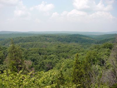
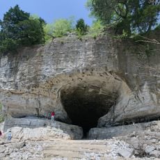
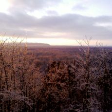
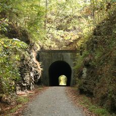
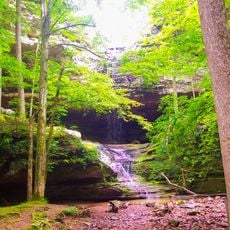
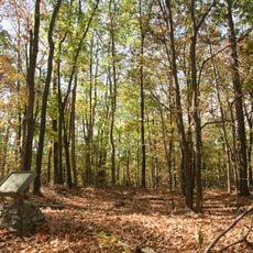
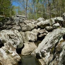
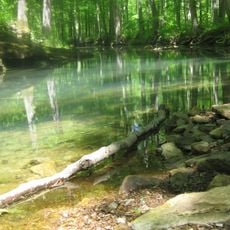
Shawnee National Forest is a large protected woodland spanning southern Illinois between the Ohio and Mississippi rivers. The landscape contains rolling hills, multiple lakes, streams, and dramatic rocky outcrops formed over millions of years.

The United States Forest Service established this forest preserve in 1939 as part of a nationwide effort to protect natural lands. This action helped safeguard ecosystems that had faced increasing pressure from development and resource extraction.

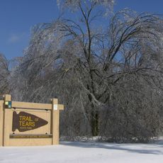
The name honors the Shawnee people who inhabited this region for generations. Walking through the forest, visitors can encounter sites and traces that reflect the long connection between the land and its indigenous residents.

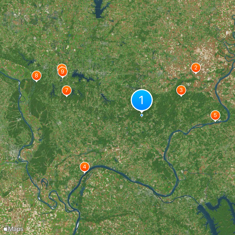
Visitor information and detailed trail maps are available at the forest administration office in Harrisburg. Before visiting, check local conditions and access guidelines as some areas may have seasonal closures or restrictions.

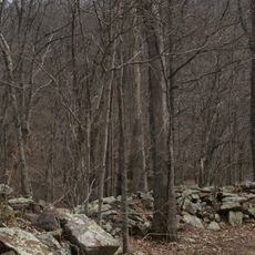
The forest contains seven officially protected wilderness zones where plants and animals develop without human management or intervention. These untouched areas reveal how landscapes naturally evolve when left completely undisturbed.

The community of curious travelers

AroundUs brings together thousands of curated places, local tips, and hidden gems, enriched daily by 60,000 contributors worldwide.

Start exploring
Location
Inception
1939
Operator
United States Forest Service
GPS coordinates
37.50000,-88.66670
Latest update
December 18, 2025 20:12
Historic and natural sites in Illinois

Illinois holds a rich collection of historical sites and natural landscapes. Visitors can explore prehistoric ruins like the Cahokia Mounds, where earthen structures reflect the achievements of ancient peoples. The region also features striking rock formations such as Garden of the Gods and natural...

Around this place
Crenshaw House
United States of America

Crenshaw House

41.8 km
Garden of the Gods Wilderness
United States of America

Garden of the Gods Wilderness

26.8 km
Olmsted Locks and Dam
United States of America

Olmsted Locks and Dam

49.7 km
Cave-in-Rock State Park
United States of America

Cave-in-Rock State Park

45.3 km
R. Buckminster Fuller and Anne Hewlett Dome Home
United States of America

R. Buckminster Fuller and Anne Hewlett Dome Home

55.1 km
Giant City State Park
United States of America

Giant City State Park

47.5 km
Little Grand Canyon
United States of America

Little Grand Canyon

67.8 km
Saluki Stadium
United States of America

Saluki Stadium

53.7 km
Tunnel Hill State Trail
United States of America

Tunnel Hill State Trail

38.5 km
Kinkaid Lake
United States of America

Kinkaid Lake

75.1 km
Tower Rock
United States of America

Tower Rock

76.2 km
United States of America

River to River Trail

21.7 km
Bald Knob Cross
United States of America

Bald Knob Cross

60.3 km
Bill Emerson Memorial Bridge
United States of America

Bill Emerson Memorial Bridge

78.5 km
United States of America

Crab Orchard Lake

46.1 km
Trail of Tears State Park
United States of America

Trail of Tears State Park

72.7 km
Ferne Clyffe State Park
United States of America

Ferne Clyffe State Park

28.1 km
Giant City Stone Fort Site
United States of America

Giant City Stone Fort Site

48.8 km
United States of America

Crab Orchard National Wildlife Refuge

41.2 km
United States of America

Devils Kitchen Lake

40.1 km
Cape Girardeau Bridge
United States of America

Cape Girardeau Bridge

78.5 km
Millstone Bluff
United States of America

Millstone Bluff

4 km
Dixon Springs State Park
United States of America

Dixon Springs State Park

13.1 km
Panther Den Wilderness
United States of America

Panther Den Wilderness

37.5 km
United States of America

Cypress Creek National Wildlife Refuge

34.5 km
Illinois Salines
United States of America

Illinois Salines

39.9 km
Williamson County Jail
United States of America

Williamson County Jail

34.5 km
United States of America

Burden Falls Wilderness

9.8 km
Show the full map
Reviews
Share your experience

No review yet

Discussions
Start a discussion...

No discussion yet

« Shawnee National Forest - National forest in southern Illinois, United States » is provided by Around Us (aroundus.com). Images and texts are derived from Wikimedia project under a Creative Commons license. You are allowed to copy, distribute, and modify copies of this page, under the conditions set by the license, as long as this note is clearly visible.

Discover hidden gems everywhere you go!

From secret cafés to breathtaking viewpoints, skip the crowded tourist spots and find places that match your style. Our app makes it easy with voice search, smart filtering, route optimization, and insider tips from travelers worldwide. Download now for the complete mobile experience.

Around Us App Screenshot

A unique approach to discovering new places

Le Figaro

All the places worth exploring

France Info

A tailor-made excursion in just a few clicks

20 Minutes

Around Us
Travel Guide & Maps
Download

Send to your phone

QR Code
1

Open the camera app on your mobile.

2

Point at the QR code with your camera. A notification will appear.

3

Tap the notification to open the link.