Chest opened
+${chestReward.xp} XP
Explorer
NOUVEAU ×${chestReward.collectible.quantity}
tapez pour fermer
Chest locked

Open chests in the app

Around Us is built for your phone — chests unlock when you walk, explore and capture nearby places.

Enable Location

We need your location to show you interesting places around you

Discover nearby places

Find interesting locations and hidden gems around you

Precise directions

Get accurate directions and distances to places

Your location is never shared with other users. It's only used when you tap the location button.

Log in to your account

Start exploring — it's free

Trusted by 72,981 travelers worldwide

Continue with Google
Continue with Apple
or

We will send you a code to connect

By continuing, you accept our Terms and Conditions and our Privacy Policy

Check your inbox

We've sent a pincode in your inbox. Please enter the code below.

Discussion Reviews Photo
32.2k Popularity

The Thumb, Peninsula region in Michigan, US.

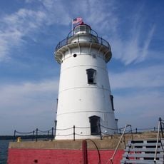
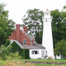
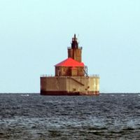
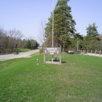
The Thumb is a peninsula in Michigan that stretches into Lake Huron and Saginaw Bay, encompassing five counties across the landscape. The region features productive farmland and an extended coastline with numerous small towns and natural areas.

A major fire swept through the region in 1881, destroying vast forest areas in a matter of hours. This event reshaped the land and influenced how the peninsula developed afterward.

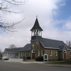
Farming shapes how people here see themselves, with fields filled with sugar beets, beans, and corn grown by local families. Fishing traditions remain woven into daily life along the Lake Huron and Saginaw Bay shores.

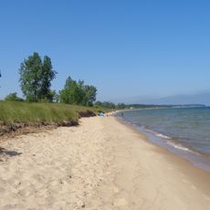
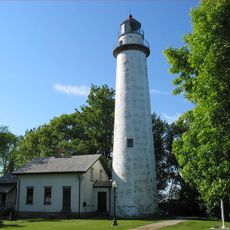
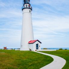
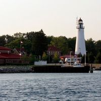
The M-25 highway runs along the shoreline and connects several coastal towns with access to state parks in the area. Visitors can explore the peninsula by road or by water, depending on their preference.

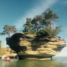
A continuous water trail runs along the Lake Huron coast, letting paddlers explore the peninsula from the water. This route connects different bays and offers a different perspective on the coastal landscape.

The community of curious travelers

AroundUs brings together thousands of curated places, local tips, and hidden gems, enriched daily by 60,000 contributors worldwide.

Start exploring
Location
GPS coordinates
43.62410,-83.03190
Latest update
December 22, 2025 16:37
Around this place
Turnip Rock
United States of America

Turnip Rock

49.8 km
United States of America

AutoWorld

85.8 km
Sanilac Petroglyphs Historic State Park
United States of America

Sanilac Petroglyphs Historic State Park

3.9 km
Port Crescent State Park
United States of America

Port Crescent State Park

42.4 km
Genesee Towers
United States of America

Genesee Towers

86.1 km
United States of America

Lakeport State Park

70.5 km
Sloan Museum
United States of America

Sloan Museum

85 km
Pointe aux Barques Light
United States of America

Pointe aux Barques Light

48.4 km
Fort Gratiot Light
United States of America

Fort Gratiot Light

84.7 km
United States of America

Crossroads Village

77.5 km
Applewood Estate
United States of America

Applewood Estate

84.6 km
Charity Island Light
United States of America

Charity Island Light

56.6 km
Capitol Theatre
United States of America

Capitol Theatre

86.2 km
Richard C. Burtis House
United States of America

Richard C. Burtis House

44.2 km
United States of America

Albert E. Sleeper State Park

41.3 km
Charles Stewart Mott Foundation Building
United States of America

Charles Stewart Mott Foundation Building

86.2 km
Grindstone City Historic District
United States of America

Grindstone City Historic District

49.1 km
Gravelly Shoal Light
United States of America

Gravelly Shoal Light

59.8 km
Flint Institute of Arts
United States of America

Flint Institute of Arts

85 km
Harbor Beach Light
United States of America

Harbor Beach Light

40.6 km
The Paterson Building
United States of America

The Paterson Building

86.2 km
Flint Public Library
United States of America

Flint Public Library

85.1 km
The Whiting
United States of America

The Whiting

84.8 km
Port Sanilac Light
United States of America

Port Sanilac Light

45.2 km
Durant-Dort Factory One
United States of America

Durant-Dort Factory One

86.3 km
Lapeer County Courthouse
United States of America

Lapeer County Courthouse

67.4 km
United States of America

Thumb Area Bottomland Preserve

49.1 km
St. Peter's Lutheran Church Kinde, Michigan
United States of America

St. Peter's Lutheran Church Kinde, Michigan

35.5 km
Show the full map
Reviews
Share your experience

No review yet

Discussions
Start a discussion...

No discussion yet

« The Thumb - Peninsula region in Michigan, US » is provided by Around Us (aroundus.com). Images and texts are derived from Wikimedia project under a Creative Commons license. You are allowed to copy, distribute, and modify copies of this page, under the conditions set by the license, as long as this note is clearly visible.

Discover hidden gems everywhere you go!

From secret cafés to breathtaking viewpoints, skip the crowded tourist spots and find places that match your style. Our app makes it easy with voice search, smart filtering, route optimization, and insider tips from travelers worldwide. Download now for the complete mobile experience.

Around Us App Screenshot

A unique approach to discovering new places

Le Figaro

All the places worth exploring

France Info

A tailor-made excursion in just a few clicks

20 Minutes

Around Us
Travel Guide & Maps
Download

Send to your phone

QR Code
1

Open the camera app on your mobile.

2

Point at the QR code with your camera. A notification will appear.

3

Tap the notification to open the link.