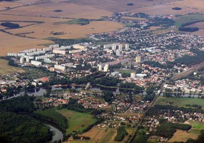
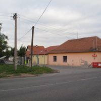
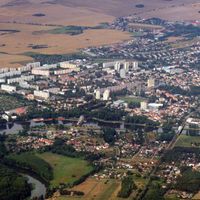
Neratovice, Industrial town in Central Bohemian Region, Czech Republic.
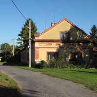
Neratovice stretches along the Elbe River and contains several settlements including Byškovice, Horňátky, Korycany, Lobkovice, and Mlékojedy. The town sits at approximately 162 meters elevation within the river valley of the Central Bohemian Region.
The settlement first appeared in records in 1227 under the name Neradice, when it belonged to the Chapter of Saint Wenceslaus at Prague Castle. The location underwent major transformation during 20th-century industrialization.
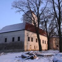
Lobkovice Castle shapes the visual character of the area with its early 17th-century design. The structure stands as a recognizable landmark that locals and visitors associate with the place's identity.
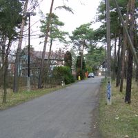
The municipality connects to Prague through the D8 motorway and receives regular train services, making travel straightforward. These transport links serve both casual visitors and those commuting for work.
The Spolana chemical plant was established in 1905, transforming the former rural settlement into a major industrial center. This factory became the driving force behind the region's development and character.
Location: Mělník District
Location: správní obvod obce s rozšířenou působností Neratovice
Elevation above the sea: 162 m
Shares border with: Kojetice, Úžice, Čakovičky, Obříství, Libiš, Tišice, Předboj, Veliká Ves, Kostelec nad Labem, Chlumín
Email: meu@neratovice.cz
Website: http://neratovice.cz
GPS coordinates: 50.25933,14.51768
Latest update: December 7, 2025 19:24
Statue of Unity
5994.6 km
Kaaba
3899.2 km
Angkor Wat
8829.1 km
Mount Kilimanjaro
6326.5 km
Antilia
6168.1 km
Narendra Modi Stadium
5813.9 km
Merdeka 118
9549.4 km
Ajanta Caves
6239.1 km
Uluru
14020.7 km
Sydney Opera House
16092.6 km
Kalambo
6749.2 km
Petronas Towers
9548.8 km
Gateway of India
6173.7 km
Jagannath Temple
7017.5 km
Borobudur
11073.3 km
Victoria Falls
7671.6 km
Black Stone
3899.2 km
Konark Sun Temple
7030.4 km
Padmanabhaswamy Temple
7351.3 km
Brihadisvara Temple
7302.6 km
Adiyogi Shiva statue
7120 km
Hampi
6728.1 km
Western Ghats
7212.7 km
Charminar
6698.6 km
Taal Volcano
9953.7 km
Meenakshi Temple
7307 km
Pinatubo
9811.1 kmVisited this place? Tap the stars to rate it and share your experience / photos with the community! Try now! You can cancel it anytime.
Discover hidden gems everywhere you go!
From secret cafés to breathtaking viewpoints, skip the crowded tourist spots and find places that match your style. Our app makes it easy with voice search, smart filtering, route optimization, and insider tips from travelers worldwide. Download now for the complete mobile experience.
A unique approach to discovering new places❞
— Le Figaro
All the places worth exploring❞
— France Info
A tailor-made excursion in just a few clicks❞
— 20 Minutes