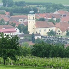
Bílé Karpaty Protected Landscape Area, Nature reserve in South Moravia, Czech Republic
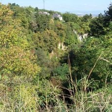
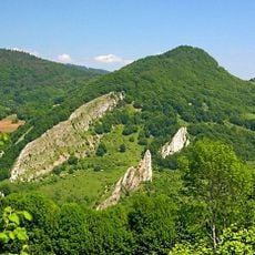
The Bílé Karpaty Protected Landscape Area covers 747 km² of flysch mountains along the Czech-Slovak border, from Petrov at 168 m to the summit of Velká Javořina at 968 m. Its western part is a mosaic of flower-rich meadows with solitary trees, while the Moravské Kopanice around Starý Hrozenkov shows scattered settlement from 17th–18th-century Wallachian colonisation.
The Czech part was declared a protected landscape area on 18 February 1981 by decree of the Ministry of Culture of the Czech Socialist Republic, covering 747 km²; the Slovak counterpart, CHKO Biele Karpaty, had been founded in 1979 on 435 km². UNESCO included the White Carpathians in its Man and the Biosphere programme on 15 April 1996, and the Council of Europe awarded the area its Diploma in 2000.
The central part around Starý Hrozenkov, called Moravské Kopanice, was settled only by late Wallachian colonization in the 17th and 18th centuries. Its scattered farmsteads, alternating woodland and open patches, small fields and orchards still shape the villages of Lopeník, Vyškovec and Žítková.
The area is crossed by about 20 marked hiking trails that let you explore different parts of the landscape. Information centers in Veselí nad Moravou offer maps and advice to help plan your visit.
The flysch bedrock of sandstones, conglomerates and claystones lets water drain quickly, so streams swell in spring. The Vlára broke through into the Vizovické vrchy by headward erosion and captured part of the Morava basin. The protected area's lowest point lies at Petrov, 168 m, the highest on Velká Javořina, 968 m.
The community of curious travelers
AroundUs brings together thousands of curated places, local tips, and hidden gems, enriched daily by 92,158 contributors worldwide.